Between cross-country moves, book projects, wild changes in the online media landscape over the past few years, and needless self-competition through social media, my laptop has accumulated hundreds and hundreds, arguably thousands, of bookmarks for things I wanted to write about and never did. Going back through them all feels like staring into a gravesite at the end of a life I didn’t realize was mortal.
In any case, another link I wanted to write about many eons ago explained that legendary producer and ambient musician Brian Eno had been hired to design new acoustics for London’s Chelsea and Westminster hospital, part of an overall rethinking of their patient-wellness plan. Healing through sound. “The aim,” the Evening Standard explained, “is to replicate techniques in use in the hospital’s paediatric burns unit, where ‘distraction therapy’ such as projecting moving images on to walls can avoid the need to administer drugs such as morphine.”
This is already interesting—if perhaps also a bit alarming, in that staring at images projected onto blank walls can apparently have the same effect as taking morphine. Or perhaps that’s beautiful, a chemical testament to the mind-altering potential of art amplified by modern electrical technology.
Either way, Eno was brought on board to “refine” the hospital’s acoustics, much as one would do for the interior of a luxury vehicle, and even to “provide soothing music” for the building’s patients, i.e. to write a soundtrack for architecture.
We are already in an era where the interiors of luxury cars are designed with the help of high-end acoustic consultants, where luxury apartments are built using products such as “acoustic plaster,” and where critical governmental facilities are constructed with acoustic security in mind—a silence impenetrable to eavesdroppers—but I remain convinced that middle-budget home developers all over the world are sleeping on an opportunity for distinguishing themselves. That is, why not bring Brian Eno in to design soothing acoustics for an entire village or residential tower?
Imagine a whole new neighborhood in Los Angeles designed in partnership with Dolby Laboratories or Bang & Olufsen, down to the use of acoustic-deflection walls and carefully chosen, sound-absorbing plants, or an apartment complex near London’s Royal Academy of Music with interiors acoustically shaped by Charcoalblue. SilentHomes™ constructed near freeways in New York City—or, for that matter, in the middle of nowhere, for sonically sensitive clients. Demonstration suburbs for unusual acoustic phenomena—like Joel Sanders et al.’s “Mix House” scaled up to suit modern real-estate marketers.
At the very least, consider it a design challenge. It’s 2020. KB Home has teamed up with Dolby Labs to construct a new housing complex covering three city blocks near a freeway in Los Angeles. What does it look—and, more to the point, what does it sound—like?
I’m pretty much obsessed with muons—subatomic particles that have been used to map the interiors of archaeological ruins—so I was interested to see that muons have now also been put to work mapping the bedrock beneath glaciers in the Swiss Alps. It is the “first application of the technique in glacial geology,” Eos reports. Even better, it uses underground railway infrastructure—the Jungfrau rail tunnel—as part of its experimental apparatus.
Robert Macfarlane has written a movie called Mountain, narrated by Willem Defoe. Macfarlane also recently joined Twitter, where he has rapidly accumulated nearly 28,000 followers.
The world’s sand is running out—indeed, “it’s scarcer than you think,” David Owen writes for The New Yorker. As highlighted on Twitter by @lowlowtide, the piece includes this great line: “The problems start when people begin to think of mutable landforms as permanent property.” Sand, and the peculiar economies that value it, has gotten quite a bit of attention over the past few years; among other coverage, a long feature in Wired two years ago is worth checking out.
Researchers at Penn State have figured out a way to generate electricity from the chemical mixing point where freshwater rivers reach the sea. “‘The goal of this technology is to generate electricity from where the rivers meet the ocean,’ said Christopher Gorski, assistant professor in environmental engineering at Penn State. ‘It’s based on the difference in the salt concentrations between the two water sources.’”
Hawaii is experiencing an unusually intense barrage of high tides, known as “king tides.” “For the people of Hawaii, alarm bells are ringing,” Adrienne LaFrance writes for The Atlantic. “King tides like this aren’t just a historic anomaly; they’re a sign of what’s to come… Scientists believe Hawaii could experience a sea-level increase of three feet by the year 2100, which is in line with global predictions of sea-level change and which would substantially reshape life on the Islands. That’s part of why scientists are enlisting volunteers to help photograph and describe incremental high tides across Hawaii.” Read more at The Atlantic.
Over at Places, landscape architect Zach Mortice takes a long look at what he calls “perpetual neglect” and the challenge of historic preservation in African-American burial grounds. Badly maintained—and, in some cases, almost entirely erased—black cemeteries reveal “that the racism and inequality that plague African Americans in life are perpetuated in death,” Mortice suggests. This is “nothing less than a preservation crisis for black burial grounds across the country.”
I recently discovered the existence of something called Betonamit. Betonamit is a “non-explosive cracking agent,” essentially a “non-toxic” powder that can be used for the slow-motion demolition of buildings and geological forms. “When mixed with water and poured into holes 1 1/4″, 1 3/8″ or 1 1/2″ diameter, it hardens and expands, exerting pressures of 12,000 psi. Reinforced concrete, boulders, and ledge[s] are fractured overnight with no noise, vibration, or flyrock.” I’m imagining a truck full of this stuff overturning on a crack-laden bridge somewhere, just an hour before a rainstorm begins, or a storage yard filled with crates of this stuff being ripped apart in the summer wind; a seemingly innocuous grey powder drifts out across an entire neighborhood for the next few hours, settling down into cracks on brick rooftops and stone facades, in sidewalks and roadbeds. Then the rains begin. The city crumbles. Weaponized demolition powder.
In any case, I actually stumbled upon Betonamit after reading a few blog posts on that company’s in-house blog. Atlas Preservation has a handful of interesting short articles up documenting their preservation work, including what might be the oldest gravestone in the United States and the challenges of open-air cemetery preservation. Let’s hope no one goes wandering amongst the tombs with a bucket of Betonamit…
The BBC went into horror-movie mode earlier this month, asking, “what would happen if we were suddenly exposed to deadly bacteria and viruses that have been absent for thousands of years, or that we have never met before? We may be about to find out. Climate change is melting permafrost soils that have been frozen for thousands of years, and as the soils melt they are releasing ancient viruses and bacteria that, having lain dormant, are springing back to life.” The headline is straight-forward enough, I suppose: “There are diseases hidden in ice, and they are waking up.”
Fans of John Carpenter’s (excellent) 1982 film The Thing might be interested to hear that the original score has been remastered and released on vinyl. The final product is visually gorgeous—and temporarily sold out. Keep your ears peeled for further pressings.
A retired F.B.I. investigator has newly dedicated himself to tracking down lost apple varietals of the Pacific Northwest. They are not extinct; they have simply disappeared into the background, both ecologically and historically. They are trees that have “faded into woods, or were absorbed by parks or other public lands,” but the apples that grow from them can still be enjoyed and cultivated.
If you are interested in apples and their history, meanwhile, don’t miss the late Roger Deakin’s superb book, Wildwood: A Journey Through Trees.
Blending into the natural landscape is the subject of a fascinating piece over at Public Domain Review about the early wildlife photographers, Richard and Cherry Kearton. In order not to scare away their subject matter, the Keartons constructed artificial trees, put on short, deliberately misleading performative displays for wildlife, and carved masks that would help camouflage them against the woodlands.
There’s more—always more!—to link to and read, but I’ll leave it at that. For other, ongoing links, I am also on Twitter.
[Image: The beginning of the Broomway path, at Wakering Stairs].
One of my favorite chapters in Robert Macfarlane’s recent book, The Old Ways: A Journey On Foot, has been excerpted over at the BBC—and, although the excerpt itself is well worth reading in full, it only reminds me of how good the entire chapter really is (note, as well, that the following quotations come from Macfarlane’s book, not from the BBC excerpt, lest there be variations in text).
The satellite photo, above, shows the Broomway’s launching point, at a place called Wakering Stairs. From there it heads into a shifting marine landscape of tidal flats—a “vast revealed world,” in Macfarlane’s words, of mud, half-buried guideposts, and omnipresent quicksand.
The path is also known as the Doomway: it is a path that leads “straight out to sea.”
[Image: One possible end-point—not the furthest—of the “Doomway” path].
The Broomway is “allegedly ‘the deadliest’ path in Britain,” Macfarlane writes, “and certainly the unearthliest path I have ever walked.”
It only exists at low tide, for starters, and it can often be followed only with the visual help of unstable wooden poles driven into the ground to mark its route across the landscape. Its unusual name, in fact, comes from “the 400 or so ‘brooms’ that were formerly placed at intervals of between thirty and sixty yards on either side of the track, thereby indicating the safe passage on the hard sand that lay between them.”
Without those brooms, the path—and not just where it’s heading, but the route you’ve already walked to get there–would disappear from view entirely, in effect stranding you at sea.
That might sound easy enough to account for, if you have a good sense of direction. “When the tide comes back in, though,” Macfarlane warns, “it comes fast—galloping over the sands quicker than a human can run.”
[Image: The endpoint of the Broomway tidal path].
A sense of how difficult the Broomway can be to follow is revealed by Macfarlane’s description of how people used to walk it in bad weather. “Until hand-held compasses became available to walkers, the safest way of navigating in bad conditions, when it was impossible to see from broom to broom, was with stone and thread. Walkers carried a 200-foot length of linen thread, with one end tied to a small stone. They would place the stone next to a broom and then walk away in what they believed to be the right direction, unspooling the thread as they went, until they could see the next broom.”
They would then either haul the stone up to their current position and start the process all over again, or they would search back through the mist and darkness for the correct route forward.
The path “is thought to have killed more than a hundred people over the centuries,” and what an utterly lost and disoriented death it must have been.
If you’re tempted to hike it—as am I—please take the necessary precautions; consider reading Macfarlane’s book the first necessary step.
(On a side note, it is very much not the same thing, but Andrew Michael Hurley’s novel The Loney takes place in a coastal British landscape that has its own disappearing footpath across the tidal sands; it can be, at times, uneven, but it is a good read for any fellow fans of Gothic horror).
[Image: “Discarded Christmas trees were used to help rebuild the sand dunes around three years ago,” writes photographer Fiona Croall on her Instagram feed. “Now you can hardly see them!”].
While discarded Christmas trees here in New York City simply piled up on the sidewalks for more than two weeks after the holidays, forming strange—if still somewhat sadly picturesque—felled forests on the margins of the city, it turns out there’s an altogether more useful fate for those trees over in England.
“Our Rangers are asking people to bring their used real Christmas trees down to Formby so they can be used to help protect our internationally important sand dunes,” the National Trust explains.
The trees “help to mitigate [wind and erosion] by mimicking the action of the Marram grass, catching the sand blown on to the dunes from the beach and also dissipating the power of the wind as it blows across the surface of the dunes. Over time the trees become buried which helps to build up the dunes and they also help to partly stabilise the surface of the dunes which often allows the Marram grass to take hold again naturally.”
[Image: The artificially stabilized beaches at Formby, with no sign of the displaced forest lurking below; photo by Fiona Croall].
Compare this approach, for example, to the widespread use of massive, industrially produced tetrapods for coastal erosion management—or even to the endless expense of so-called “beachnourishment”—and the idea of rebuilding the landscape using nothing more than linked chains of dead Christmas trees seems both tactically brilliant and cost-effective.
Not to mention archaeologically intriguing: it doesn’t take much to wonder how geotechnical assemblages such as these—huge arboreal lumps without a nearby forest to explain them—might appear to some distant researcher hoping to make sense of the stratigraphic record.
Like evidence of an ancient tsunami, the buried woods of Formby could surely sustain many a strange landscape theory to come.
Geologist Michael Welland has an interesting post up about the “first detailed examination of extra-terrestrial sand dunes” on Mars, coming later this year. His post also briefly discusses the life and career of Ralph Bagnold, after whom the Martian dunes are named, as well as the granular physics of a remote landscape that, in Welland’s words, “just seems, instinctively, to be unearthly.”
Incredibly, a “new type of rock cobbled together from plastic, volcanic rock, beach sand, seashells, and corals has begun forming on the shores of Hawaii,” Science reports.
This new rock type, referred to as a “plastiglomerate,” requires a significant heat-source in order to form, as plastiglomerates are, in effect, nothing but molten lumps of plastic mixed-in with ambient detritus. Hawaii with its coastal and marine volcanoes, offers a near-perfect formational landscape for this artificially inflected geology to emerge—however, Patricia Corcoran, one of the discoverers of these uncanny rocks, thinks we’ll likely find them “on coastlines across the world. Plastiglomerate is likely well distributed, it’s just never been noticed before now, she says.”
We’ve been surrounded by artificial geologies all along.
But is it really geology? Or is it just melted plastic messily assembled with local minerals? Well, it’s both, it seems, provided you look at it on different time-scales. After heavier chunks of plastiglomerate form, fusing with “denser materials, like rock and coral,” Science writes, “it sinks to the sea floor, and the chances it will become buried and preserved in the geologic record increase.” It can even form whole veins streaking through other rock deposits: “When the plastic melts, it cements rock fragments, sand, and shell debris together, or the plastic can flow into larger rocks and fill in cracks and bubbles,” we read.
It doesn’t seem like much of a stretch to suggest that our landfills are also acting like geologic ovens: baking huge deposits of plastiglomerate into existence, as the deep heat (and occasional fires) found inside landfills catalyzes the formation of this new rock type. Could deep excavations into the landfills of an earlier, pre-recycling era reveal whole boulders of this stuff? Perhaps.
The article goes on to refer to the work of geologist Jan Zalasiewicz, which is exactly where I would have taken this, as well. Zalasiewicz has written in great detail and very convincingly about the future possible fossilization of our industrial artifacts and the artificial materials that make them—including plastic itself, which, he suggests, might very well leave traces similar to those of fossilized leaves and skeletons.
In a great essay I had the pleasure of including in the recent book Landscape Futures, Zalasiewicz writes: “Plastics, which are made of long chains of subunits, might behave like some of the long-chain organic molecules in fossil plant twigs and branches, or the collagen in the fossilized skeletons of some marine invertebrates. These can be wonderfully well preserved, albeit blackened and carbonized as hydrogen, nitrogen and oxygen are driven off under the effect of subterranean heat and pressure.” Plastiglomerates could thus be seen as something like an intermediary stage in the long-term fossilization of plastic debris, a glimpse of the geology to come.
Ultimately, the idea that the stunning volcanic beaches of Hawaii are, in fact, more like an early version of tomorrow’s semi-plastic continents and tropical archipelagoes is both awesome and ironic: that an island chain known for its spectacular natural beauty would actually reveal the deeply artificial future of our planet in the form of these strange, easily missed objects washing around in the sand and coral of a gorgeous beach.
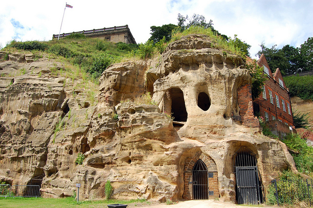
[Image: Cliffs and caves of Nottingham; photo by Nicola Twilley].
For severalyears now, I’ve admired from afar the ambitious laser-scanning subterranean archaeological project of the Nottingham Caves Survey.
Incredibly, there are more than 450 artificial caves excavated from the sandstone beneath the streets and buildings of Nottingham, England—including, legendarily, the old dungeon that once held Robin Hood—and not all of them are known even today, let alone mapped or studied. The city sits atop a labyrinth of human-carved spaces—some of them huge—and it will quite simply never be certain if archaeologists and historians have found them all.
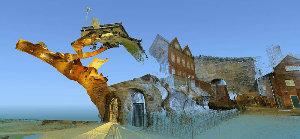
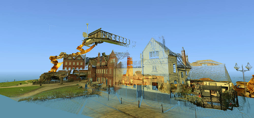
[Images: Laser scans from the Nottingham Caves Survey show Castle Rock and the Mortimer’s Hole tunnel, including, in the bottom image, the Trip to Jerusalem Pub where we met archaeologist David Strange-Walker; images like this imply an exhilarating and almost psychedelic portrait of the city as invisibly connected behind the scenes by an umbilical network of caves and tunnels. Scans courtesy of the Nottingham Caves Survey].
“Even back in Saxon times, Nottingham was known for its caves,” local historian Tony Waltham writes in his helpful guide Sandstone Caves of Nottingham, “though the great majority of those which survive today were cut much more recently.” From malt kilns to pub cellars, “gentlemen’s lounges” to jails, and wells to cisterns, these caves form an almost entirely privately-owned lacework of voids beneath the city.
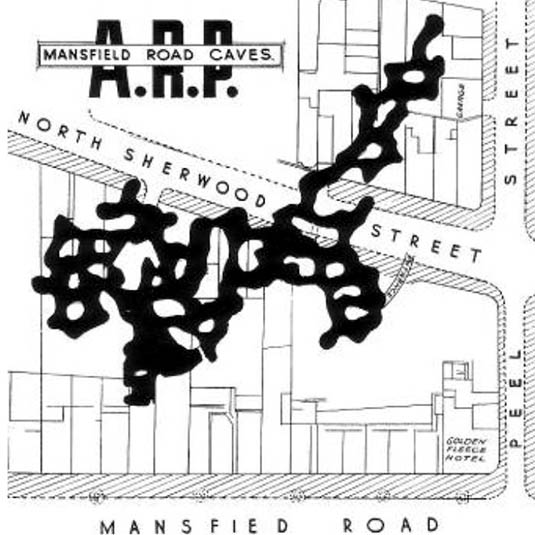
[Image: Map of only the known caves in Nottingham, and only in Nottingham’s city center; map by Tony Waltham, from Sandstone Caves of Nottingham].
As Waltham explains, “Nottingham has so many caves quite simply because the physical properties of the bedrock sandstone are ideal for its excavation.” The sandstone “is easily excavated with only hand tools, yet will safely stand as an unsupported arch of low profile.”
In a sense, Nottingham is the Cappadocia of the British Isles.
The purpose of the Nottingham Caves Survey, as their website explains, is “to assess the archaeological importance of Nottingham’s caves. Some are currently scheduled monuments and are of great local and national importance. Some are pub cellars and may seem less vital to the history of the City.”
Others, I was soon to learn, have been bricked off, taken apart, filled in, or forgotten.
“All caves that can be physically accessed will be surveyed with a 3D laser scanner,” the Survey adds, “producing a full measured record of the caves in three dimensions. This ‘point cloud’ of millions of individual survey points can be cut and sliced into plans and sections, ‘flown through’ in short videos, and examined in great detail on the web.”
[Video: One of very many laser-scan animations from the Nottingham Caves Survey].
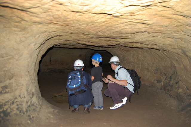
While over in England a few weeks ago, I got in touch with archaeologist David Strange-Walker, the project’s manager, and arranged for a visit up to Nottingham to learn more about the project. Best of all, David very generously organized an entire day’s worth of explorations, going down into many of the city’s underground spaces in person with David himself as our guide. Joining me on the trip north from London was Nicola Twilley of Edible Geography; architect Mark Smout of Smout Allen and co-author of the fantastic Pamphlet Architecture installment, Augmented Landscapes; and Mark’s young son, Ellis.
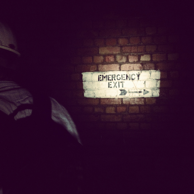
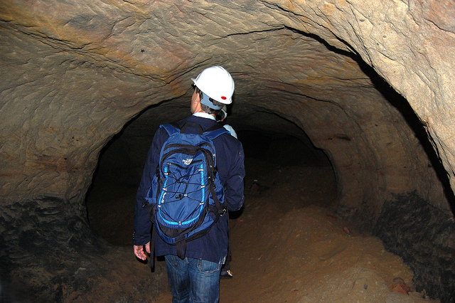
[Image: Artificially enlarged pores in the sandstone; photo by BLDGBLOG].
We met the very likable and energetic David—who was dressed for a full day of activity, complete with a well-weathered backpack that we’d later learn contained hard hats and floodlights for each of us—outside Nottingham’s Trip to Jerusalem pub.
Rather than kicking off our visit with a pint, however, we simply walked inside to see how the pub had been partially built—that is, expanded through deliberate excavation—into the sandstone cliffside.
The building is thus more like a facade wrapped around and disguising the artificial caves behind it; walking in past the bar, for instance, you soon notice ventilation shafts and strange half-stairways, curved walls and unpredictable acoustics, as the “network of caves” that actually constitutes the pub interior begins to reveal itself.
My mind was already somewhat blown by this, though it was just the barest indication of extraordinary spatial experiences yet to come.
[Image: Examining sandstone with Dr. David Strange-Walker; photo by BLDGBLOG].
Wasting no time, we headed back outside, where afternoon rain showers had begun to blow in, and David introduced us to the sandstone cliff itself, pointing out both natural and artificially enlarged pores pockmarking the outside.
The sandstone formations or “rock units” beneath the city, as Tony Waltham explains, “were formed as flash flood sediments in desert basins during Triassic times, about 240 million years ago, when Britain was part of a hot and dry continental interior close to the equator. Subsequent eons of plate tectonic movements have brought Britain to its present position; and during the same time, the desert sediments have been buried, compressed and cemented to form moderately strong sedimentary rocks.”
The city is thus built atop a kind of frozen Sahara, deep into which we were about to go walking.
[Image: A gate in the cliff; photo by BLDGBLOG].
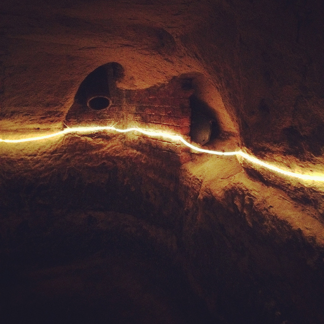
Outside here in the cliff face, small openings led within to medieval tunnels and stairs—including the infamous Mortimer’s Hole—that themselves curled up to the top of the plateau; doors in the rock further up from the Trip to Jerusalem opened onto what were now private shooting ranges, of all things; and, with a laugh, David pointed out shotcrete cosmetic work that had been applied to the outer stone surface.
[Image: Artificial shotcrete geology; photo by BLDGBLOG].
We headed from there—walking a brisk pace uphill into the town center—with David casually narrating the various basements, cellars, tunnels, and other urban perforations that lay under the buildings around us, as if we were traveling through town with a human x-ray machine for whom the city was an archaeologically rich cobweb of underground loops and dead-ends.
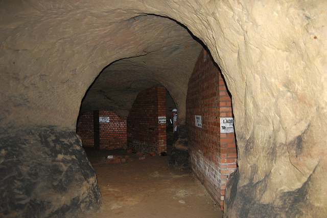
We soon ended up at the old jails of the Galleries of Justice. A well-known tourist destination, complete with costumed re-enactors, the building sits atop several levels of artificial caves that are well worth exploring.
We were joined at this point by the site’s director, who generously took time out of his schedule to lead us down into parts of the underground complex that are not normally open to the general public.
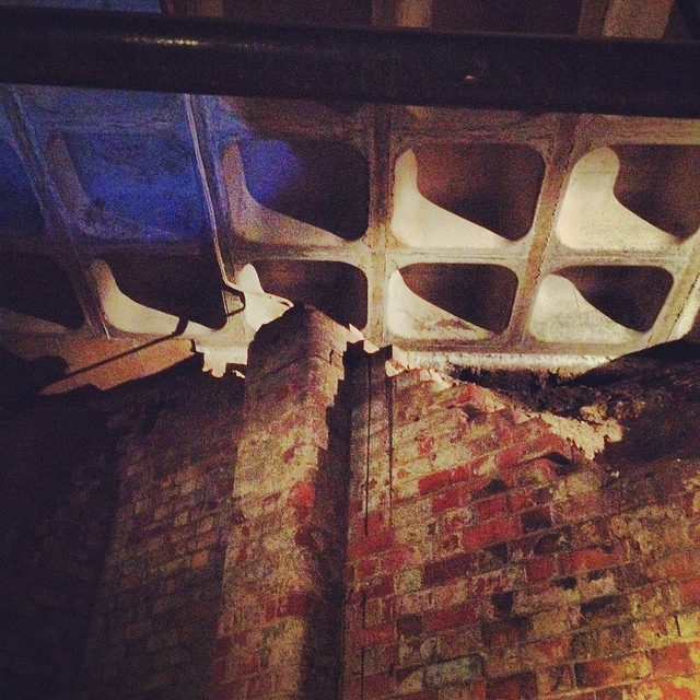
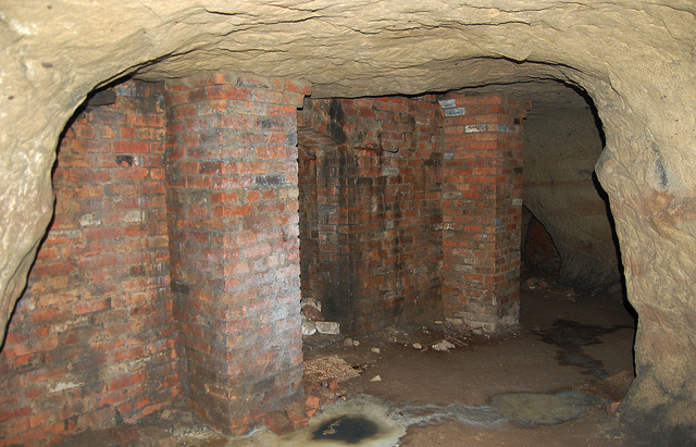
Heading downward—at first by elevator—we eventually unlocked a door, stepped into a tiny room beneath even the jail cells, crouching over so as not to bang our heads on the low ceiling, and we leaned against banded brick pillars that had been added to help support all the architecture groaning above us.
Avoiding each other’s flashlight beams, we listened as our two guides talked about the discovery—and, sadly, the willful reburial—of caves throughout central Nottingham.
[Image: Brick pillars below Nottingham; photo by BLDGBLOG].
We learned, for instance, that, elsewhere in the city, there had once been a vacuum shop with a cave beneath it; if I remember this story correctly, the shop’s owners had the habit of simply discarding broken and unsold vacuum cleaners into the cave, inadvertently creating a kind of museum of obsolete vacuum parts. Discontinued models sat in the darkness—a void full of vacuums—as the shop went out of business.
We heard, as well, about a nearby site where caves had been discovered beneath a bank during a recent process of renovation and expansion—but, fearing discovery of anything that might slow down the bank’s architectural plans, the caves were simply walled up and left unexplored. They’re thus still down there, underneath and behind the bank, their contents unknown, their extent unmapped—a fate, it seems, shared by many of the caves of Nottingham.
Rather than being greeted by the subterranean and historical wonder that such structures deserve—and I would argue that essentially all of subterranean Nottingham should be declared a UNESCO World Heritage Site—the caves are too often treated as little more than annoying construction setbacks or anomalous ground conditions, suitable only for bricking up, filling with concrete, or forgetting. If the public thinks about them at all, in seems, it is only long enough to consider them threats to building safety or negative influences on property value.
[Images: Learning about caves; photos by BLDGBLOG].
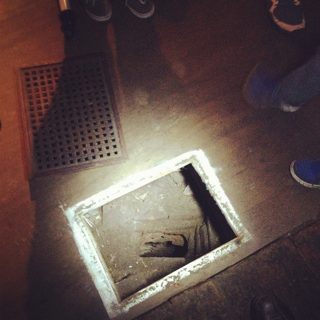
In any case, on our way out of the Galleries of Justice, we lifted up a ventilation grill in the floor and looked down into a small vertical shaft, too narrow and contorted even for Ellis to navigate, and we learned that there are urban legends that this particular shaft leads down to a larger room in which Robin Hood himself was once held… But we had only enough time to shine our flashlights down and wonder.
[Images: Ellis Smout looks for Robin Hood below; photos by BLDGBLOG].
From here, we headed over to our final tourist-y site of the day, which is the awesomely surreal City of Caves exhibition, located in Nottingham’s Broad Marsh shopping mall.
You literally take an escalator down into an indoor mall, where, amidst clothing outlets and food courts, there is an otherwise totally mundane sign pointing simply to “Caves.”
If you didn’t know about Nottingham’s extensive sub-city, this would surely be one of the most inexplicable way-finding messages in mall history.
Here, where we picked our copy of Tony Waltham’s Sandstone Caves of Nottingham pamphlet, from which I’ve been quoting, we learned quite a bit more about how the city has grown, how the caves themselves have often been uncovered (for example, during building expansions and renovations), and what role Nottingham’s underground spaces served during the Nazi bombings of WWII.
[Image: Beneath Broad Marsh shopping mall; photo by BLDGBLOG].
The specific underground complex beneath the shopping mall offers an interesting mix of old tanning operations and other semi-industrial, pre-modern work rooms, now overlapping with 20th-century living and basement spaces that were sliced open during the construction of the Broad Marsh mall.
[Images: Cave spaces beneath the Superstudio-like concrete grid of Nottingham’s Broad Marsh shopping Mall].
That these caves were preserved at all is testament to the power of local conservationists, as the historically rich and spatially intricate rooms and corridors would have been gutted and erased entirely during post-War reconstruction without their intervention.
As it now stands, the mall is perched above the caves on concrete pillars, with the effect that curious shoppers can wander down into the caves through an entrance that could just as easily lead to a local branch of Accessorize.
[Image: A well bucket in the caves beneath Broad Marsh; photo by BLDGBLOG].
Again, we were fortunate to be taken down into some off-limits areas, stepping over lights and electric wires and peering ahead into larger rooms not on the tourist route.
[Images: Lines of lights we switched on in one of the off-limits rooms below Broad Marsh; photo by BLDGBLOG].
This included stepping outside at one point to wander through an overgrown alleyway behind the mall. Small openings even back here stretched beneath and seemingly into the backs of shops; one doorway, a short scramble up a hill of weed-covered rubble, appeared to contain a half-collapsed spiral staircase installed inside a brick-lined sandstone opening.
[Image: A doorway to voids behind Broad Marsh Centre; photo by BLDGBLOG].
At this point, we began to joke about the ease with which it seemed you could plan a sort of speleological super-heist, breaking into shops from below, as an entire dimension of the city seemed to lie unwatched and unprotected.
Nottingham, it appeared, is a city of nothing but doors and openings, holes, pores, and connections, complexly layered knots of space coiling beneath one building after another, sometimes cutting all the way down to the water table.
Incredibly, the day only continued to build in interest, reaching near-impossible urban sights, from catacombs in the local graveyard to a mind-bending sand mine that whirled and looped around like smoke rings beneath an otherwise quiet residential neighborhood.
Leaving the mall behind, and maintaining a brisk pace, David took us further into the city, where our next stop was the Old Angel Inn, another pub with an extensive cellar of caves, in this case accessed through a deceptively workaday door next to an arcade game.
[Images: The Old Angel Inn (top), including the door inside the pub that leads down to the caves below; photos by Nicola Twilley].
Once again, it can hardly be exaggerated how easy it would be to visit or even live in Nottingham and have absolutely no idea that underground spaces such as this can be found almost anywhere. As Tony Waltham points out, “It would be a fair assumption that every building or site within the old city limits either has or had some form of cave beneath it. About 500 caves are now known, and this may be only half the total number that have been excavated under Nottingham.”
In any case, “Although the Old Angel is a ‘modern’ brick building,” as the Nottingham Caves Survey describes the pub on its website, “an investigation of the caves below reveals stone walls belonging to an earlier incarnation. It is likely that there were buildings on this site as far back as the Anglo-Saxon period. Whether the caves beneath are also this old cannot be demonstrated definitively.”
Typical, as well, for these types of pub caves, we found ventilation and delivery tunnels leading back up to the surface, and the walls themselves are lined with long benches, perfect for sitting below ground and, provided you have candles or a flashlight along with you, enjoying a smoke and a pint of beer. As Tony Waltham explains, pub cellars often include “perimeter thralls,” or “low ledges cut in the rock,” normally used for storing kegs and barrels of beer but quite easily repurposed for a quick sit-down.
But I sense I’m going on way too long about all this, especially because the two most memorable details of the entire day were yet to come.
Jumping forward a bit, we left the Old Angel and followed some twists and turns in the street to find ourselves standing outside a nightclub called Propaganda.
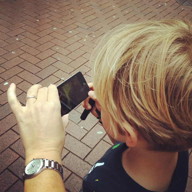
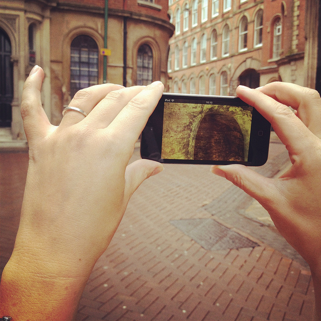
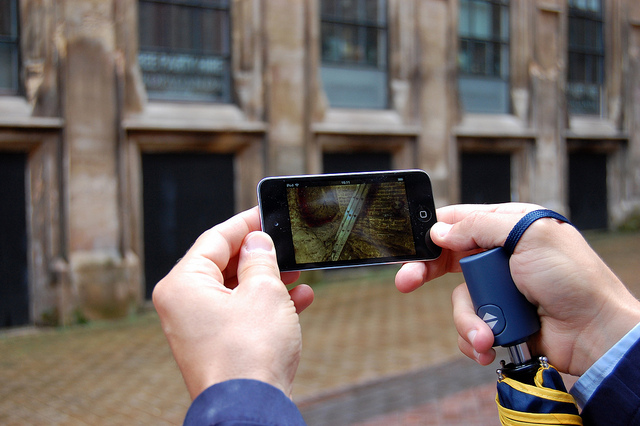
Here, David revealed that he has been working on what, in my opinion, will easily be one of the must-have apps of the year. In a nutshell, David has managed to make the subterranean 3D laser-scans of the Nottingham Caves Survey accessible by location, such that, holding up his iPod Touch, he demonstrated that you could, in effect, scan the courtyard we were standing in to see the caves, tunnels, stairways, cellars, vents, storage rooms, and more that lay hidden in the ground around us.
[Images: We test-drive the cave-spotting app; bottom photo by Nicola Twilley].
Ideally, once the Survey’s extensive catalog of 3D visualizations and laser point-clouds has been made available and the app is ready for public download, you will be able to walk through the city of Nottingham, smartphone in hand, revealing in all of their serpentine complexity the underground spaces of the city core.
For anyone who has ever dreamt of putting on x-ray glasses and using them to explore architectural space, this app promises to be a thrilling and vertiginous way to experience exactly that—peering right through the city to see its most ancient foundations.
[Video: A fly-through of the Propaganda Nightclub malting caves].
I, for one, can’t wait to see what David and the Nottingham Caves Survey do with the finished application and I eagerly await its public availability.
[Image: Mark Smout looks for caves in the sky; photo by Nicola Twilley].
I’ll wind up this already quite long post with just a few more highlights.
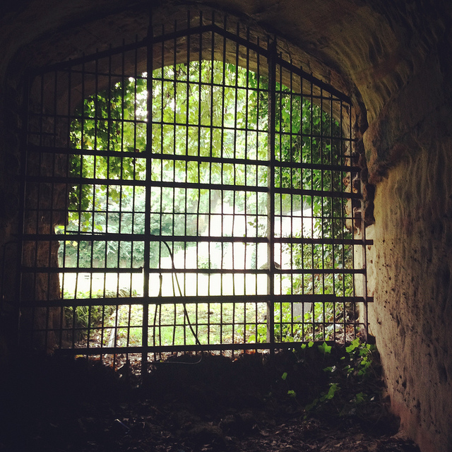
Nottingham’s Rock Cemetery, north from the center of town along the Mansfield Road, contains, among other things, the collapsed remains of a sand mine. Three of the mine’s old entrances are now gated alcoves surrounded by graves, like something out of Dante. They “are the only surviving remnants of the mine,” Waltham writes in his pamphlet.
[Images: Nottingham’s Rock Cemetery, where archaeologist David Strange-Walker explained the history of the local landscape].
However, an ambitious plan to carve sizable catacombs, inspired by Paris and Rome, through the sandstone beds of the ancient desert here resulted in the never-completed Catacomb Caves, “probably done in 1859-63,” Waltham suggests. These long arched tunnels, accessible through one of the gates described above, eventually lead to a radial terminus from which branch the unused proto-catacombs.
The air there is cloudy with sand—leading me, several days later, to experience a brief attack of hypochondria, worried about developing silicosis—the walls are graffiti’d, and years of trash are piled on the sides of the sandy floor (which has since taken on the characteristics of a dune sea in places, as 150 years of footfall and a collapsing ceiling have led to the appearance of drifts).
[Images: The Rock Cemetery catacomb gates].
What was so extraordinary here, among many other things, was that, for most of this walk through the catacombs, we were actually walking below the graves, meaning that people were buried above us in the earth. At the risk of overdoing it, this felt not unlike becoming aware of an altogether different type of constellation, with bodies and all the stories their lives could tell held above us in a terrestrial sky like legends and heroes, like Orion and Cassiopeia, as we looked up at the vaulted ceiling, flashlights in hand.
[Image: A door on the street—the black door with bars—leading down into a sand mine; photo by BLDGBLOG].
Serving as something of the ultimate proof that Nottingham is a city of overlooked doors that lead into the underworld, there were two locked doors—one of which (the black door, near the sidewalk) appears in the photo, above, another of which, on a street nearby, leads down into the Peel Street Caves—simply sitting there on the sidewalk that, if opened, will take you down into extensive and now defunct sand mines. David’s laser-scans of these for the Nottingham Caves Survey are absolutely gorgeous, as you can see, below.
For a variety of reasons, I am going to avoid being too specific about some of the details here, but, aside from that, I can only enthuse about the experience of donning our hard hats and heading down several flights of comparatively new concrete steps into a coiling and vast artificial cavern from the 19th century, one we spent nearly an hour exploring.
[Image: Nicola Twilley and Mark Smout head down into the sand mine; photo by BLDGBLOG].
Getting lost down there would be so absurdly easy that it is frightening even to contemplate, and, in case the group of us somehow got split up or our batteries ran out of juice, we joked about—if only we could remember them—the easy techniques for navigating a labyrinth offered in Umberto Eco’s novel The Name of the Rose.
[Image: Many of these way-finding signs are actually incorrect, David explained, and seem to have been painted as a kind of sick joke by someone several years ago; photos by BLDGBLOG].
Avoiding such a fate, however, we found graffiti and men’s and women’s latrines; we popped our heads through holes allowing glimpse of other levels; and we cracked our helmets loudly against the low and rough roof more times than I could count.
[Images: Inside the sand mine; all photos by Nicola Twilley].
And even that doesn’t complete the day. From here, heading back out onto the street through a nondescript steel door, as if we had been doing nothing more than watching football in someone’s basement, we went on to eat pie and chips in a restaurant built partially into a cave; we walked back across town, returning to where we started, talking about the future and seemingly obvious possibility of Nottingham’s caves being declared a UNESCO World Heritage Site and thus saved from their all but inevitable destruction (it’s easy to imagine a future in which a tour like the one David gave us will be impossible for lack of caves to see); and we all said goodbye beneath an evening sky cleared of clouds as a late-day breeze began to cut through town.
[Image: Mark & Ellis Smout explore our final “underground” space of the day, the magnificent Park Tunnel; the banded strata clearly visible in the walls show how the tunnel was carved through the dunes of an ancient desert. Photo by BLDGBLOG].
David proved to be a heroic guide that day. His energy never flagged throughout the tour, and he never once appeared impatient with or exhausted by any of our often ridiculous questions—not to mention our tourists’ insistence on pausing every three or four steps to take photographs—and he remained always willing to stay underground far longer than he had originally planned, all this despite having never met any of us before in person and only communicating with me briefly via a flurry of emails the week before.
Meeting David left me far more convinced than I already was that the Nottingham Caves Survey fully deserves the financial support of individuals and institutions, so that it can complete its ambitious and historically valuable work of cataloging Nottingham’s underground spaces and making that knowledge freely accessible to the general public.
Weirdly, England has within its very heart a region deserving comparison to Turkish Cappadocia—yet very few people even seem to know that this subterranean world exists. There very well could be more than 1,000 artificial caves beneath the city, many of them fantastically elaborate, complete with fine carvings of lions and ornate stairwells, and it is actually somewhat disconcerting to think that people remain so globally unaware of Nottingham’s underground heritage.
With any luck, the work of David Strange-Walker, Trent & Peak Archaeology, and the Nottingham Caves Survey will help bring this extraordinary region of the earth the attention—and, importantly, the focused conservation—it is due.
(For further reading, don’t miss Nicola Twilley’s write-up of the tour on her own blog, Edible Geography; and Tony Waltham’s Sandstone Caves of Nottingham, cited extensively in this post, is worth a read if you can find a copy).
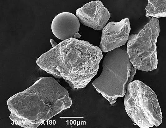
[Image: Geologist Earle McBride’s microscopic images of war sand on the beaches of Normandy].
A short piece in the September/October 2012 issue of Archaeology magazine highlights the presence of spherical magnetic shards—remnants of the D-Day operations of World War II—found hidden amongst natural sand grains on the beaches of Normandy. “Up to 4 percent of the sand is made up of this shrapnel,” the article states; however, “waves, storms, and rust will probably wipe this microscopic archaeology from the coast in another hundred years.”
This is not a new discovery, of course. In Michael Welland’s book Sand, often cited here on BLDGBLOG, we read that, “on Normandy beaches where D-Day landings took place, you will find sand-sized fragments of steel”—an artificial landscape of eroded machines still detectable, albeit with specialty instruments, in the coastal dunes.
I’m reminded of a line from The Earth After Us: What Legacy Will Humans Leave in the Rocks?, a speculative look by geologist Jan Zalasiewicz at the remains of human civilization 100 million years from now. There, we read that “skyscrapers and semi-detached houses alike, roads and railway lines, will be reduced to sand and pebbles, and strewn as glistening and barely recognizable relics along the shoreline of the future.”
The oddly shaped magnetic remains of World War II are thus a good indication of how our cities might appear after humans have long departed.
[Image: Bookstore for Shibuya Publishing, Japan, designed by Hiroshi Nakamura].
Through a combination of publisher review copies and the slow-to-end fire sale at my favorite local bookstore, Stacey’s – they’ve gone out of business and are selling everything at 50% off, including now even the furniture – BLDGBLOG’s home office is awash in books. Since there literally is not enough time left in a person’s life to read all of these, I decided that I would instead start a new, regular series of posts on the blog called “Books Received” – these will be short descriptions of, and links to, interesting books that have crossed my desk. Note that these lists will include books I have not read in full – but they will never include books that don’t deserve the attention. Note, as well, that if you yourself have a book you’d like to see on BLDGBLOG, get in touch – send us a copy, and, if it fits the site, we’ll mention your title in a future Books Received.
1)Oase #75 and #76 — Oase is an excellent architecture and urban studies journal published by the Netherlands Architecture Institute and designed by Karel Martens of Werkplaats Typografie. Oase #75 is the 25th anniversary issue, and includes essays from Jurjen Zeinstra (“Houses of the Future”), René Boomkens (“Modernism, Catastrophe and the Public Realm”), and Frans Sturkenboom (“Come una ola de fuerza y luz: On Borromini’s Naturalism”), among many, many others. To be honest, there is so much interesting material in this issue that it’s hard to know where to start; look for this in specialty architecture bookstores and definitely consider picking up a copy. Meanwhile, Oase #76 arrived just in time for me to quote part of its interview with photographer Bas Princen in The BLDGBLOG Book – but the entire issue, bilingually printed in both English and Dutch and themed around what the editors call “ContextSpecificity,” is worth reading. There’s a whole section on “In-Between Buildings,” itself coming between long looks at context, tradition, and the generation of architectural form. #76 also includes virtuoso displays of how to push the typographic grid. A new favorite.
2)Blank Spots on the Map: The Dark Geography of the Pentagon’s Secret World by Trevor Paglen (Dutton) — Trevor Paglen is an “experimental geographer” at UC-Berkeley, well-known – perhaps infamous – for his successful efforts in tracking unmarked CIA rendition flights around the world. Using optical equipment normally associated with astronomy, Paglen has managed to photograph the goings-on of deep desert military bases and has even been able to follow US spy satellites through what he calls “the other night sky.” This book serves more or less as an introduction to Paglen’s work, from Afghanistan to Los Alamos.
3)The Thief at the End of the World: Rubber, Power, and the Seeds of Empire by Joe Jackson (Penguin) — Jackon’s book, new in paperback, explores the industrial implications of monopoly plantlife, telling the story of Henry Wickham, who “smuggled 70,000 rubber tree seeds out of the rainforests of Brazil and delivered them to Victorian England’s most prestigious scientists at Kew Gardens.” This led directly to the “great rubber boom of the early twentieth century,” we read – which itself resulted in such surreal sites as Henry Ford’s failed utopian-industrial instant city in the rain forest, Fordlandia. Here, Jackson describes that city, now in ruins and like something from a novel by Patrick McGrath:
The American Villa still stands on the hill. The green and white cottages line the shady lane, but the only residents now are fruit bats and trap-door tarantulas. The state-of-the-art hospital shipped from Michigan is deserted. Broken bottles and patient records litter the floor. A towering machine shop houses a 1940s-era ambulance, now on blocks. A riverside warehouse built to hold huge sheets of processed rubber holds six empty coffins arranged in a circle around the ashes of a small campfire.
4)Ghettostadt: Łódź and the Making of a Nazi City by Gordon J. Horwitz (Harvard University Press) — By choosing the historical experience of Łódź, Poland, during its political assimilation and ethnic ghettoization by the Nazis, Gordon Horwitz shows how a long series of seemingly minor bureaucratic decisions can radically alter the normal urban order of things, paving the way for something as nightmarish as the Final Solution. This latter fact Horwitz memorably describes as “a phenomenon so unexpected and outrageous in design and execution as to exceed the then-understood limits of organized human cruelty.” About Łódź itself, he writes: “Secured by German arms, reshaped by German planning and technical expertise, the city was to be remade inside and out.” Horwitz shows how property confiscation, spatial rezoning, and literal new walls transformed Łódź into a Ghettostadt.
5)Condemned Building by Douglas Darden (Princeton Architectural Press) — The late Douglas Darden’s work seems both underknown and underexposed (perhaps because so little of it can be found online). This book, published in 1993, collects ten speculative projects, including the Museum of Impostors, the Clinic for Sleep Disorders, and the Oxygen House, complete with plans, models, elevations, and historical engravings. Darden’s work is an interesting hybrid of narrative fiction, visual storytelling, and architectural design – and so naturally of great interest to BLDGBLOG. For instance, his “Temple Forgetful” project weds amnesia, flooding, and the mythic origins of Rome. Good stuff.
6)Architecture Depends by Jeremy Till (MIT Press) — Architectural theory written with the rhetorical pitch of a blog, Architecture Depends is a kind of from-the-hip philosophy of “rogue objects,” construction waste, massive landfills, “lo-fi architecture,” and the fate of buildings over long periods of time. As Till states in the book’s preface, “Mess is the law.”
7)Wired for War: The Robotics Revolution and Conflict in the Twenty-first Century by P.W. Singer (Penguin) — An extremely provocative look at the future of war in an age of robot swarms and autonomous weaponry, Singer’s book is nonetheless a bit too casual for its own good (reading that Singer wrote the book because robots are “frakin’ cool” doesn’t help me trust the author’s sense of self-editing). Having said that, there is so much here to discuss and explore further that it’s impossible not to recommend the book – eyepopping micro-histories of individual war machines come together with Singer’s on-the-scene anthropological visits to robotics labs and military testing grounds, by way of Artificially Intelligent snipers, drone “motherships” forming militarized constellations in the sky, and even “mud batteries” and automated undersea warfare. Like Singer’s earlier Corporate Warriors – another book I would quite strongly recommend – the often terrifying implications of Wired for War nag at you long after you’ve stopped reading. For what it’s worth, by the way, this book seems almost perfectly timed for the release of Terminator Salvation.
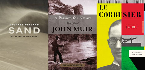
8)Sand: The Never-Ending Story by Michael Welland (University of California Press) — This book is awesome, and I hope to draw a much longer post out of it soon. Only slightly marred by an unfortunate subtitle, Welland’s book is disproportionately fascinating, considering its subject matter. On the other hand, “it has been estimated,” he writes, “that on the order of a billion sand grains are born around the world every second” (emphasis his) – so the sheer ubiquity of his referent makes the book worth reading. From the early history of sand studies to the aerial physics of dunes – by way of the United States’ little-known WWII-era Military Geology Unit – the interesting details of this book are inexhaustible.
9)A Passion for Nature: The Life of John Muir by Donald Worster (Oxford University Press) — Donald Worster has written a long biography of John Muir, the naturalist and writer who once famously climbed as high as he could into the canopy of a Californian forest during a lightning storm so that he could see what it was like to experience nature firsthand. At its most basic, Worster’s book explores the natural landscape of the American West as “a source of liberation.”
Going into wild country freed one from the repressive hand of authority. Social deferences faded in wild places. Economic rank ceased to matter so much. Bags of money were not needed for survival – only one’s wits and knowledge. Nature offered a home to the political maverick, the rebellious child, the outlaw or runaway slave, the soldier who refused to fight, and, by the late nineteenth century, the woman who climbed mountains to show her strength and independence.
10)Le Corbusier: A Life by Nicholas Fox Weber (Alfred A. Knopf) — I’m strangely excited to read this, actually – and I say “strangely” because I am not otherwise known for my interest in reading about Le Corbusier. But Nicholas Fox Weber’s approximately 765 pages of biographical reflection on Corbu’s life look both narratively satisfying, as a glimpse into the man’s daily ins and outs over eight decades, but also architecturally minded, contextualizing Le Corbusier’s spatial work within his other political (and libidinal) interests. I hope to dive into this one over the summer.
It what sounds like the coolest job description going, the BBC reports that “scientists have been sailing across the Atlantic in a bid to track down sand from the Sahara Desert.” They are chasing an aerial landform while plying currents through the sea.
Tracking that desert in the sky, the scientists have already “encountered two large sand storms during their cruise and recorded footage of their dust-drenched experience for the BBC News website.”
Of course, the Sahara is always popping up in unexpected places. A few quick links away from the BBC and we find that Saharan sand even peppered the ground in Wales last month; and that desert often blooms northward to cover parts of France, Italy, and Mediterranean Europe more generally, going as far north as England. It’s like some shapeless, living landmass from Greek myth – or from the tales of Scheherazade. (Leading me to wonder aloud: are the world’s religious texts an untapped resource of ideas for avant-garde landscape design?)
So here’s a landscape design project for your next summer school studio: go around Europe tracking down the Sahara. Map these sites of territorial spread. Find where airborne terrains stratigraphically settle onto fields and cities elsewhere. Photograph zones of undisturbed deposition – small pockets of sand in a gully in eastern Spain – where it’s already compressing to form stone.
Then you hear rumors of a particularly violent storm that blew grains as far as Japan… and so off you go in your personal jetliner, sponsored by SCI-Arc.
In any case, the future geology of Europe will come down to it from the air, a distant lamination of the Sahara. Landscape at a distance.
If we stop sweeping the streets, what new sedimentary rocks would be forming here?
Perhaps that famous graffiti from Paris in May 1968 got it all wrong. Instead of: “Beneath the paving stones – the beach!” It should have read: “Above these roofs – the desert!”
Sailing across the Atlantic, scanning for nomadic side-storms of the Sahara, seems like a good place to start.
“Sand dunes in certain parts of the world are notorious for the noises they make,” New Scientist reports, “as sand avalanches down their sides. Some [dunes] emit low powerful booms, others sound like drum rolls or galloping horses, and some are even tuneful. These dune songs have been reported to last for up to 15 minutes and can sound as loud as a low-flying airplane.”
To test for the causes, properties, and other effects of these sand dune booms, “Stéphane Douady of the French national research agency CNRS and his colleagues shipped sand from Moroccan singing dunes back to his lab to investigate.” There, Douady’s team “found that they could play notes by pushing the sand by hand, or with a metal handle.”
The transformation of a sand dune – and, by extension, the entire Sahara desert, indeed any desert – even, by extension, the rust deserts of Mars – into a musical instrument. Music of the spheres, indeed.
“When the sand avalanches, the grains jostle each other at different frequencies, setting up standing waves in the cascading layer, says Douady. These waves reinforce one another, making the layer vibrate like the surface of a loud speaker. ‘What’s funny is that in these massive dunes, only a thin layer of 2 or 3 centimetres is needed to set up the resonance,’ says Douady. ‘Soon all grains begin to vibrate in step.'”
Douady has so perfected his technique of dune resonance that he has now “successfully predicted the notes emitted by dunes in Morocco, Chile and the US simply by measuring the size of the grains they contain.” The music of the dunes, in other words, was determined entirely by the size, shape, and roughness of the sand grains involved, where excessive smoothness dampened the dunes’ sound.
I’m reminded of the coast of Inishowen, a peninsula south of Malin Head in the north of Ireland, where the rocks endlessly grind across one another in the backwash of heaving, metallic, grey Atlantic waves. Under constant pressure of the oceanic, the rocks carve into themselves and each other, chipping down over decades into perfectly polished and rounded spheres, columns, and eggs – as if Archimedean solids or the nested orbits of Kepler could be discovered on the Irish ocean foreshore –
– all glittering. The rocks, I later learned, were actually semi-precious stones, and I had a kind of weird epiphany, standing there above the hush and clatter of bejewelled rocks, rubbing and rubbed one to the other in the depopulated void of a coastal November. It was not a sound easy to forget.
Because the earth itself is already a musical instrument: there is “a deep, low-frequency rumble that is present in the ground even when there are no earthquakes happening. Dubbed the ‘Earth’s hum‘, the signal had gone unnoticed in previous studies because it looked like noise in the data.”
Elsewhere: “Competing with the natural emissions from stars and other celestial objects, our Earth sings like a canary – it drones on in a constant hum of a gazillion notes. If it were several octaves higher, and hence, audible to the human ear,” it could probably get recorded by the unpredictably omnidirectional antennas of ShortWaveMusic and… you could download the sound of the earth. Free Radio Interterrestrial. [Note: the “drones on” link, a sentence or two back, offers a contrary theory (published in 2000) about the origins of these planetary sound waves.]
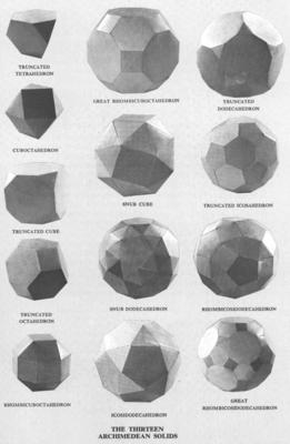
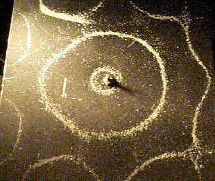
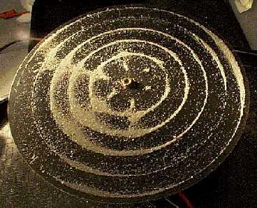
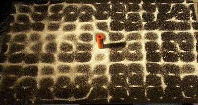
Which, finally, brings us to Ernst Chladni and his Chladni figures, or: architectonic structures appearing in sand due to patterns of acoustic resonance. The architecture of sand, involving sound—or architecture through sound, involving sand. Silicon assuming structure, humming.
The gist of Chladni’s experiments involved spreading a thin layer of sand across a vibrating plate, changing the frequency at which the plate vibrated, and then watching the sand as it shivered round, forming regular, highly geometric patterns. Those patterns depended upon, and were formed in response to, whatever vibration frequency it was that Chladni chose.
So you’ve got sand, dune music, terrestrial vibration, some Chladni figures – one could be excused for wondering whether the earth, apparently a kind of carbon-ironic bell made of continental plates and oceanic resonators, is really a vast Chladni plate, vibrating every little mineral, every pebble, every grain of sand, perhaps every organic molecule, into complex, three-dimensional, time-persistent patterns for which we have no standard or even technique of measurement. Or maybe William Blake knew how to do it, or Pythagoras, or perhaps even Nikola Tesla, but…
The sound dunes continue to boom and shiver. The deserts roar. The continents hum.
 [Image: “Mix House” by Joel Sanders Architect, Karen Van Lengen/KVL, and Ben Rubin/Ear Studio].
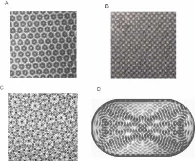
 [Images: Muons beneath the Alps;
  [Image:
  [Image: Courtesy

 [Images: Courtesy
 [Images: Courtesy
  [Image: The beginning of the Broomway path, at
  [Image: One possible end-point—not the furthest—of the “Doomway” path].
 [Image: The endpoint of the Broomway tidal path].
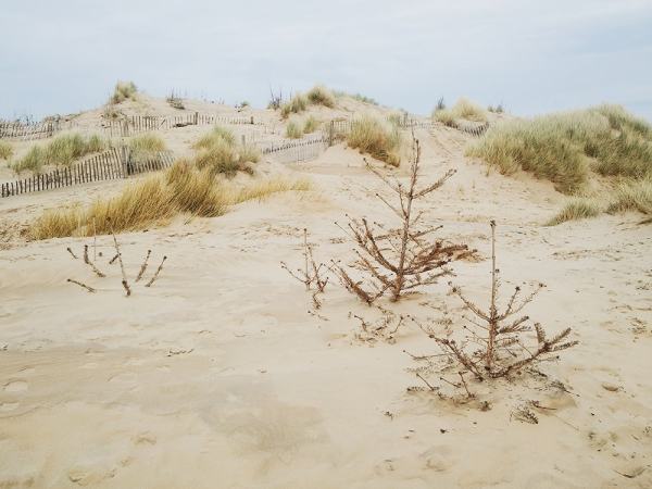 [Image: “Discarded Christmas trees were used to help rebuild the sand dunes around three years ago,” writes
  [Image: The Christmas trees at Formby; photo courtesy
  [Image: The artificially stabilized beaches at Formby, with no sign of the displaced forest lurking below;
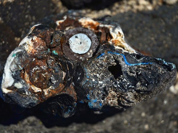 [Image: The new plastic geology, photographed by
 [Image: Cliffs and caves of Nottingham; photo by
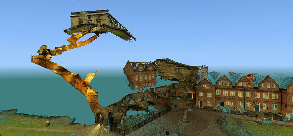
 [Images: Laser scans from the
 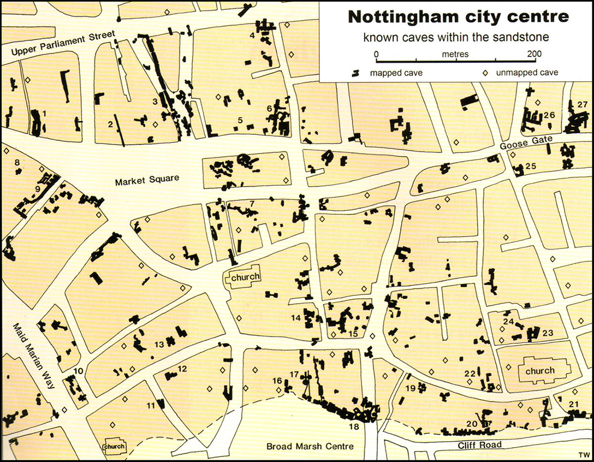 [Image: Map of only the known caves in Nottingham, and only in Nottingham’s city center; map by Tony Waltham, from
 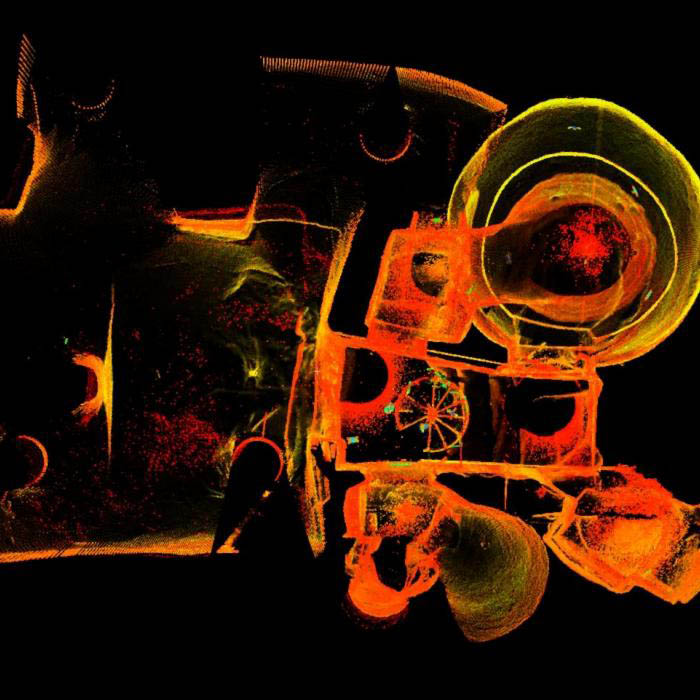 [Image: The extraordinary caves at
 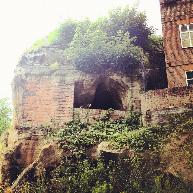 [Image: Artificially enlarged pores in the sandstone; photo by BLDGBLOG].
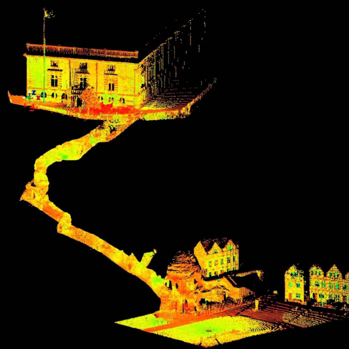 [Image: A laser scan showing the umbilical connection of
 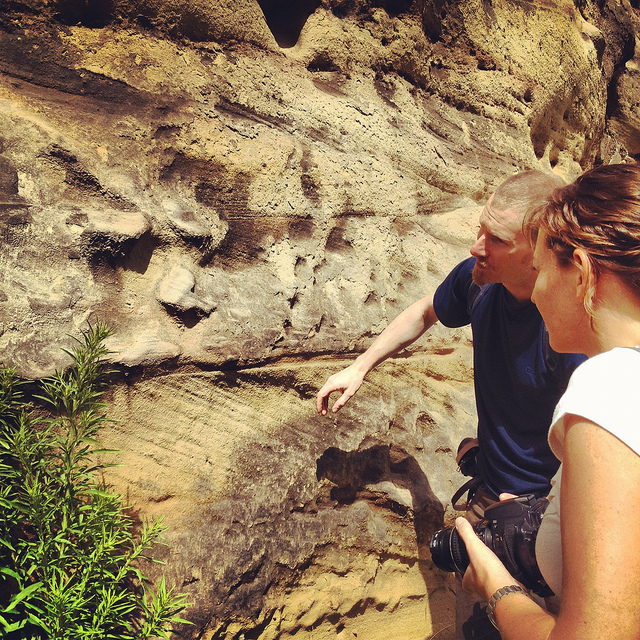 [Image: Examining sandstone with Dr. David Strange-Walker; photo by BLDGBLOG].
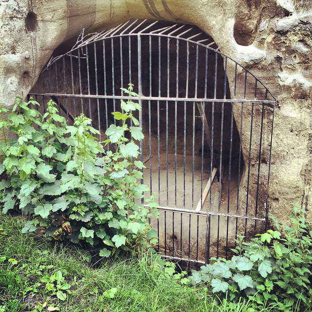 [Image: A gate in the cliff; photo by BLDGBLOG].
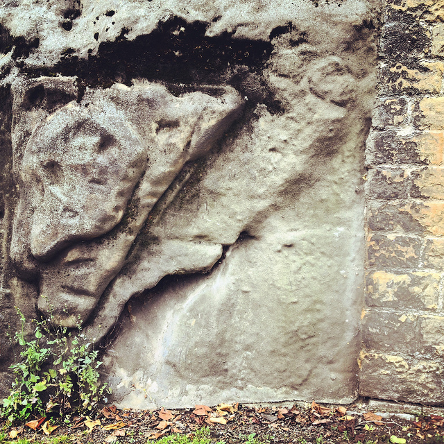 [Image: Artificial shotcrete geology; photo by BLDGBLOG].
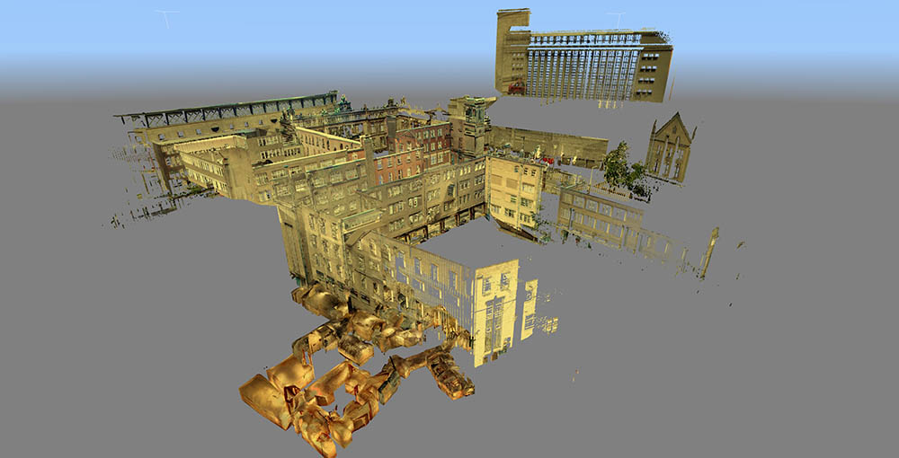 [Image: Scan of the Guildhall caves, courtesy of the
 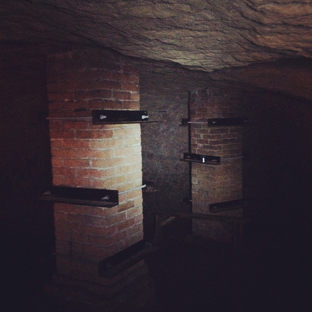 [Image: Brick pillars below Nottingham; photo by BLDGBLOG].
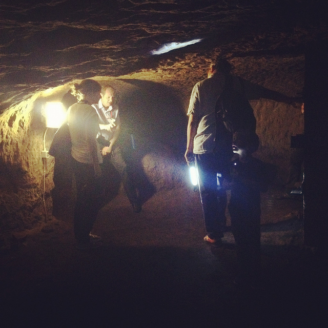
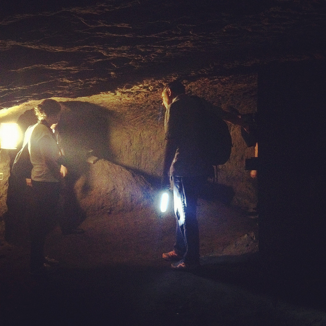 [Images: Learning about caves; photos by BLDGBLOG].
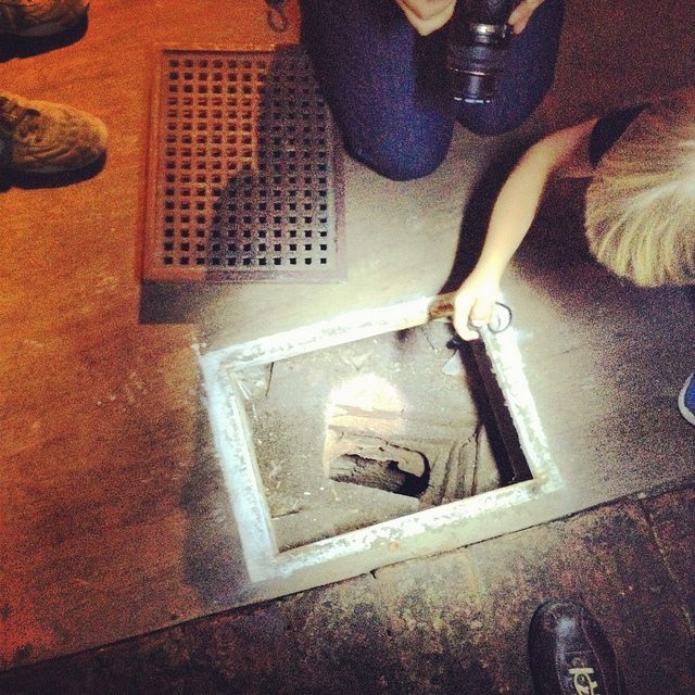
 [Images: Ellis Smout looks for Robin Hood below; photos by BLDGBLOG].
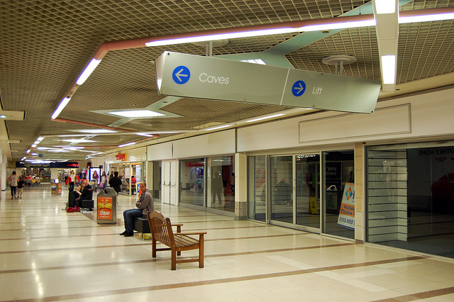 [Image: Caves; photo by
 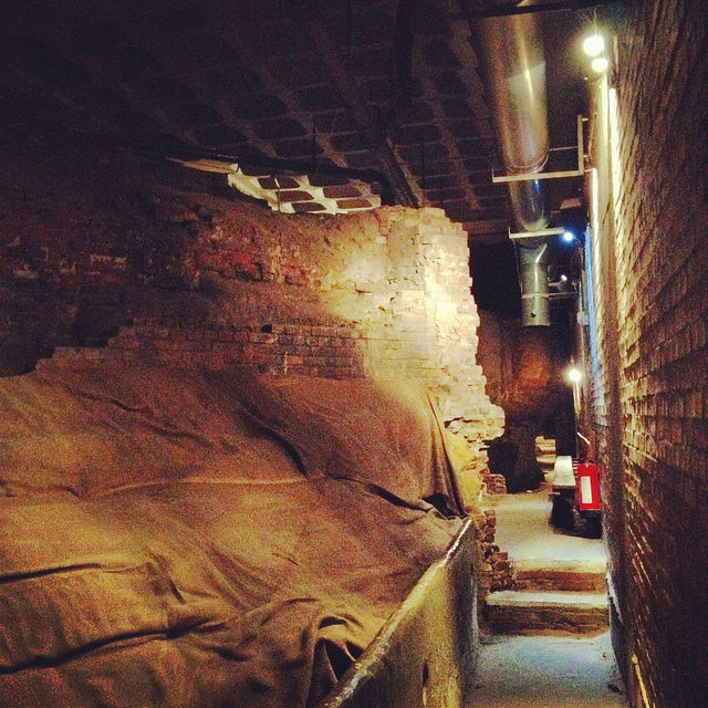 [Image: Beneath Broad Marsh shopping mall; photo by BLDGBLOG].
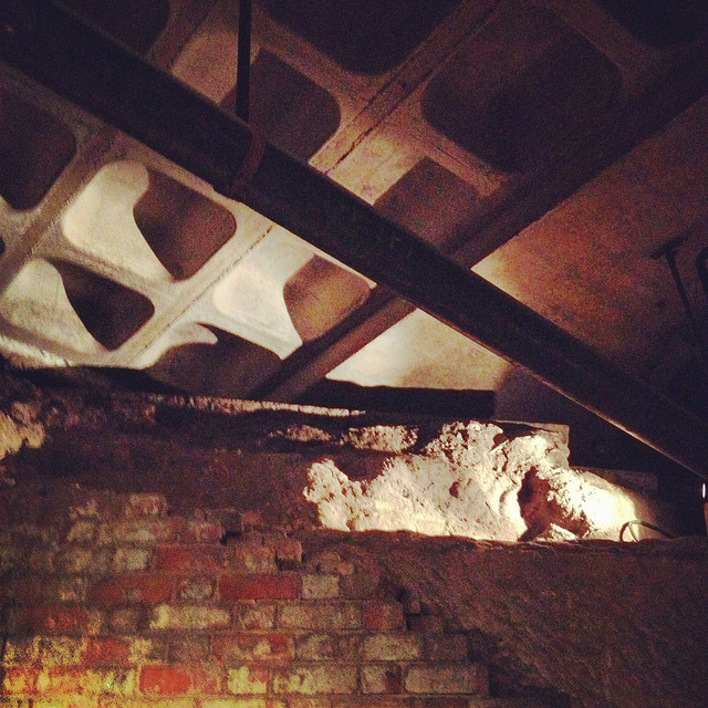
 [Images: Cave spaces beneath the Superstudio-like concrete grid of Nottingham’s Broad Marsh shopping Mall].
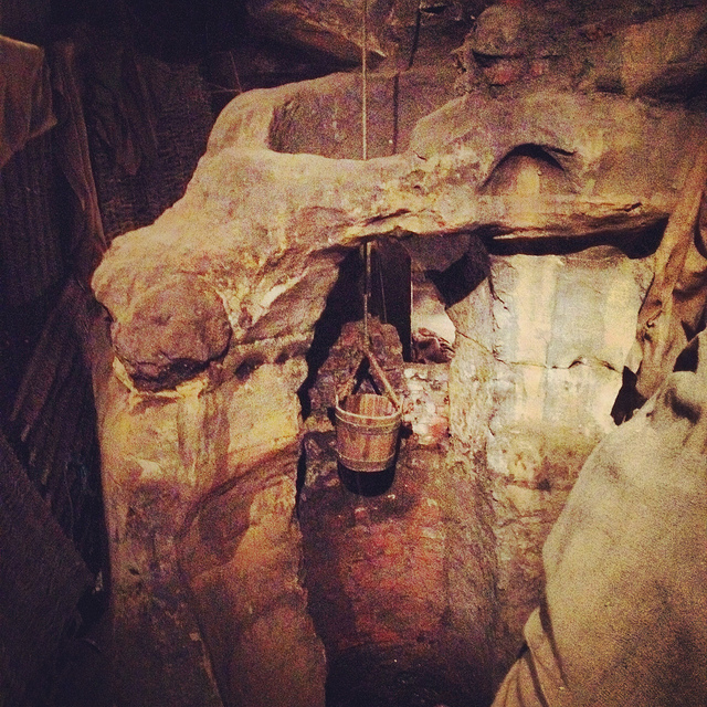 [Image: A well bucket in the caves beneath Broad Marsh; photo by BLDGBLOG].
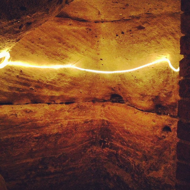
 [Images: Lines of lights we switched on in one of the off-limits rooms below Broad Marsh; photo by BLDGBLOG].
 [Image: A doorway to voids behind Broad Marsh Centre; photo by BLDGBLOG].
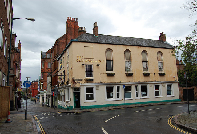
 [Images: The Old Angel Inn (top), including the door inside the pub that leads down to the caves below; photos by
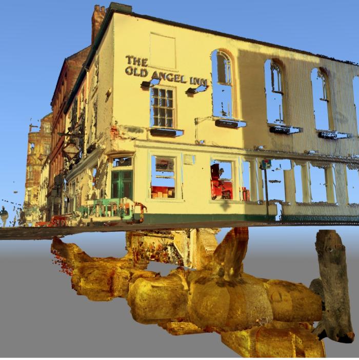
 [Images: The caves of the Old Angel Inn, courtesy of the
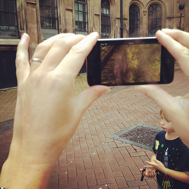
 [Images: We test-drive the cave-spotting app; bottom photo by
 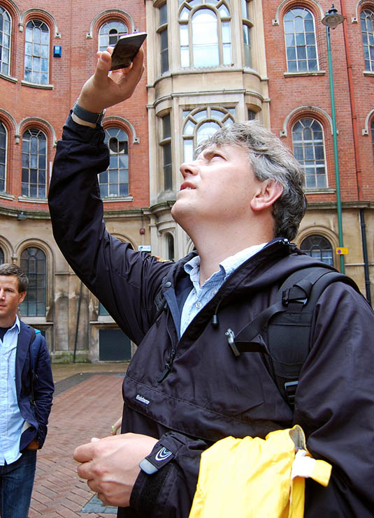 [Image: Mark Smout looks for caves in the sky; photo by
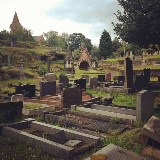
 [Images: Nottingham’s Rock Cemetery, where archaeologist David Strange-Walker explained the history of the local landscape].
 [Images: The Rock Cemetery catacomb gates].
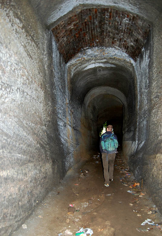 [Image: Inside the catacombs; photo by
  [Image: A door on the street—the black door with bars—leading down into a sand mine; photo by BLDGBLOG].
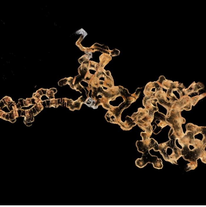
 [Image: The
 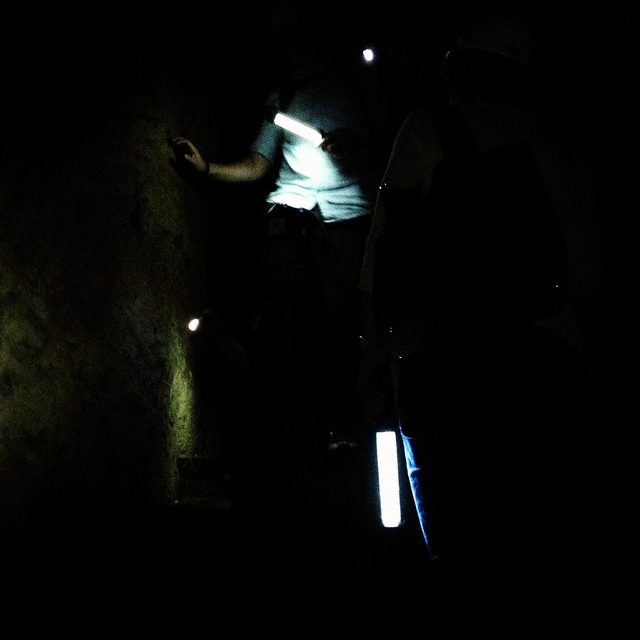 [Image: Nicola Twilley and Mark Smout head down into the sand mine; photo by BLDGBLOG].
 [Image: Many of these way-finding signs are actually incorrect, David explained, and seem to have been painted as a kind of sick joke by someone several years ago; photos by BLDGBLOG].
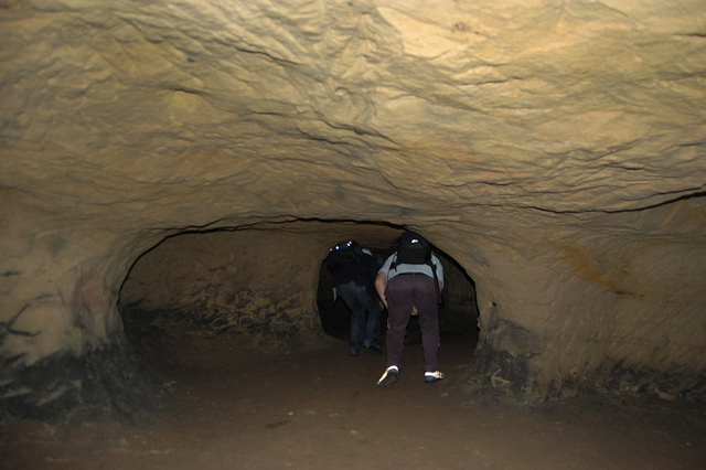
 [Images: Inside the sand mine; all photos by
 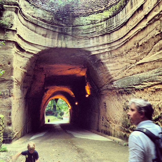 [Image: Mark & Ellis Smout explore our final “underground” space of the day, the magnificent Park Tunnel; the banded strata clearly visible in the walls show how the tunnel was carved through the dunes of an ancient desert. Photo by BLDGBLOG].
 [Image: Geologist
  [Image: Bookstore for Shibuya Publishing, Japan, designed by
 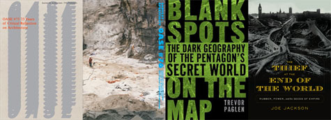 1)
1)  4)
4)  8)
8)  [Image: Photo by
  [Image: The Libyan Sahara; photo ©