Warnings Along the Drought Line

[Photo by Petr David Josek/AP, via NPR].

Elise Hunchuck, whose project “An Incomplete Atlas of Stones” sought to document warning stones placed along the Japanese coast to indicate safe building limits in case of tsunamis, has called my attention to a somewhat related phenomena in Central Europe.

So-called “hunger stones” have been uncovered by the low-flowing, drought-reduced waters of Czech Republic’s Elbe River, NPR reports. Hunger stones are “carved boulders… that have been used for centuries to commemorate historic droughts—and warn of their consequences.” One stone, we read, has been carved with the phrase, Wenn du mich siehst, dann weine, or “If you see me, weep.”

Although there are apparently extenuating circumstances for the rocks’ newfound visibility—including a modern-day dam constructed on the Elbe River which has affected water levels—I nonetheless remain haunted by the idea of uncovering buried or submerged warnings from our own ancestors stating that, in a sense, if you are reading this, you are already doomed.

Read a bit more over at NPR.

(Thanks, Elise!)

Warnings Along the Inundation Line

[Image: Cover from An Incomplete Atlas of Stones by Elise Hunchuck].

After the Tōhoku tsunami in 2011, one of the most ominous details revealed about the coast where it struck, for those of us not familiar with the region, was that a series of warning stones stand there overlooking the sea, carved with sayings such as, “Do not build your homes below this point!

As part of her recent thesis at the Daniels Faculty of Architecture, Landscape, and Design—a school of the University of Toronto—landscape architect Elise Hunchuck spent the summer of 2015 traveling around Japan’s Sanriku coast, documenting every available tsunami stone in photographs, maps, and satellite views, and accumulating seismic and geological data about each stone’s local circumstances.

The end result was a book called An Incomplete Atlas of Stones. It was inspired, she writes, by “a combined interest in warning systems and cartography.”

[Image: From An Incomplete Atlas of Stones by Elise Hunchuck].

“Rising from the earth,” Hunchuck writes in the book’s introduction, “many [of the warning stones] were placed in the landscape to mark either the height of the inundation line or to mark territory above the inundation line.”

They formed a kind of worst-case boundary line for where solid land meets the sea, the known limit of catastrophic inundation.

[Images: Spreads from An Incomplete Atlas of Stones by Elise Hunchuck].

The book introduces each stone taxonomically:

Each tsunami stone is introduced by its geographic coordinates: latitude, longitude, and elevation. Latitude and longitude site each stone on the surface of the earth while elevation situates each stone in relation to the mean level of the sea. The stones are further situated; first, by the boundaries of the village, town, or city they are located within; second, by their administrative prefecture; and, third, their geographical region. As each stone has been erected in response to a major tsunami, both the year and name of the tsunami is listed in addition to the stone’s relation to the inundation line (below the line, on the line, or above the line) of both its target tsunami and the tsunami of 2011. Each stone, at the time of its erection, was engraved with a message. The stones mapped in this atlas may be considered as belonging to one of two categories: as a memorial, commemorating people and places lost to an earthquake tsunami, or as a lesson, providing a description of events and directions as to where to build, where to evacuate to, and where waters have risen in the past.

Each stone or set of stones thus gets a four-page spread, giving the book a nice structural consistency.

[Images: Spreads from An Incomplete Atlas of Stones by Elise Hunchuck].

As you can also see, satellite shots are used to show the landscape at different states in time: one depicts the coastline immediately following the 2011 tsunami, the next then showing the same locatio after up to five years of rebuilding have taken place.

In some of these comparisons, seemingly nothing at all has changed; in others, it appears nearly the entire landscape has been consumed by forests.

[Images: Spreads from An Incomplete Atlas of Stones by Elise Hunchuck].

The entire book is nearly 250 pages in length, and the selections I’ve chosen here barely scratch the surface. The material Hunchuck has gathered would not only be served well by a gallery installation; the project also sets up an interesting formal precedent for other documentary undertakings such as this.

Given my own background, meanwhile—I am a writer, not an architect—I would love to see more of a reporting angle in future versions of this sort of thing, e.g. interviews with local residents, or even with disaster-response workers, connected to these landscapes through personal circumstance.

The narratives of what these stones are and what they mean would be well-illustrated by more than just data, in other words, including verbal expressions of how and why these warnings were heeded (or, for that matter, fatally overlooked).

[Images: Spreads from An Incomplete Atlas of Stones by Elise Hunchuck].

In any case, the title of Hunchuck’s book—it is an incomplete atlas—also reveals that Hunchuck is still investigating what the stones might mean and how, as a landscape architect, she might respond to them. Her goal, she writes, “is not to offer an explicit response—yet. This incomplete atlas shares the stories of seventy five places, each without a definitive beginning or end.”

Along those lines, I’m reminded of a geologist quoted by the New York Times in their own coverage of the megaliths: “We need a modern version of the tsunami stones.”

Stay tuned for Hunchuck’s forthcoming website with more about the project.

(Vaguely related: Boundary Stones and Capital Magic and, to a certain extent, Watermarks.)

Voids and Vacuums

[Image: Google Maps view of Mosul Dam (bottom center) and the huge reservoir it creates].

Dexter Filkins—author of, among other things, The Forever War—has a long new piece in the first 2017 issue of The New Yorker about the impending collapse of Iraq’s Mosul Dam.

The scale of the potential disaster is mind-boggling.

If the dam ruptured, it would likely cause a catastrophe of Biblical proportions, loosing a wave as high as a hundred feet that would roll down the Tigris, swallowing everything in its path for more than a hundred miles. Large parts of Mosul would be submerged in less than three hours. Along the riverbanks, towns and cities containing the heart of Iraq’s population would be flooded; in four days, a wave as high as sixteen feet would crash into Baghdad, a city of six million people. “If there is a breach in the dam, there will be no warning,” Alwash said. “It’s a nuclear bomb with an unpredictable fuse.”

Indeed, “hundreds of thousands of people could be killed,” according to a UN report cited by Filkins.

What’s interesting from a technical perspective is why the dam is so likely to collapse. It’s a question of foundations. The dam was built, Filkins writes, on rock “interspersed with gypsum—which dissolves in contact with water. Dams built on this kind of rock are subject to a phenomenon called karstification, in which the foundation becomes shot through with voids and vacuums.”

Filling those voids with grout is now a constant job, requiring dam engineers to pump huge amounts of cementitious slurry down into the porous rock in order to replace the dissolved gypsum.

[Image: Mosul Dam spillway; photo by U.S. Army Staff Sgt. Brendan Stephens].

At one point, Filkins goes inside the dam where “engineers are engaged in what amounts to an endless struggle against nature. Using antiquated pumps as large as truck engines, they drive enormous quantities of liquid cement into the earth. Since the dam opened, in 1984, engineers working in the gallery have pumped close to a hundred thousand tons of grout—an average of ten tons a day—into the voids below.”

Finding and caulking these voids, Filkins writes, is “deeply inexact.” They are deep underground and remain unseen; they have to be inferred. The resulting process is both absurd and never-ending.

The engineers operating [the grout pumps] can’t see the voids they are filling and have no way of discerning their size or shape. A given void might be as big as a closet, or a car, or a house. It could be a single spacious cavity, requiring mounds of grout, or it could be an octopus-like tangle, with winding sub-caverns, or a hairline fracture. “We feel our way through,” [deputy director Hussein al-Jabouri] said, standing by the pump. Generally, smaller cavities require thinner grout, so Jabouri started with a milky solution and increased its thickness as the void took more. Finally, after several hours, he stopped; his intuition, aided by the pressure gauges, told him that the cavity was full. “It’s a crapshoot,” [civil engineer Azzam Alwash] told me. “There’s no X-ray vision. You stop grouting when you can’t put any more grout in a hole. It doesn’t mean the hole is gone.”

It’s hard not to think of a scene in Georges Perec’s novel Life: A User’s Manual, a scene I have written about before. There, a character named Emilio Grifalconi picks up an old, used table only to find that the support column at its center is “completely worm-eaten.” Slowly, painstakingly, operating by intuition, he fills the worm-eaten passages with a permanent adhesive, “injecting them with an almost liquid mixture of lead, alum and asbestos fiber.”

The table collapses anyway, alas, giving Grifalconi an idea: “dissolving what was left of the original wood” in order to “disclose the fabulous arborescence within, this exact record of the worms’ life inside the wooden mass: a static, mineral accumulation of all the movements that had constituted their blind existence, their undeviating single-mindedness, their obstinate itineraries; the faithful materialization of all they had eaten and digested as they forced from their dense surroundings the invisible elements needed for their survival, the explicit, visible, immeasurably disturbing image of the endless progressions that had reduced the hardest of woods to an impalpable network of crumbling galleries.”

Whether or not such a rhizomatic tangle of grout-filled chambers, linked “voids and vacuums” like subterranean grapes, could ever be uncovered and explored beneath the future ruins of a safely dismantled Mosul Dam is something I will leave for engineers.

[Image: Mosul Dam water release; photo by U.S. Army Staff Sgt. Brendan Stephens].

However, Filkins points out one possible solution that would sidestep all of this: this option, he writes, “which has lately gained currency, is to erect a ‘permanent’ seal of the existing dam wall—a mile-long concrete curtain dropped eight hundred feet into the earth.”

This would not be the only huge subterranean wall to be proposed recently: think of the “giant ice wall” under construction beneath the Fukushima nuclear power plant in Japan: “Japan is about to switch on a huge refrigeration system that will create a 1.5-km-long, underground frozen ‘wall,’ in hopes of containing the radioactive water that’s spilling out of the Fukushima nuclear power plant, which went into meltdown following the earthquake and tsunami of March 2011.”

Read more over at The New Yorker.

Detecting lost rooms with architectural antennae

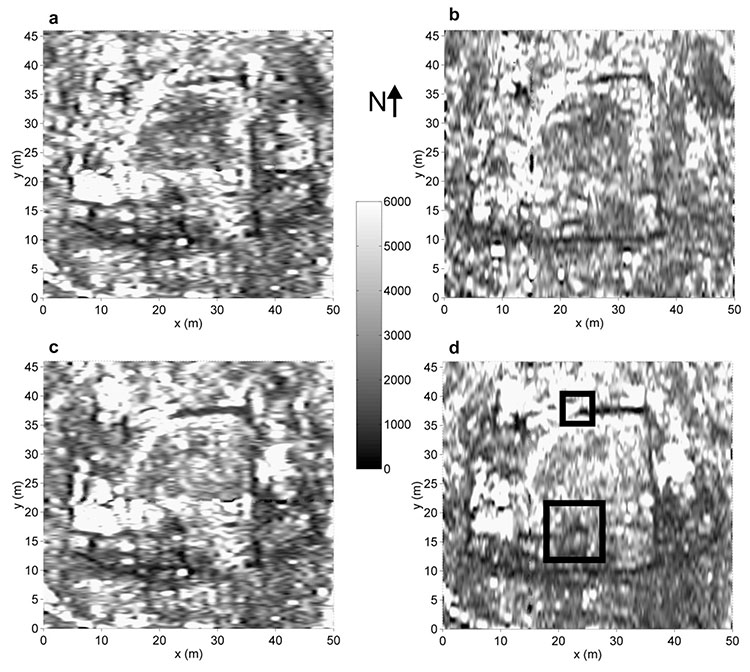
[Image: “Constant time slices” reveal buildings buried in northwestern Argentina; image from, and courtesy of, the Journal of Archaeological Science, “Detecting and mapping buried buildings with Ground-Penetrating Radar at an ancient village in northwestern Argentina,” by Néstor Bonomo, Ana Osella, and Norma Ratto].

While reading The Losers last night for the first time—a graphic novel about a team of ex-CIA members now executing a series of elaborate heists against their former employer—I was pleasantly surprised to see that one of the final scenarios involves a small volcanic island featuring an abandoned village that had very recently been buried by ash and pumice.

In a nutshell, the buildings beneath all that rock and ash are still intact—and one of them contains a locked safe that our eponymous group of “losers” is searching for. So begins an unfortunately quite short scene of vertical archaeology: locating the proper building amidst the featureless landscape of ash, blasting a hole down through the building’s roof, stabilizing the ceiling from within so that heavy-lifting equipment can be installed on the rooftop, and then descending into the hallways and staircases below by way of mountaineering ropes to find the safe.

For whatever reason, there are few things I find more exciting to read about than high-risk descents into buried cities, especially one that, as in the case of The Losers, remains otherwise indistinguishable from the surface of the earth, only gradually revealing itself to be an extraordinary honeycomb of connected rooms and passages—and this brief moment in the book was made even more interesting when I remembered a handful of articles I’d saved last year, one of which also involves a lost village, buried by volcanic ash.
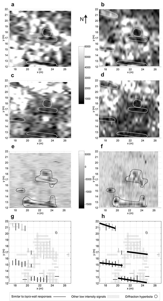
[Image: A selection of “time slices” from the buried buildings of northwestern Argentina; image from, and courtesy of, the Journal of Archaeological Science, “Detecting and mapping buried buildings with Ground-Penetrating Radar at an ancient village in northwestern Argentina,” by Néstor Bonomo, Ana Osella, and Norma Ratto].

In a 1998 paper from the Journal of Applied Geophysics, called “The use of ground penetrating radar to map an ancient village buried by volcanic eruptions,” we read about a village in Japan called Komochi-mura, in Gunma prefecture: “The entire area surrounding the village is covered by a thick deposit of pumice derived from the eruption of Futatsudake volcano of Mt. Haruna, approximately 10km to the southwest of the village.”

Beneath the modern village, its predecessor from the middle of the 6th century is buried by the pumice deposits. Since these were laid down over a very short period, the ancient village should survive in a high state of preservation and will therefore contain much significant archaeological information. Ground penetrating radar (GPR) has been used to investigate this site over a period of 10 years. As a result, the plan of the ancient village can be accurately mapped… In this paper, the authors demonstrate how GPR was able to map the structural remains of the ancient village under a deposit of pumice.

In addition to various buildings, “pit-dwellings,” and other destroyed structures preserved but invisibly buried beneath today’s village, “traces of brushwood hedges, paths and other slight features have also been identified by the survey.”

These types of articles—on the remote-sensing of buried architectural remains, using technologies that “can detect and map buried structures without disturbing them,” in the words of the paper I am about to cite—are increasingly easy to find, but no less interesting because of their ubiquity.

Another paper, then, called “Detecting and mapping buried buildings with Ground-Penetrating Radar at an ancient village in northwestern Argentina,” published in 2010 in the Journal of Archaeological Science, describes an archaeological survey in which ground-penetrating radar was used “in order to detect new buildings,” including a system of “complex wall distribution and a number of unknown enclosures.” These “new buildings,” however, were just signals from the earth awaiting spatial interpretation:

The exploration showed signals of mud-walls in a sector that was located relatively far from the previously known buildings. A detailed survey was performed in this sector, and the results showed that the walls belonged to a large dwelling with several rooms. The discovery of this dwelling has considerably extended the size of the site, showing that the dwellings occupied at least twice the originally assumed area. High-density GPR surveys were acquired at different parts of the discovered building in order to resolve complex structures. Interpreted maps of the building were obtained.

“From the joint analysis of the transverse sections, time slices and volume slices of the data and their time averaged intensity,” the authors explain, “we have obtained a final map for the new building”—where the “new” building, of course, is a much older, forgotten one, a structure interpretively remade and refreshed through this newfound legibility.
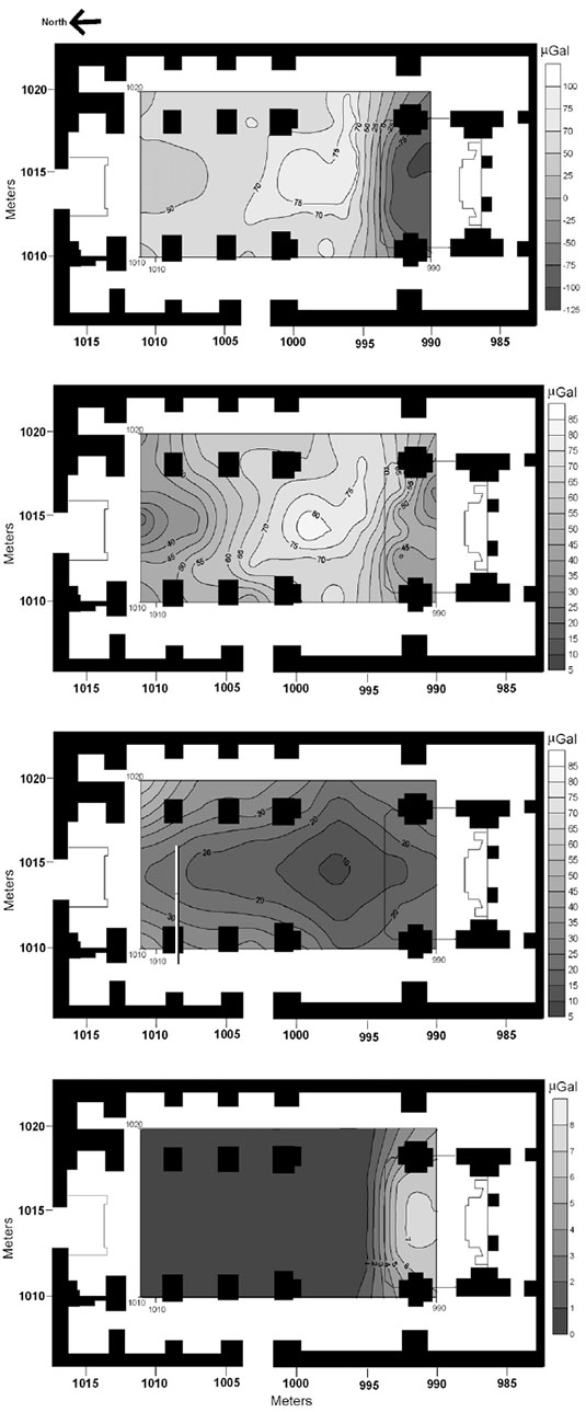
[Image: From “Archaeological microgravimetric prospection inside don church (Valencia, Spain),” by Jorge Padín, Angel Martín, Ana Belén Anquela, in a 2012 issue of the Journal of Archaeological Science].

Architecture, in this context, comes to our attention first as a series of “intensity blots continued through consecutive slices,” an almost impossibly abstract geometry of signals and reflections, of patterned “electromagnetic responses” hidden in the landscape.

In all of these cases, it’d be interesting to propose a kind of archaeological discovery park the size of a football stadium, whose interior is simply a massive, open-span paved landscape on which small devices like floor-waxing machines or lawnmowers have been parked. Paying visitors can walk out onto this vast, continuous monument of bare concrete where they will begin moving the machines around, cautiously at first but then much more ambitiously, revealing as they do so the underground perimeters and outlines of entire villages buried deep in the mud and gravel beneath the building. The “park” is thus really a kind of terrestrial TV show of invisible architecture previously lost to history but beautifully preserved—that is, entombed—in the geology below.

In any case, in writing this post I’ve realized that I’ve accumulated over the past two years or so several gigabytes’ worth of PDFs about these and other archaeological technologies—from mapping ancient ships buried in the Egyptian pyramids and micro-gravity detection of “shallow subsurface structures” in a church in Italy (“indicating,” in the authors’ words, “that the actual church was constructed above another one”) to “archaeomagnetic data” taken from Roman sites in Tunisia—but here’s at least one more reference for good measure.

In a paper called “Ground penetrating radar (G.P.R.) surveys applied to the research of crypts in San Sebastiano’s church in Catania (Sicily),” from a 2007 issue of the Journal of Cultural Heritage, a team of Italian geophysicists explored “natural or anthropic buried cavities” under a church in Sicily—that is, both architectural chambers and caves physically inaccessible in the foundations of the building. Soon enough, the authors write, “the existence of hidden structures was revealed.”

“In fact,” they add, “a crypt with a barrel vault, under the central aisle of the church, and a room of small dimensions next to this crypt were identified. Moreover, near the altar, the presence of a quadrangular crypt with a cross-vault was revealed. The presence of such buried masonries confirms that the church, rebuilt on previous building rests, has been subjected along the centuries to repeated repairs.”
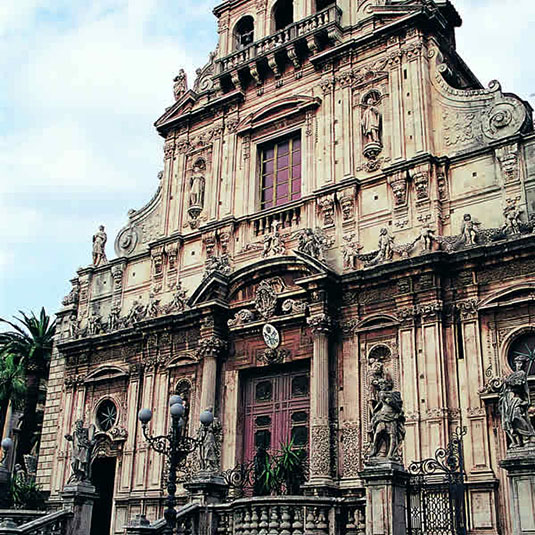
[Image: The church of San Sebastiano in Catania, Sicily, courtesy of the regional tourism council].

There is something particularly awesome—that is, it is a story that lends itself particularly to metaphor—about envisioning a squad of well-equipped scientists setting up shop in a church in Sicily, using radar and rigs of strange antennae to scan the structure around them for secret rooms, heavenly nooks and crannies out of human reach. A kind of electromagnetic baroque.

The paper cited in a caption above—”Archaeological microgravimetric prospection inside don church (Valencia, Spain),” by Jorge Padín, Angel Martín, Ana Belén Anquela, from a 2012 issue of the Journal of Archaeological Science—even includes such strangely resonant lines as calculating against “residual gravity anomalies” in a “microgravimetric correction for the altar,” as if the high science of geophysical investigation has been rhetorically wed with theological speculation.

In the words of a paper by N. Farnoosh et al., published in a 2008 issue of NDT & E International, analyzing a given architectural space becomes a question of “buried target detection” using high-tech means—that is, establishing a sustained and coordinated “electromagnetic interaction among the radar antennas, ground, and buried objects.”

Here, the study of architectural history can very, very loosely be compared to astronomy: using tools of remote-sensing, including antennae, but targeted downward, into the earth, to reveal the flickering, gossamer traces of something that, for a variety of reasons, humans can’t yet physically reach. Like astronomy, then, archaeology and architectural history become a case of interpreting signals from afar, not of stars and supernovae but of lost rooms and buildings beneath our feet.

Seismic Decentralization

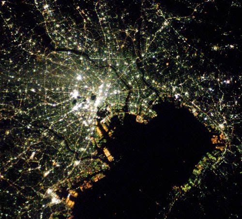
[Image: Tokyo at night, courtesy of NASA’s Earth Observatory].

At the height of the Cold War, the sprawling, decentralized suburban landscape of the United States was seen by many military planners as a form of spatial self-defense. As historian David Krugler explains in This Is Only a Test: How Washington D.C. Prepared for Nuclear War, “urban dispersal” was viewed as a defensive military tactic, one that would greatly increase the nation’s chance of survival in the event of nuclear attack.

Specially formatted residential landscapes such as “cluster cities” were thus proposed, “each with a maximum population of 50,000.” These smaller satellite cities would not only reshape the civilian landscape of the United States, they would make its citizens, its industrial base, and its infrastructure much harder to target.

“This might seem the stuff of Cold War science fiction,” Krugler writes, “but after World War II, many urban and civil defense planners believed cluster cities, also called dispersal, should be the future of the American metropolis.”

These planners, like the U.S. Strategic Bombing Survey, imagined atomic firestorms engulfing American cities and advocated preventive measures such as dispersal. Just one or two atomic bombs could level a concentrated metropolitan area, but cluster cities would suffer far less devastation: enemy bombers could strike some, but not all, key targets, allowing the unharmed cities to aid in recovery.

Krugler points out that this suburban dispersal was not always advised in the name of military strategy: “Many urban planners believed dispersal could spur slum clearance, diminish industrial pollution, and produce parks. Not only would dispersal shield America’s cities, it would save them from problems of their own making.”

However, the idea that urban dispersal might be useful only as a protective tactic against the horrors of aerial bombardment overlooks other threats, including earthquakes and tsunamis.

Earlier this week, Japanese prime minister Naoto Kan was advised “to decentralize Japan” out of fear of “Tokyo annihilation danger.” Indeed, we read, the recent 9.0 earthquake, tsunami, and partial nuclear meltdown at Fukushima together suggest that “the nation must reduce the role of its capital city to avert an even greater catastrophe.”

Takayoshi Igarashi, a professor at Hosei University, explains: “I told the prime minister that nationwide dispersal is the first thing we need to do as we rebuild. We have no idea when the big one’s going to hit Tokyo, but when it does, it’s going to annihilate the entire country because everything is here.” His conclusion: “The lesson we need to take away from this disaster is that we have to restructure Japan as an entire nation”—a seismic decentralization that relies as much on horizontal geography as on vertical building code. This could thus be “the nation’s biggest investment in urban planning in decades.”

The idea that urban design might find a reinvigorated sense of national purpose in response to a threat in the ground itself is fascinating, of course, perhaps especially for someone who also lives in an earthquake zone. But the prospect of large-scale urban dispersal remaking the urban landscape of Japan—that Tokyo itself might actually be broken up into smaller subcities, and that future urban planning permission might be adjusted to enforce nationwide sprawl as a form of tectonic self-defense, from megacity to exurban lace—presents an explicit spatialization of Japanese earthquake policy that will be very interesting to track over the years to come.

(Spotted via @urbanphoto_blog).

Spatial Gameplay in Full-Court 3D

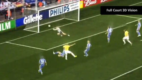
Japan is distinguishing its bid to host the 2022 World Cup with a plan to broadcast the entire thing as a life-size hologram.

[Image: Courtesy of the Japan Football Association/CNN].

“Japanese organizers say each game will be filmed by 200 high definition cameras, which will use ‘freeviewpoint’ technology to allow fans to see the action unfold from a player’s eye view—the kind of images until now only seen in video games,” CNN reports.

[Image: Courtesy of the Japan Football Association/CNN].

British football theorist Jonathan Wilson puts an interestingly spatial spin on the idea: “Speaking as a tactics geek,” he said to CNN, “the problem watching games on television is it’s very hard to see the shape of the teams, so if you’re trying to assess the way the game’s going, if you’re trying to assess the space, how a team’s shape’s doing and their defense and organization, then this will clearly be beneficial.”

Watching a sport becomes a new form of spatial immersion into strategic game geometries.

[Image: Courtesy of the Japan Football Association/CNN].

Of course, there’s open disbelief that Japan can actually deliver on this promise—it is proposing something based on technology that does not quite exist yet, on the optimistic assumption that all technical problems will be worked out in 12 years’ time.

But the idea of real-time, life-size event-holograms being beamed around the world as a spatial replacement for TV imagery is stunning.

(Thanks to Judson Hornfeck for the tip!)

Glacier / Island / Storm

I thought it might be fun to post the course description and design brief for a course I’ll be teaching this semester at Columbia.

[Image: Photo via the Alfred Wegener Institute].

The idea behind the studio is to look at naturally occurring processes and forms—specifically, glaciers, islands, and storms—and to ask how these might be subject to architectural re-design.

We will begin our investigations by looking at three specific case-studies, including the practical techniques and concerns behind each. This research will then serve as the basis from which studio participants will create original glacier/island/storm design proposals.

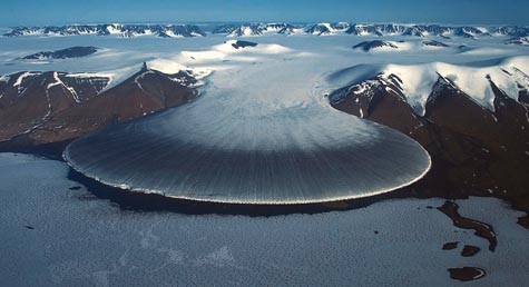
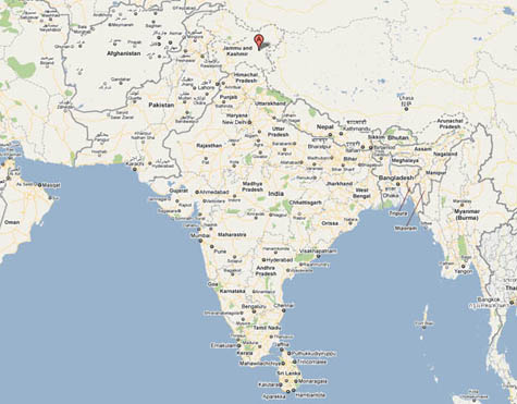
GLACIER: For centuries, a vernacular tradition of constructing artificial glaciers in the Himalayas has been used to create reserves of ice from which freshwater can be reliably obtained during dry years. This is the glacier as non-electrical ice reserve, in other words; some of these structures have even received funding as international relief projects—for instance, by the Aga Khan Rural Support Program in Pakistan. Interestingly, the artificial glacier here becomes a philanthropic pursuit, falling somewhere between Architecture For Humanity and a sustainable water-bank.
Through an examination of glacier-building techniques, water requirements, and the thermal behavior of ice, we will both refine and re-imagine designs for self-sustaining artificial glaciers, for the ultimate purpose of storing fresh water.

But what specific tools and spatial techniques might this require? Further, what purposes beyond drought relief might an artificial glacier serve? There are myths, for instance, of Himalayan villagers building artificial glaciers to protect themselves against invasion, and perhaps we might even speculate that water shortages in Los Angeles could be relieved with a series of artificial glaciers maintained by the city’s Department of Water and Power at the headwaters of the Colorado River…

ISLAND: Building artificial islands using only sand and fill is relatively simple, but how might such structures be organically grown?
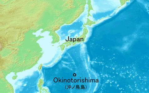
In the ocean south of Japan is a complex of reefs just slightly below the surface of the water; Japan claims that these reefs are, in fact, islands. This is no minor distinction: if the international community supports this claim, Japan would not only massively extend its Exclusive Economic Zone (EEZ), complete with seabed-mining and fishing rights, but it would also block China from accessing those same resources. This would, however, also limit the ability of Chinese warships to patrol the region—and so the U.S. has publicly backed Japan’s territorial claim (China does not).

Okinawan scientists have thus been developing genetically-modified species of coral with the express idea of using these species to “grow” the reefs into a small but internationally recognized archipelago: the Okinotori Islands. Think of it as bio-technology put to use in the context of international sovereignty and the U.N. Law of the Sea.

The stakes are high—but, our studio will ask, by way of studying multiple forms of reef-building as well as materials such as Biorock, where might other such island-growing operations be politically and environmentally useful? Further, how might the resulting landforms be most interestingly designed? Assisted by a class visit from marine biologist Thomas Goreau, one-time collaborator of architect Wolf Hilbertz, we will look at the construction techniques and materials necessary for building wholly new artificial landforms.

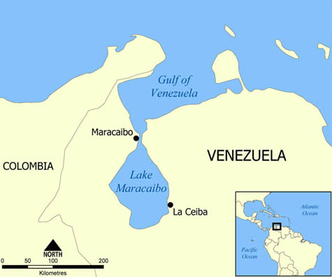
STORM: For hundreds of years, a lightning storm called the Relampago del Catatumbo has flashed in the sky above Venezuela’s coastal Lake Maracaibo. The perfect mix of riverine topography, lake-borne humidity, and rain forest air currents has produced what can be described, with only slight exaggeration, as a permanent storm.
This already fascinating anecdote takes on interesting spatial design implications when we read, for instance, that Shanghai city officials have expressed alarm at the inadvertent amplification of wind speeds through their city as more and more skyscrapers are erected there—demonstrating that architecture sometimes has violent climatological effects. Further, Beijing and Moscow both have recently declared urban weather control an explicit aim of their respective municipal governments—but who will be in charge of designing this new weather, and what role might architects and landscape architects play in its creation?

We will be putting these—and many other—examples of weather control together with urban, architectural, and landscape design studies in an attempt to produce atmospheric events. For instance, could we redesign Manhattan’s skyline to create a permanent storm over the city—or could we rid the five boroughs of storms altogether? And under what circumstances—drought-relief in the American southwest or Gulf Coast hurricane-deflection—might our efforts be most practically useful?

• • •

The studio will be divided into three groups—one designing “glaciers,” one designing “islands,” one designing “storms.” Each group will mix vernacular building technologies with what sounds like science fiction to explore the fine line between architectural design and the amplified cultivation of natural processes. Importantly, this will be done not simply for the sake of doing so (although there will be a bit of that…), but to address much larger questions of international sovereignty, regional drought, global climate change, and more.

The Emperor’s Castle

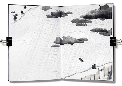
[Image: Image 1, “Eternal Punishment,” from The Emperor’s Castle by Thomas Hillier].
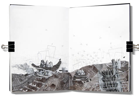
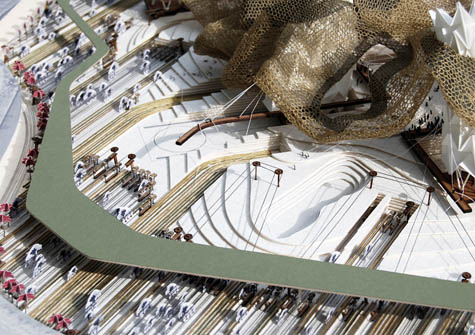
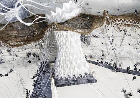
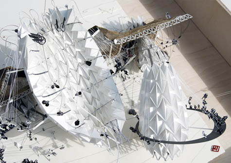
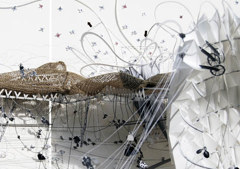
For his student thesis project at the Bartlett School of Architecture, Thomas Hillier produced an immersive narrative world, complete with origami-filled hand-cut book pages and an elaborate model of the story’s architectural landscape. Hillier’s project was called The Emperor’s Castle and it was inspired by the work of Japanese printmaker Hiroshige.

The Emperor’s Castle originates from a mythical and ancient tale hidden within a woodblock landscape scene created by Japanese Ukiyo-e printmaker, Ando Hiroshige. This tale charts the story of two star-crossed lovers, the weaving Princess and the Cowherd, who have been separated by the Princess’s father, the Emperor. These characters have been replaced by architectonic metaphors creating an urban theatre within the grounds of the Imperial Palace in central Tokyo.

The result is astonishing; the images here have been presented in order, so you can follow the flow of the tale, with descriptive text supplied by Hillier. I would advise, however, that you also check out the Flickr set I put together for the project, where much larger versions of these images (and more text) are available.

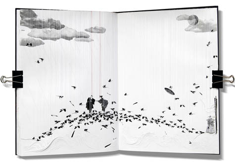
The first two images, Hillier says, are taken from his “research storybook.” They are hand-cut paper collages, and they show us “two acts from a series of five that illustrate and explore the narrative structure of the tale.” The scenes thus supply “a series of clues, which can inform the future architectural proposition.”

[Image: Image 2, “The Last Meeting,” from The Emperor’s Castle by Thomas Hillier].
As Hillier writes:

Image 1 (Act 3, Eternal Punishment) illustrates the Emperor’s anger over his daughter’s relationship with a cowherd. He separates the couple, placing them back in their original locations. The Emperor wanted to be sure they would never meet again, so he closed the castle and opened the heavens. Rain fell, causing the castle’s moat to flood, creating an island of the castle surrounded by a deep and swift lake unassailable by any man.
Image 2 (Act 5, The Last Meeting). Seeing the sadness of their friend, the Princess, the birds and animals came together to decide how to stop the torrent of her tears. So the sky became black as all the magpies and crows, with their wings spread wide, formed a bridge across the lake. When the Princess realizes what the birds have done, she stops crying and rushes across the feathery bridge to embrace the Cowherd and renew their pledge of eternal love.

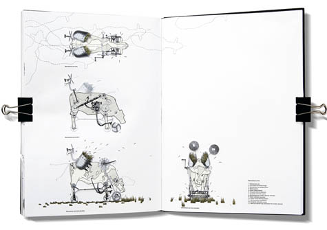
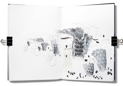
The next three images “are hand-cut exploratory paper collages” illustrating “the architectonic character transition” through which the story’s human figures are transformed into pieces of architecture.

In a way, it’s the Hypnerotomachia Poliphili as retold for Late Edo Japan.

[Images: Image 3, “The Emperor’s Origami Lungs”; Image 4, “The Princess’s Knitted Canopy”; and Image 5, “The Cowherd’s Mechanical Cow-cutters”; from The Emperor’s Castle by Thomas Hillier].
From Hillier’s project text:

Image 3 (The Emperor’s Origami Lungs). The Emperor’s lungs come alive through differing gestures and surface transformations based on geometrical tessellations adopted from origami crease patterns. The lungs imitate the motion of breathing through expansion and contraction creating a bellowing volume that allows the Emperor to project his emotions both visually and audibly. They rise and fall, creating a bobbing motion, which produces a rippling affect onto the surrounding skin. The severity of these ripples will depend on the anger of the Emperor, and can cause the newly knitted areas of skin to become loose and break, stopping the Princess from ever reaching the cow herder.
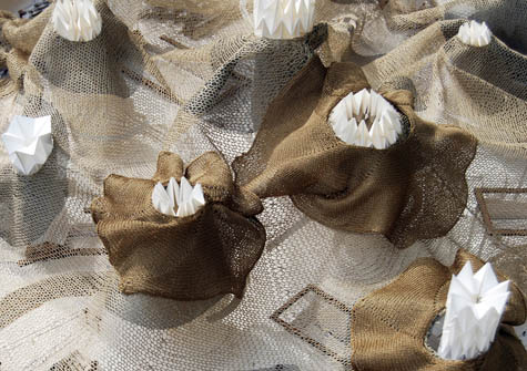
Image 4 (The Princess’s Knitted Canopy). The Princess, a flexible, diaphanous knitted membrane, envelopes the spaces below and is fabricated using the surrounding ‘Igusa’: a natural rush material used in the fabrication of tatami mats. Igusa expels a soothing scent as the skin undulates, which is said to calm body and mind. This scent acts as a perfume of remembrance to the cow herder and his time spent running hand in hand through the meadows with the Princess.
Image 5 (The Cowherd’s Mechanical Cow-Cutters). The cowherd has been reinterpreted architecturally as the grass band, which wraps the perimeter of the site, encompassing the Emperor’s lungs and Princess’s knitted skin. Embodying the cowherd are the mechanical cows, which act as wind-up grass-cutting devices that constantly wander the grazing land, cutting the grass and fanning the aroma towards the Princess as a reminder of the cowherd. These cows are waiting and hoping for the moment the Princess knits her skin over the mechanical waves towards them, re-enacting the connection between the two star-crossed lovers.

The mechanical symbology of the resulting landscape—with “the Princess’s knitted membrane knit[ting] itself ever larger… to reach the grass parkland perimeter representing the Cowherd”—is outlined in more detail in the project text (again, as seen in the Flickr set).

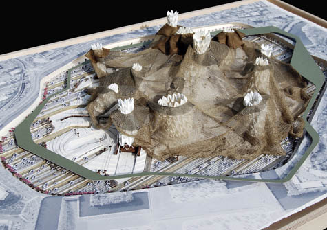
[Image: Image 6 from The Emperor’s Castle by Thomas Hillier].
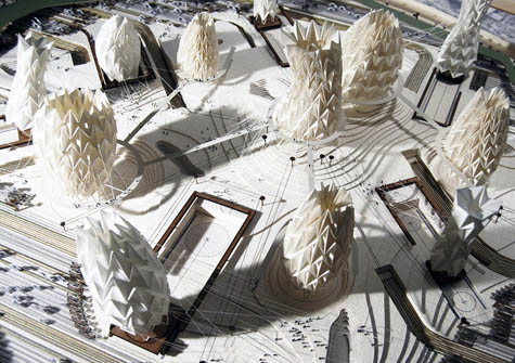
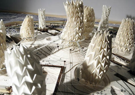
The rest of the images—including the full model, above—showcase Hillier’s exquisite craftmanship.

[Images: Images 7, 8, 9, and 10 from The Emperor’s Castle by Thomas Hillier].
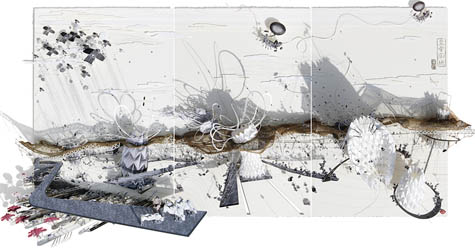
Image 7, above, shows us “the contoured landscape underneath the knitted canopy, exposing the series of connecting walkways that allow the Emperor’s army to run from one lung to another,” while Image 8 reveals “the Emperor’s origami lungs.” Image 9 reveals how those lungs operate; there, we begin to see “the lung movements” of the Emperor, Hillier writes, as they “generate a bellowing volume of air.” This air is then “forced upwards, sending the woven lung collars into a thrashing frenzy, visually increasing the impact of the Emperor’s anger.” In another context, it might be interesting to explore the use of pneumatic metaphors to explore the nature and function of imperial power; but such an essay will have to wait for another day.

Image 10, meanwhile, zooms in on the Emperor’s “Mechanical Moat,” a machine-hydrology that surrounds and delimits the project landscape.

And then we reach the finale.

[Image: Image 11 from The Emperor’s Castle by Thomas Hillier].
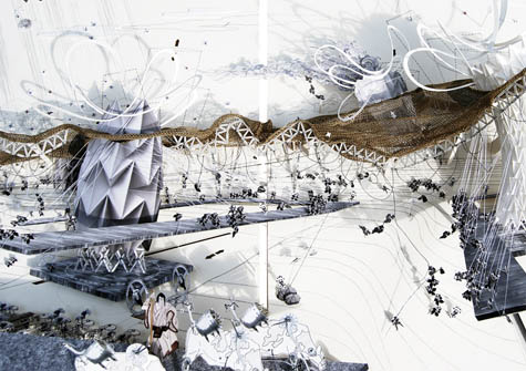
The images below are “the final triptych,” Hillier writes. They offer “a section through the urban theatre [that] illustrates the frenetic ‘life’ of the building. This 1.8m x 0.8m piece is the culmination of all the research and design synthesis carried out above.”

[Images: Images 12, 13, 14, and 15 from The Emperor’s Castle by Thomas Hillier].
Hillier’s project is a beautifully realized example of something I’ve long been curious about—for instance, if a book like Ulysses had been “written” not with a typewriter but with a 3D printer, what sort of architectural world might result? The Emperor’s Castle offers at least one possible answer for how literature could be translated directly into urban and architectural space.

Now reverse-engineer this: take a landscape garden somewhere—or an accidental assemblage of parks, buildings, rivers, and homes—and interpret that setting as if it is literature. Do a reverse-Hillier, so to speak: start with the landscape and extract characters and motivated dramatic actions from the objects placed within it.

In any case, again, check out the Flickr set for more text and much larger images; and don’t miss Johan Hybschmann’s “book of space,” also produced this year at the Bartlett.

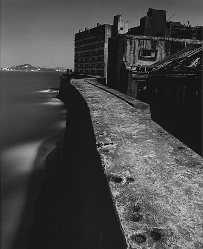
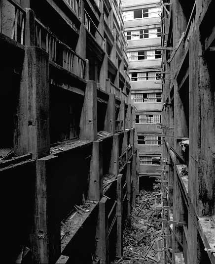
Gunkanjima Island

[Image: Gunkanjima Island (via)].

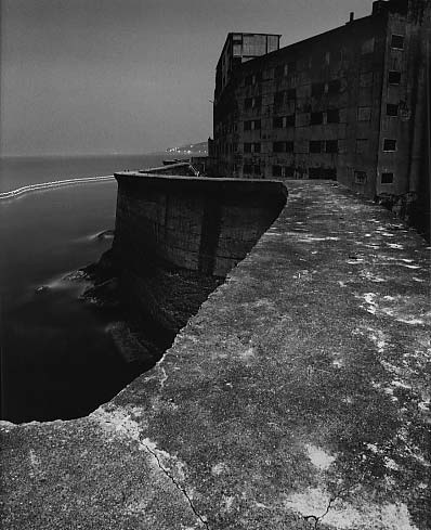
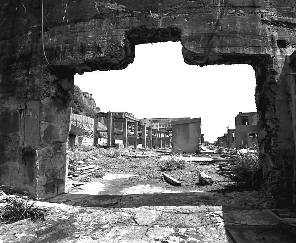
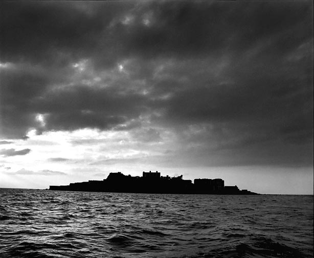
“Off the westernmost coast of Japan,” we read, “is an island called ‘Gunkanjima’ that is hardly known even to the Japanese.”

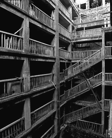
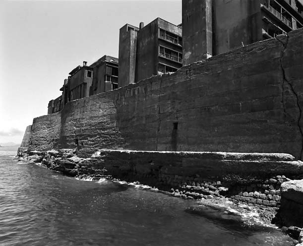
Long ago, the island was nothing more than a small reef. Then in 1810, [with] the chance discovery of coal … people came to live here, and through coal mining the reef started to expand continuously. Befor [sic] long, the reef had grown into an artificial island of one kilometer (three quarters of a mile) in perimeter, with a population of 5300. Looming above the ocean, it appeared a concrete labyrinth of many-storied apartment houses and mining structures built closely together.

“Seen from the ocean,” the site continues, “the silhouette of the island closely resembled a battleship – so, the island came to be called Gunkanjima, or Battleship Island.”

[Images: Gunkanjima Island (via)].

The idea of an entirely artificial mining island seems to lie somewhere between James Bond and Greek mythology. I’ve always wanted to write a short story about a mineral-rich island where a man similar to Conrad’s Kurtz sets up a mining operation; in mining the mineral wealth of his new little island, the architecture and structural engineering – the gantries, vaults, platforms, roads, etc. – come to be built from the island itself. Eventually the island entirely disappears beneath the waterline, mined down to nothing – and yet a small stilt-city of mining platforms, engineering decks, control rooms, and cantilevered walkways still exists there, built from the island it all now replaces.

[Image: Gunkanjima Island (via)].

In The Scar by China Miéville, there’s a floating city made from tightly lashed-together hulls of ships, built so densely that, for those deep within it, it appears simply to be a particularly over-built – albeit floating – island. The rudders and keels of old boats cut through the water at angles contrary to the direction that the ship-island floats in, and thousands of anchors secure the city in place when it needs to find harbor.

What seems to be missing, at least to my experience, from architectural history & design courses are things like – drum roll – offshore mining derricks. Once again, it seems the wrong people are teaching our design labs: instead of more M.Arch grads who’ve read too much – or not enough – Deleuze, we need to bring in junior executives from BP or Halliburton, geologists and NASA engineers, and put them into dialogue with Situationism – and, why not, with China Miéville. Science fiction writers. Get ideas out of the one side, practical engineering science out of the other, and shebang…

What could that produce…? is a legitimate question. A terrible example, but still marginally interesting I think, would be something like the Burning Man festival, thrown not in the desert but in the middle of the Atlantic Ocean. A joint-venture between BP, Halliburton, and Peter Cook of Archigram. And the Mars Homestead Project. Seaborne utopias. Platform cities. Perhaps Atlantis was built by a battalion of rogue Roman engineers lost to history.

[Image: Gunkanjima Island (via)].

It’s not Damien Hirst, Daniel Libeskind, Matthew Barney, or Norman Foster we should be watching, neither artistically nor architecturally, I mean; it’s the Chief Operating Officers of offshore oil-services firms. The architectural patrons of today are not avant-garde, middle class Connecticut home-owners but logistical managers in the US Department of Energy. New building types are not being discovered or invented in the design labs of American architectural offices, but in the flowcharts and budgetary projection worksheets of multinational petrochemical firms. Forget Spiral Jetty – we need a platform city built above the mid-Atlantic rift, an uninhabited, reinforced concrete archipelago ideal for untrained astronomical observation. The Reef Foundation – you win their residency grant and get to spend six months alone staring at the sun on a perfectly calibrated Quikrete lily pad.

We need the wastrel sons of hedge fund billionaires out there patronizing manmade archipelagos in the South China Sea.

We need more Gunkanjima Islands.

[Image: Gunkanjima Island (via)].