 [Image: Cover from An Incomplete Atlas of Stones by Elise Hunchuck].
After the Tōhoku tsunami in 2011, one of the most ominous details revealed about the coast where it struck, for those of us not familiar with the region, was that a series of warning stones stand there overlooking the sea, carved with sayings such as, “Do not build your homes below this point!”
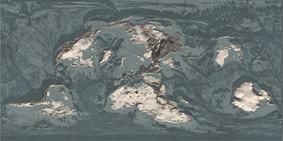
As part of her recent thesis at the Daniels Faculty of Architecture, Landscape, and Design—a school of the University of Toronto—landscape architect Elise Hunchuck spent the summer of 2015 traveling around Japan’s Sanriku coast, documenting every available tsunami stone in photographs, maps, and satellite views, and accumulating seismic and geological data about each stone’s local circumstances.
The end result was a book called An Incomplete Atlas of Stones. It was inspired, she writes, by “a combined interest in warning systems and cartography.”
 [Image: From An Incomplete Atlas of Stones by Elise Hunchuck].
“Rising from the earth,” Hunchuck writes in the book’s introduction, “many [of the warning stones] were placed in the landscape to mark either the height of the inundation line or to mark territory above the inundation line.”
They formed a kind of worst-case boundary line for where solid land meets the sea, the known limit of catastrophic inundation.


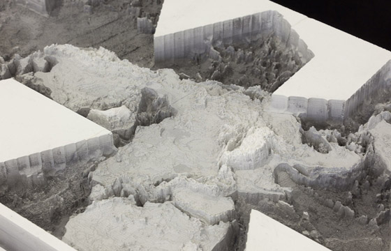
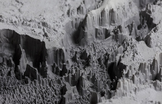
 [Images: Spreads from An Incomplete Atlas of Stones by Elise Hunchuck].
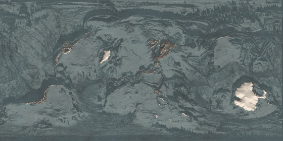
The book introduces each stone taxonomically:
Each tsunami stone is introduced by its geographic coordinates: latitude, longitude, and elevation. Latitude and longitude site each stone on the surface of the earth while elevation situates each stone in relation to the mean level of the sea. The stones are further situated; first, by the boundaries of the village, town, or city they are located within; second, by their administrative prefecture; and, third, their geographical region. As each stone has been erected in response to a major tsunami, both the year and name of the tsunami is listed in addition to the stone’s relation to the inundation line (below the line, on the line, or above the line) of both its target tsunami and the tsunami of 2011. Each stone, at the time of its erection, was engraved with a message. The stones mapped in this atlas may be considered as belonging to one of two categories: as a memorial, commemorating people and places lost to an earthquake tsunami, or as a lesson, providing a description of events and directions as to where to build, where to evacuate to, and where waters have risen in the past.
Each stone or set of stones thus gets a four-page spread, giving the book a nice structural consistency.


 [Images: Spreads from An Incomplete Atlas of Stones by Elise Hunchuck].
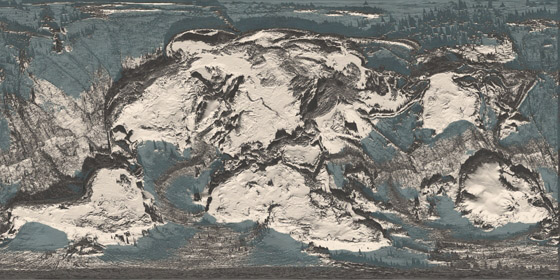
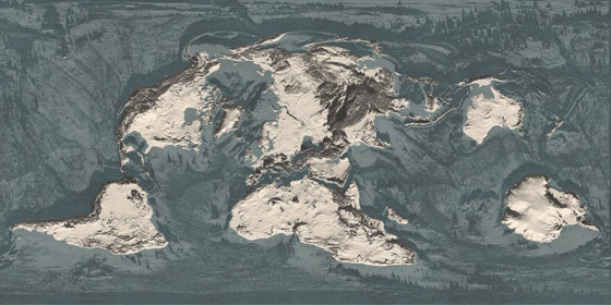
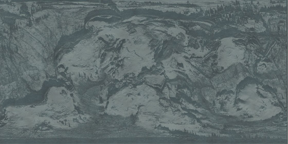
As you can also see, satellite shots are used to show the landscape at different states in time: one depicts the coastline immediately following the 2011 tsunami, the next then showing the same locatio after up to five years of rebuilding have taken place.
In some of these comparisons, seemingly nothing at all has changed; in others, it appears nearly the entire landscape has been consumed by forests.


 [Images: Spreads from An Incomplete Atlas of Stones by Elise Hunchuck].
The entire book is nearly 250 pages in length, and the selections I’ve chosen here barely scratch the surface. The material Hunchuck has gathered would not only be served well by a gallery installation; the project also sets up an interesting formal precedent for other documentary undertakings such as this.
Given my own background, meanwhile—I am a writer, not an architect—I would love to see more of a reporting angle in future versions of this sort of thing, e.g. interviews with local residents, or even with disaster-response workers, connected to these landscapes through personal circumstance.
The narratives of what these stones are and what they mean would be well-illustrated by more than just data, in other words, including verbal expressions of how and why these warnings were heeded (or, for that matter, fatally overlooked).


 [Images: Spreads from An Incomplete Atlas of Stones by Elise Hunchuck].
In any case, the title of Hunchuck’s book—it is an incomplete atlas—also reveals that Hunchuck is still investigating what the stones might mean and how, as a landscape architect, she might respond to them. Her goal, she writes, “is not to offer an explicit response—yet. This incomplete atlas shares the stories of seventy five places, each without a definitive beginning or end.”
Along those lines, I’m reminded of a geologist quoted by the New York Times in their own coverage of the megaliths: “We need a modern version of the tsunami stones.”
Stay tuned for Hunchuck’s forthcoming website with more about the project.
(Vaguely related: Boundary Stones and Capital Magic and, to a certain extent, Watermarks.)
 [Image: Schmidt Ocean Institute, via ScienceDaily].
 [Image: Test-crash from “
 [Image: From
  [Image: Google Maps view of Mosul Dam (bottom center) and the huge reservoir it creates].
 [Image: Mosul Dam spillway; photo by U.S. Army Staff Sgt.
  [Image: Mosul Dam water release; photo by U.S. Army Staff Sgt.

 [Image: From
 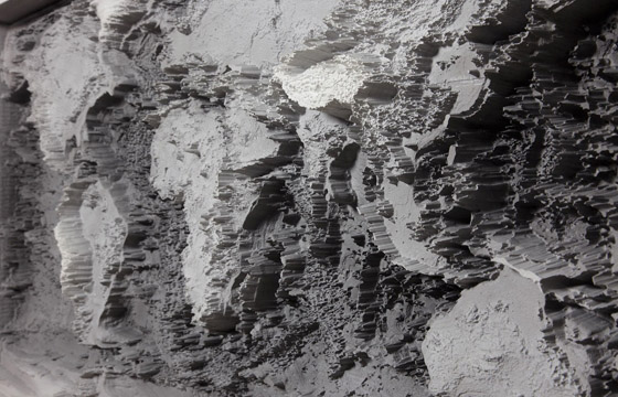 [Image: From
 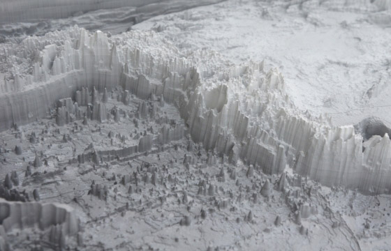 [Image: From
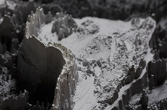
 [Images: From
 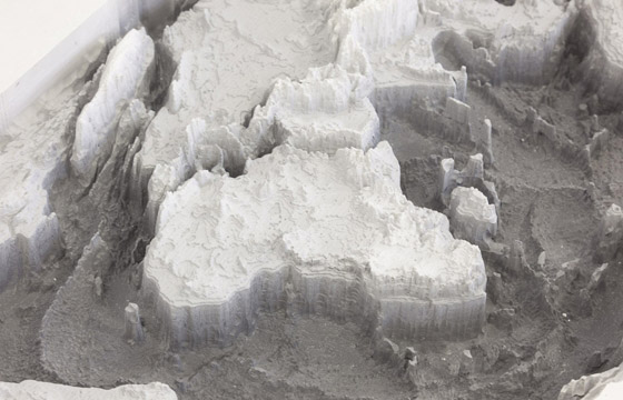 [Image: From
 [Images: From
 [Image: Micromotors at work, via
 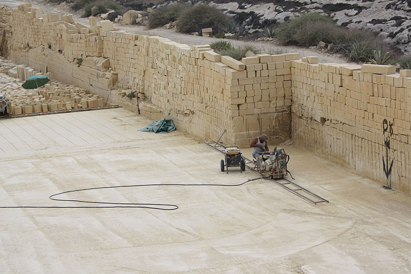 [Image: A Maltese limestone quarry, via
 [Image: Via the
  [Image: Via the
  [Image: Via the
  [Image: Via the
  [Image: From the
  [Image: From the
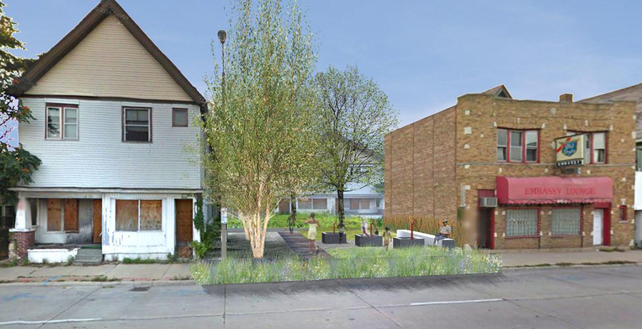 [Image: Rendering of a possible “BaseTern” landscape by students Brett Harris, Andrew D’Arcy, and Heidi Petersen, via
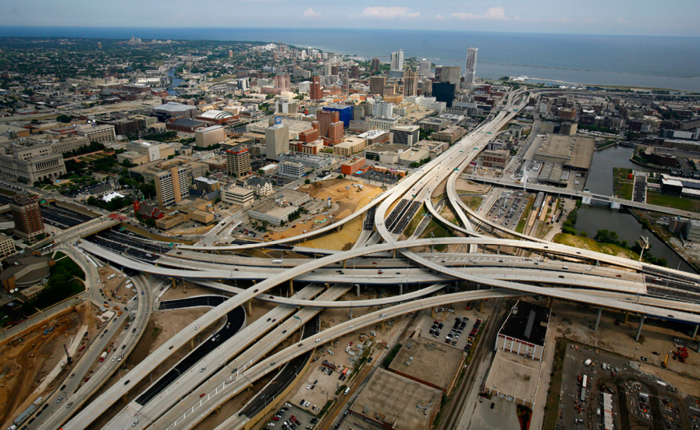
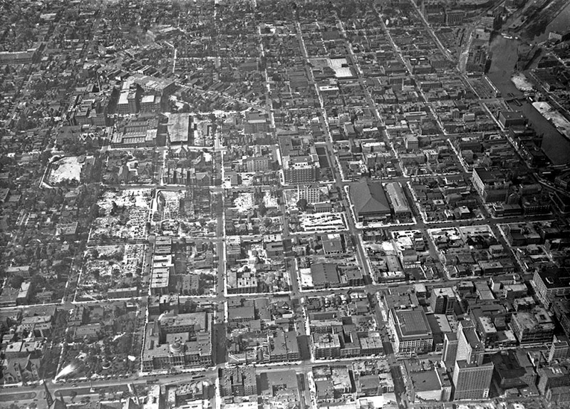 [Images: (top) Milwaukee’s Marquette interchange, nearly the same size as the city it cuts through; (bottom) Milwaukee before the interchange. Images via
 [Images: Two BaseTern design diagrams, taken from Milwaukee’s “