 [Image: View larger! From “Celestial Detector,” 2025 Lisbon Architecture Triennale; all text by Geoff Manaugh, all images by John Becker/WROT Studio.]
I had a new piece of short fiction commissioned by the 2025 Lisbon Architecture Triennale that was just published last week over at e-flux.
The theme of the Triennale this year is “How Heavy is a City?” To address that, I wrote about a fictional German physicist named Wendell Brandt. During the Cold War, Brandt proposed using cosmic particles—known as muons—to spy under the Berlin Wall.
 [Image: From “Celestial Detector,” 2025 Lisbon Architecture Triennale; all text by Geoff Manaugh, all images by John Becker/WROT Studio.]
Although Brandt (and the story’s first-person narrator) is entirely fictional, muon tomography—or muography—is a real visualization technique.
Muons are constantly passing through all of us—through our skin and bones, our cars and buildings, through the mountains and landforms around us. They are so small, moving so quickly, that they have little interaction with matter. We never feel them, though they are inside our muscle and bone; we never see them, though they pass through our pupils and optic nerves.
Although muons are everywhere, they are surprisingly few in number: every second, fewer than ten muons pass through an area the size of your palm, literally just a handful. With the right instrumentation, however, the passage of muons can be recorded, like light on a digital sensor, which means that, given enough time, muons can be used to create images. Similar to an X-ray, the resulting “muographs,” as they are known, reveal otherwise inaccessible voids inside even the densest of materials.
Muography allows people to peer inside dense materials and structures, from cathedrals and hydroelectric dams to Mayan temples and Egyptian pyramids. Or, of course, entire neighborhoods in Cold War Berlin.

 [Images: From “Celestial Detector,” 2025 Lisbon Architecture Triennale; all text by Geoff Manaugh, all images by John Becker/WROT Studio.]
Brandt’s experiment in celestial espionage took advantage of an abandoned church near the Berlin Wall where, funded by the U.S. Department of Defense, he installed his first detector. As the data came in, however, Brandt became obsessed with exactly who he was spying on—perhaps even old friends and family members, now isolated in East Berlin by the construction of the Wall.
In a project notebook I obtained through a Freedom of Information Act request, I found that Brandt had used several pages as a personal journal, reflecting on his experience developing muographic techniques in Berlin. The notes—strangely, written in English, as if he had hoped his American sponsors would someday read them—suggested a scientific curiosity gradually becoming more philosophical. Whether muons could image strategically important military features gave way to speculation about families living in apartments nearby, about the quiet lives of fellow Germans separated by the Wall—people who, he believed, he would never meet face to face. All he would know of them were these shadows and blurs, etched by cosmic particles on secret electronics in the deep.
Brandt’s fixation with capturing the lives of strangers, using particles from space, led him onward from there to a series of increasingly ambitious scientific experiments. These included, after the fall of the Wall in November 1989, a purpose-built architectural facility for rigorously measuring the passage of muons.
 [Images: From “Celestial Detector,” 2025 Lisbon Architecture Triennale; all text by Geoff Manaugh, all images by John Becker/WROT Studio.]
Although there is much more to the (fictional) story, Brandt’s experiments culminated in a massive lab constructed beneath a remote California town, within the San Andreas Fault.
 [Image: From “Celestial Detector,” 2025 Lisbon Architecture Triennale; all text by Geoff Manaugh, all images by John Becker/WROT Studio.]
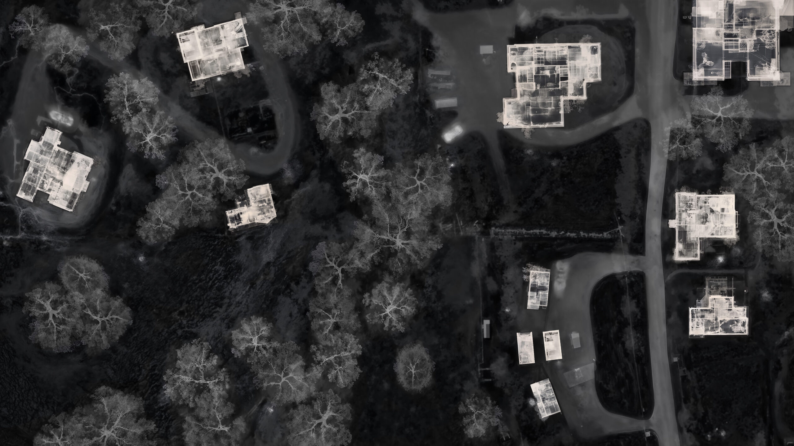
Although his scientific goal there was to see if muography could be used to image large-scale terrestrial phenomena, such as a moving tectonic fault, Brandt began to notice, within the data, the outlines of the town above, down to individual houses and rooms—even, over the course of fifteen years, specific pieces of furniture showing up in the resulting scans.
Once again, Brandt was looking into the lives of strangers from below, using particles from space.
 [Image: From “Celestial Detector,” 2025 Lisbon Architecture Triennale; all text by Geoff Manaugh, all images by John Becker/WROT Studio.]
The story itself, I hope, is worth reading in full, but the visuals are a huge part of it. Those were all produced by John Becker of WROT Studio, a frequent collaborator of mine (for projects like the “Institute for Controlled Speleogenesis” and 3D-printing concrete bees).
John put together some spectacular depictions of architecture as imaged using muons, including short AI-generated film sequences and a larger animation that will be screened in Lisbon at the Triennale next month.
 [Image: View larger! From “Celestial Detector,” 2025 Lisbon Architecture Triennale; all text by Geoff Manaugh, all images by John Becker/WROT Studio.]
The story was at least partially inspired by my old friend Lebbeus Woods, whose fictional projects—including his proposal for an unmade film called “Underground Berlin”—are never far from my mind.
Check it out, if you get a chance.
(Thanks to Nick Axel of e-flux for editorial guidance, and to Ann-Sofi Rönnskog and John Palmesino of Territorial Agency for commissioning the story in the first place.)
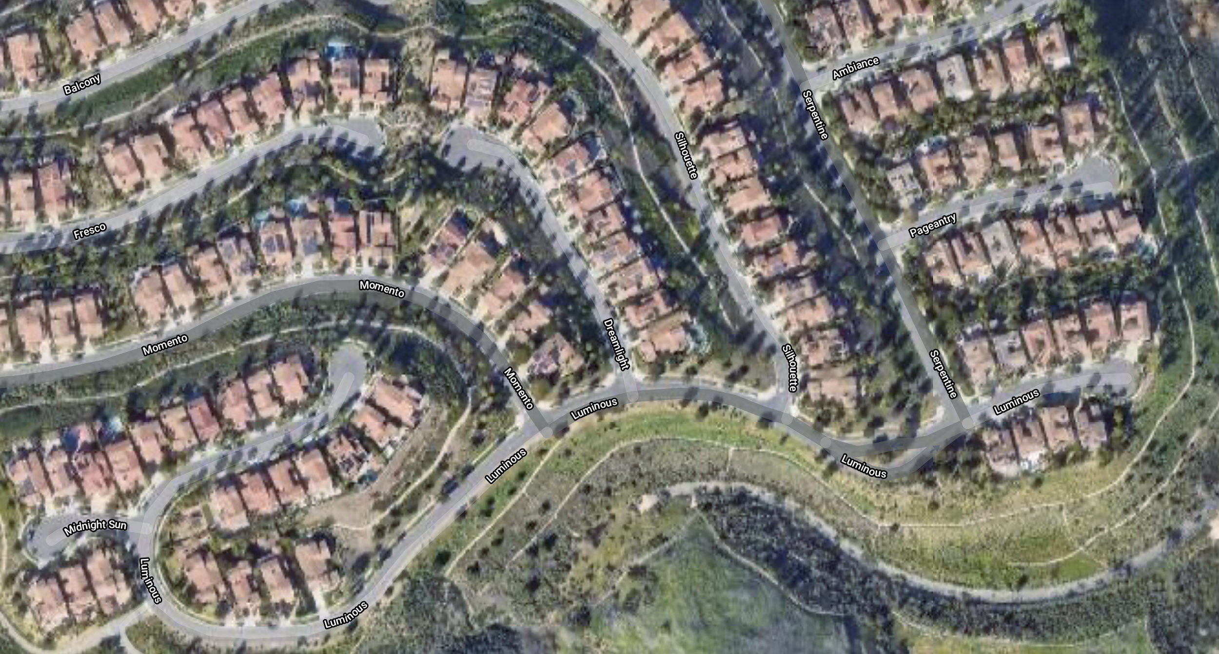
 [Image: Courtesy Google Maps.]
 [Image: Courtesy Google Maps.]
 [Image: Courtesy Google Maps.]
 [Image: Courtesy Google Maps.]
 [Image: Photo by
  [Image: My own loose sketch of the
 [Image: The Ridgecrest quakes and their aftershocks seem to support the idea of a linear connection along the Walker Lane; note that I have added a straight orange line in the bottom image, purely to indicate the very broad location of the Walker Lane].
 [Image: Courtesy Xenon Collaboration, via
  [Image: Xenon, via
  [Image: Otherwise unrelated satellite view of the Pyramid Lake Fault (diagonal line from top left to bottom right), via
  [Image: The shadow of the San Andreas Fault emerges near sunset at
  [Image: My own sketch of the
  [Image: The gorgeous
  [Image: Coso Volcanic Field, near where the Eastern California Shear Zone meets the Walker Lane; photo by
  [Image: Via
 [Image: Via
  [Images: Hiking in Joshua Tree National Park; photos by Geoff Manaugh].
 [Image: Joshua Tree National Park; photo by Geoff Manaugh].
 [Image: Joshua Tree National Park; photo by Geoff Manaugh].
 [Image: Joshua Tree National Park; photo by Geoff Manaugh].
 [Image: Drawing courtesy
  [Image: Drawing courtesy
 [Images: Drawings courtesy
 [Images: Drawings courtesy
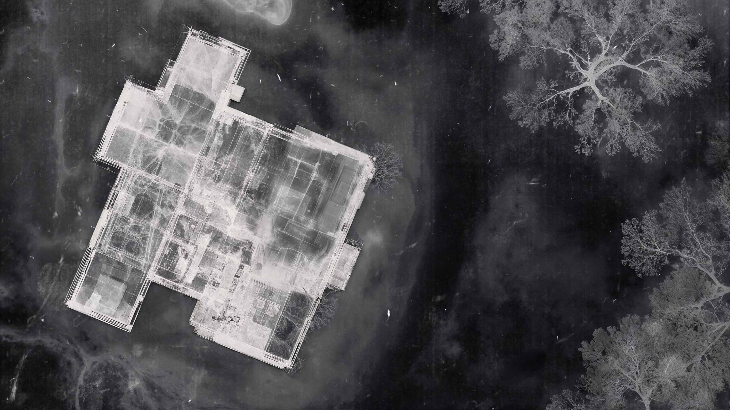