Despite taking a strong public stance against modern climate science, oil firms such as Mobil and Shell have calculated the effects of climate change-induced sea-level rise into the construction of their drilling platforms and coastal facilities, the Los Angeles Times reports.
Year: 2015
Rootstocks and Rhizotrons
Edible Geography explores the exhumation of whole trees in a new post called “Rootstock Archaeology.” Don’t miss the incredible rhizotron, “an underground corridor whose walls consist of forty-eight shuttered windows, which researchers can open to peer out onto the root systems of adjacent trees and plants.”
The Four-Floor War

[Image: Russian troops in Grozny, February 2000; image courtesy of AP].
“U.S. land forces will eventually find themselves locked in fights within huge, dense urban environments where skyscrapers tower over enormous shanty towns, and these troops need more realistic training to operate within these future megacities,” Brigadier General Julian Alford of the U.S. Marine Corps Warfighting Laboratory explained earlier this month, as reported by Defense News.
It’s war in the age of megacities: “We talk about the three-block war, but we are moving quickly to the four-floor war,” Alford adds.
We are going to be on the top floor of a skyscraper… evacuating civilians and helping people. The middle floor, we might be detaining really bad people that we’ve caught. On the first floor we will be down there killing them. …At the same time they will be getting away through the subway or subterrain. How do we train to fight that? Because it is coming, that fight right there is coming I do believe with all my heart.
The verticalization of Alford’s metaphor—“the four-floor war”—is an interesting revision of the existing “three-block war” paradigm. In that earlier version, U.S. General Charles C. Krulak suggested that three separate and very different military goals—humanitarian assistance, peace-keeping, and “traditional warfighting”—could all occur within only three blocks of one another in the urban combat of the future. In his words, soldiers would be confronted by “the entire spectrum of tactical challenges in the span of a few hours and within the space of three contiguous city blocks.”
This would not only be a problem of so-called “feral cities,” but of feral buildings within a functional metropolis.
The idea that this is now a “four-floor” problem—that “the entire spectrum of tactical challenges” could now be experienced within the space of four floors of a single high-rise—is a dark indicator not only that our own everyday surroundings are now being modeled and war-gamed as sites of speculative combat, but also how terrifying full-scale architectural warfare would be. Battling upward through the interior of skyscrapers, perhaps even zip-lining from one tower to another, it would be Nakatomi space taken to its logical, militarized extreme.
Recall Mike Davis’s observation from more than a decade ago that so-called Third World cities were being viewed as the “key battlespace of the future,” and that U.S. forces were thus preparing “for protracted combat in the near impassable, maze-like streets of the poverty-stricken cities of the Third World.” Davis elaborates on these points in an old interview with BLDGBLOG called Planet of Slums: An Interview with Mike Davis, Parts One and Two.
(Earlier on BLDGBLOG: Cities Under Siege.)
“A City on Mars is Possible. That’s What All This is About.”

Last week’s successful demonstration of a reusable rocket, launched by Elon Musk’s firm SpaceX, “was a critical step along the way towards being able to establish a city on Mars,” Musk later remarked. The proof-of-concept flight “dramatically improves my confidence that a city on Mars is possible,” he added. “That’s what all this is about.”
Previously, of course, Musk had urged the Royal Aeronautical Society to view Mars as a place where “you can start a self-sustaining civilization and grow it into something really big.” He later elaborated on these ideas in an interview with Aeon’s Ross Anderson, discussing optimistic but still purely speculative plans for “a citylike colony that he expects to be up and running by 2040.” In Musk’s own words, “If we have linear improvement in technology, as opposed to logarithmic, then we should have a significant base on Mars, perhaps with thousands or tens of thousands of people,” within this century.
(Image courtesy of SpaceX. Elsewhere: Off-world colonies of the Canadian Arctic and BLDGBLOG’s earlier interview with novelist Kim Stanley Robinson).
Bonus Levels
Over at AVANT, Lawrence Lek explores the spatial metaphor of “bonus levels,” or what he calls “the continuation of architecture through other means: an ongoing series of fictitious, utopian landscapes conceived as site-specific simulations.”
Pivot

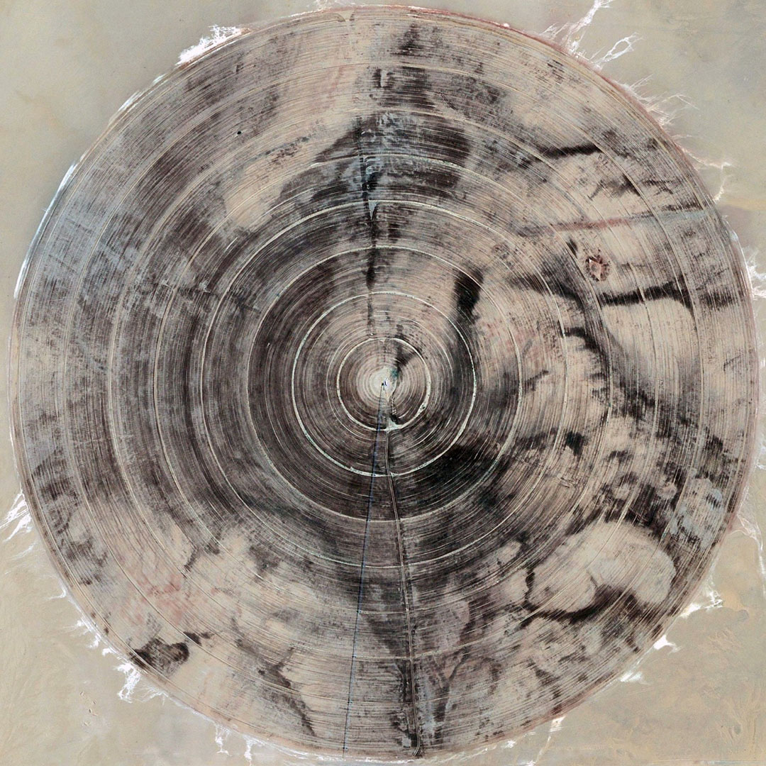
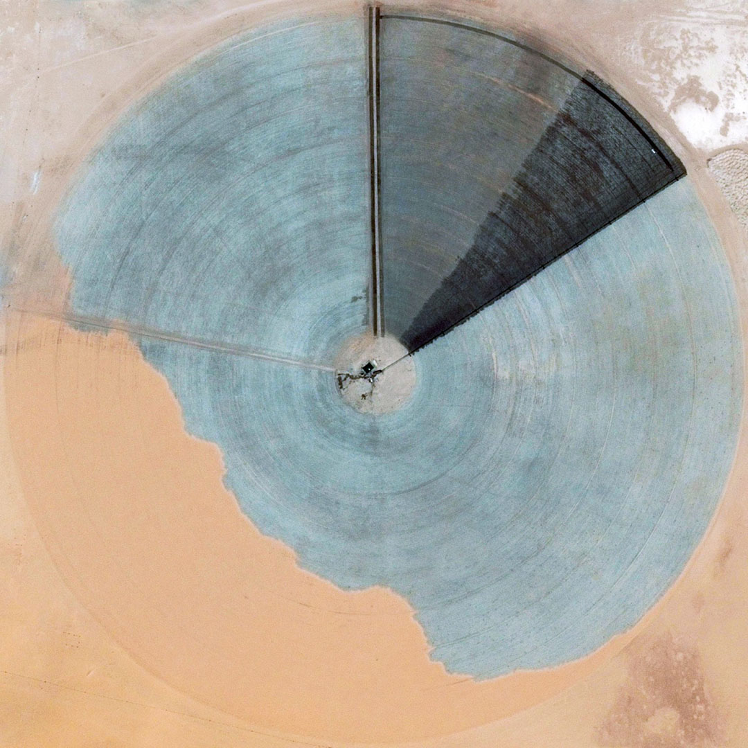
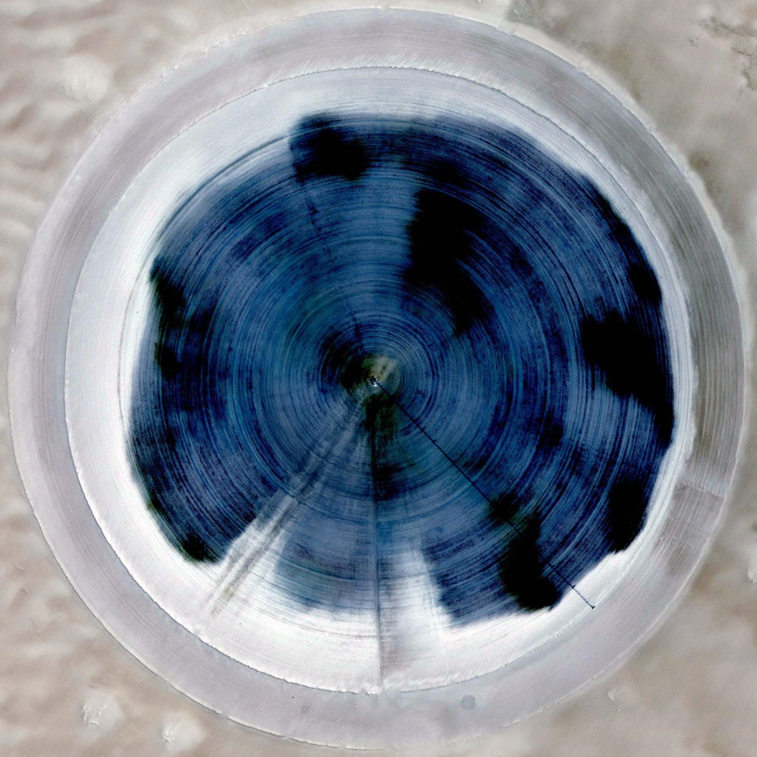
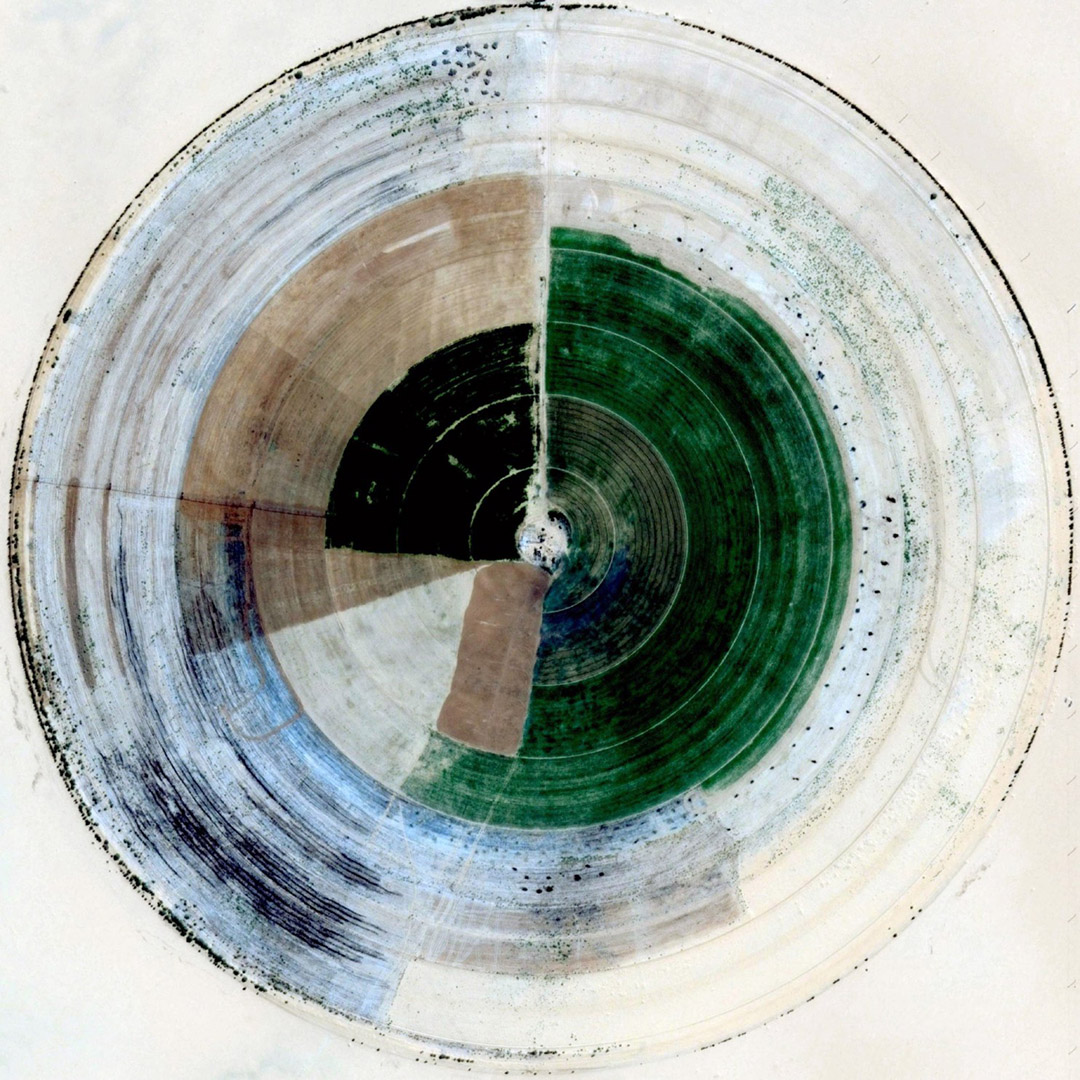
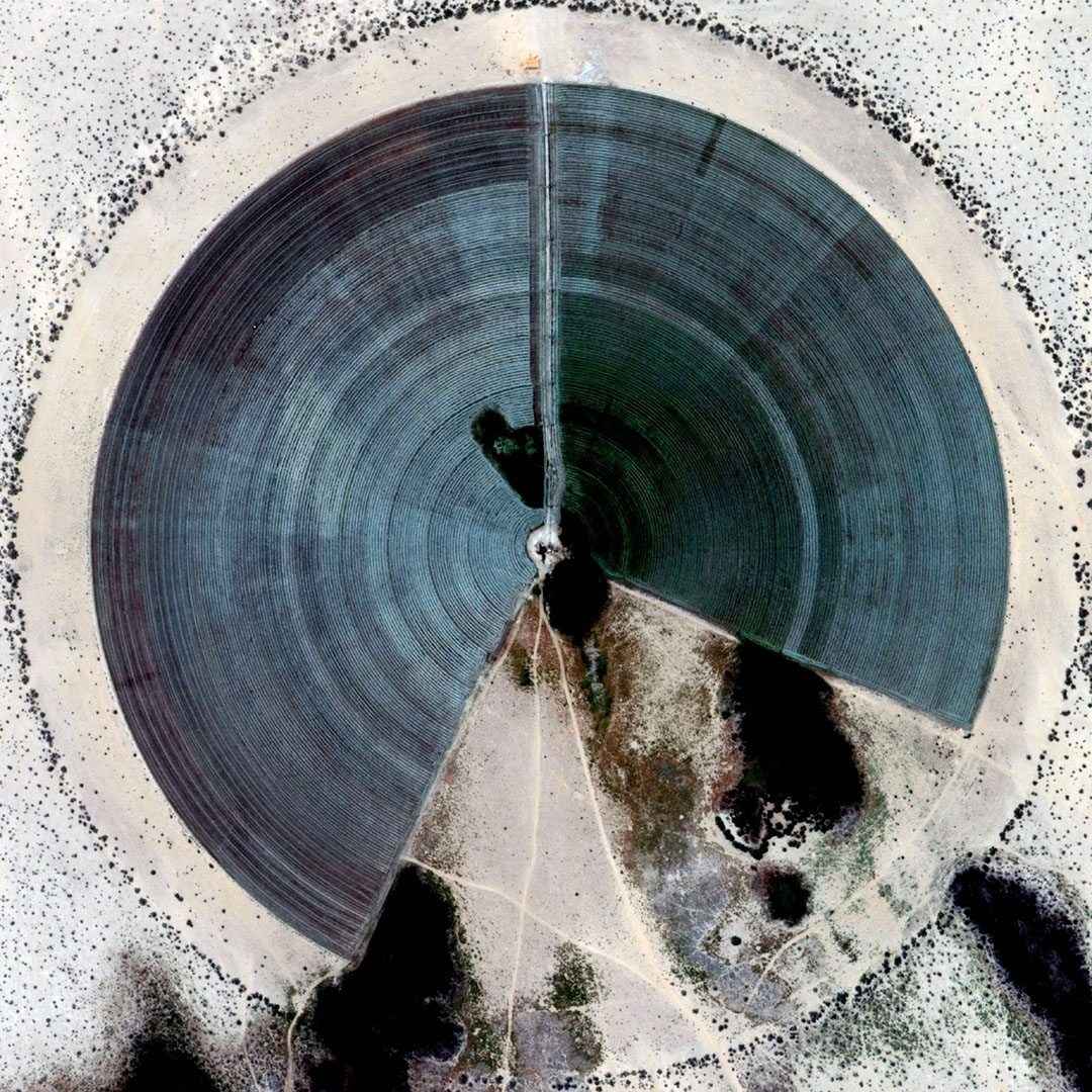
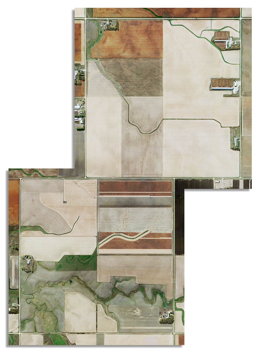
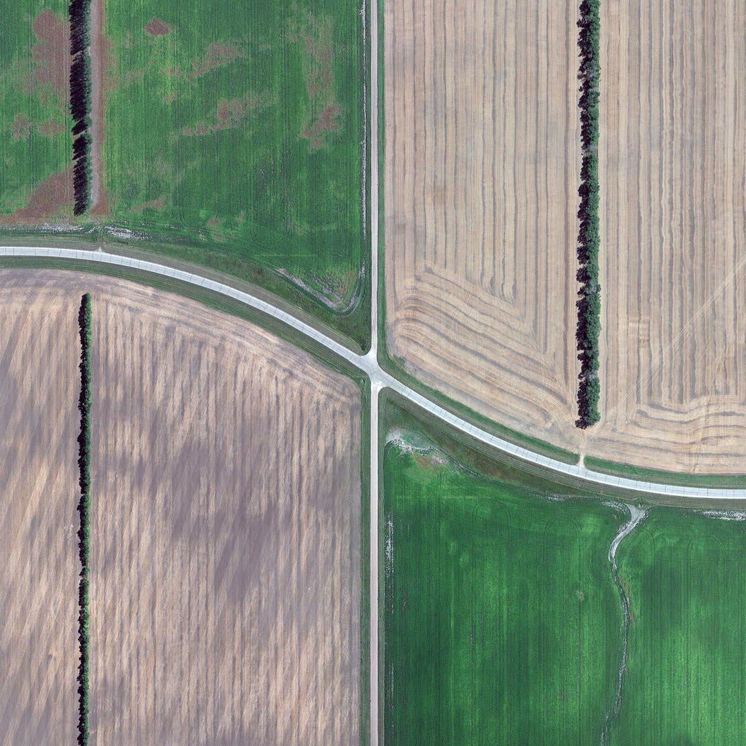
 [Image: From “Cropped” by Gerco de Ruijter; view larger].
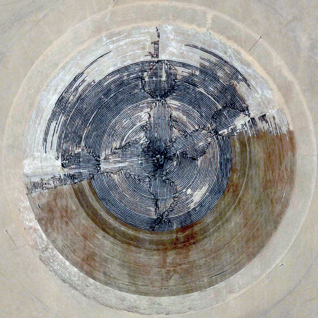
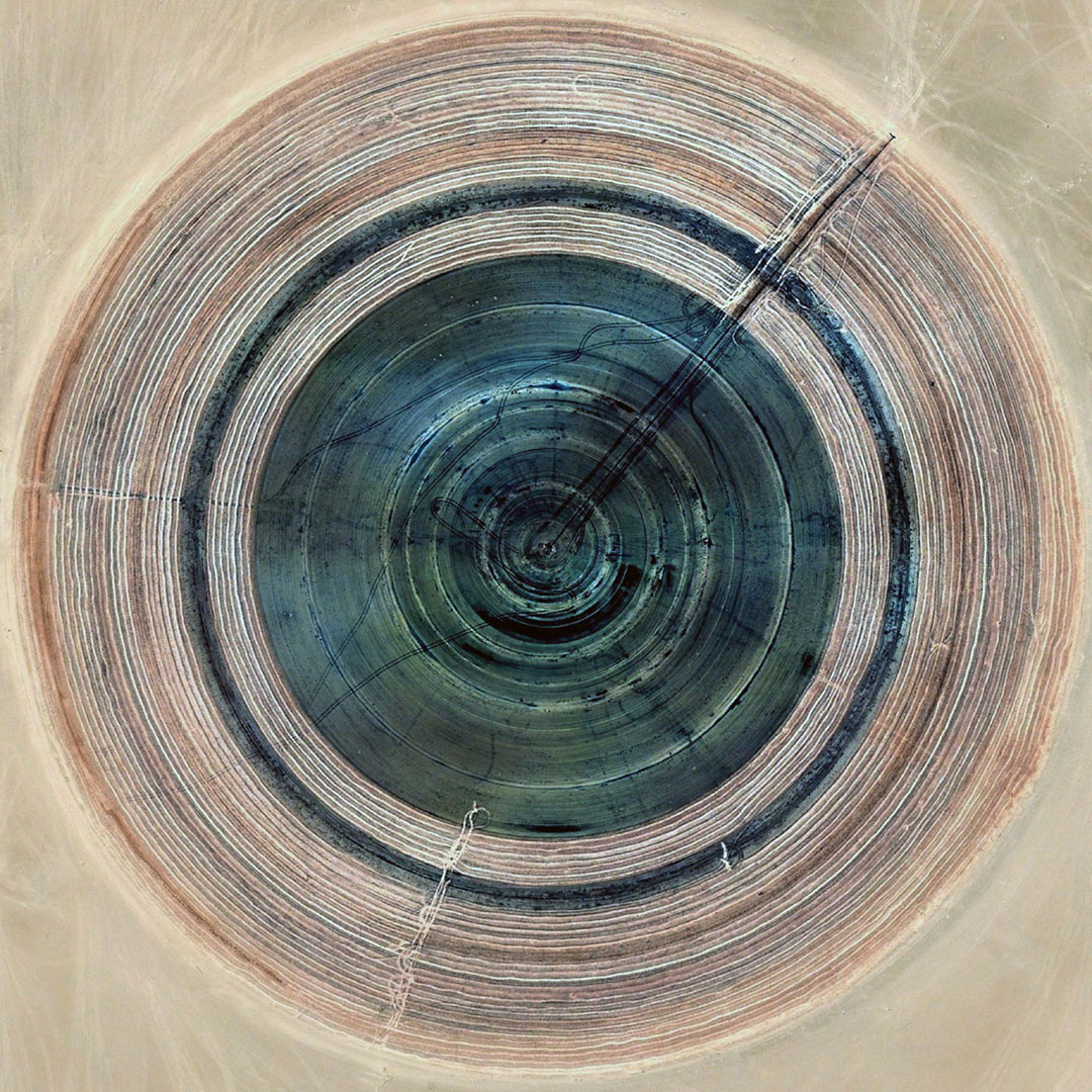
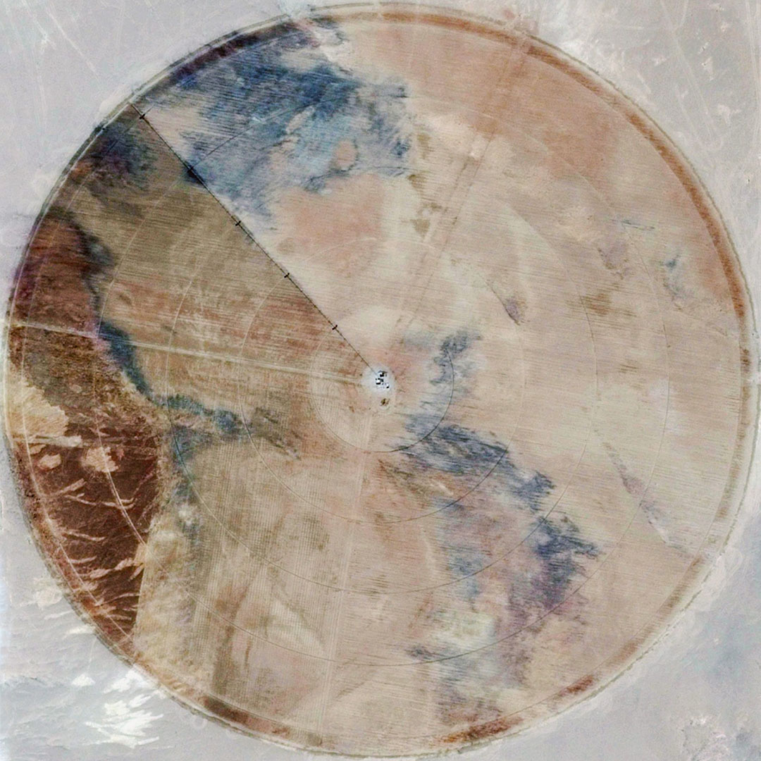
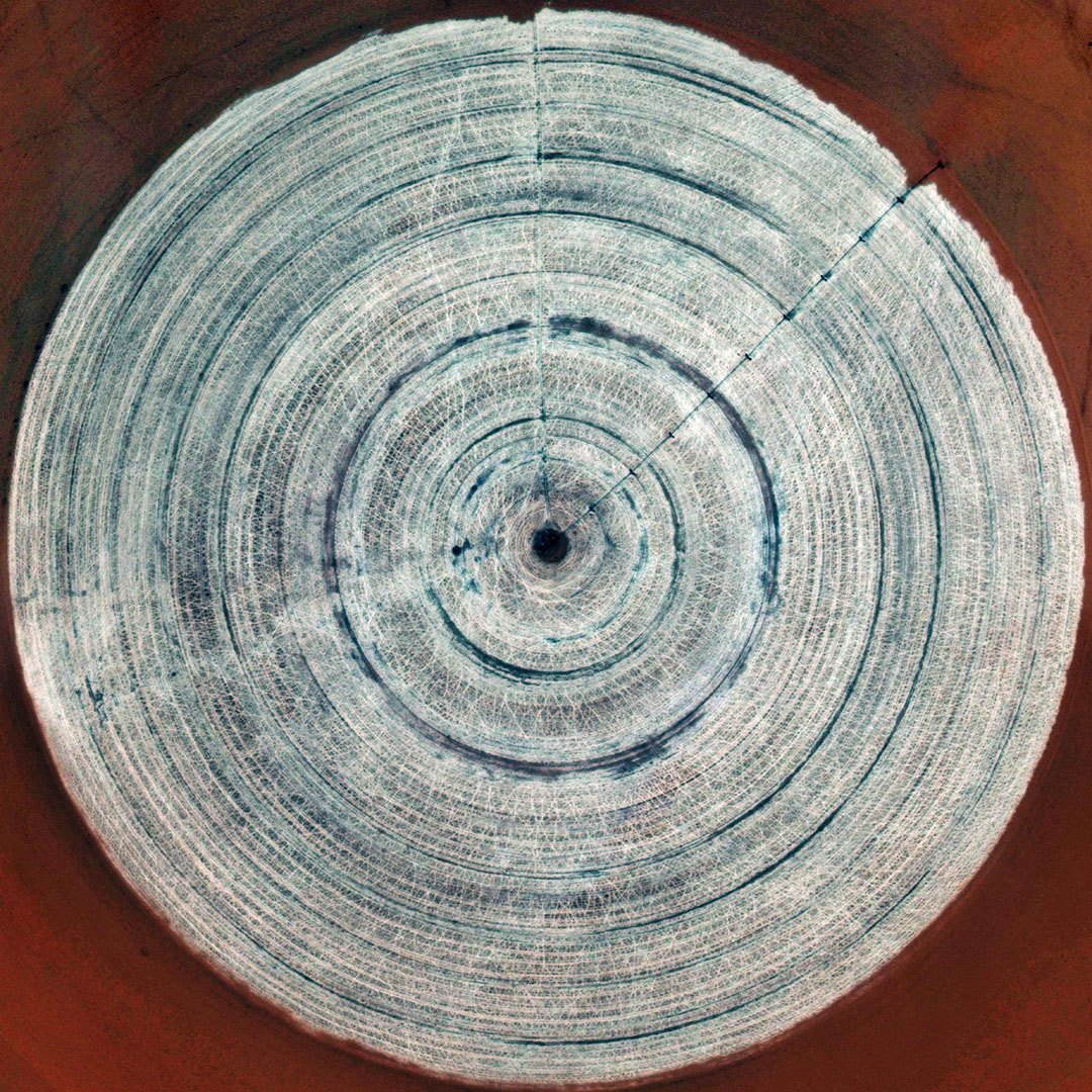
The images of “Grid Corrections” seen in the previous post reminded me of an earlier project, also by photographer Gerco de Ruijter, called “Cropped,” previously seen here back in 2012.
 [Image: From “Cropped” by Gerco de Ruijter; view larger].
The images seen here are all satellite views of pivot irrigation systems, taken from Google Earth and cleaned up by de Ruijter for display and printing.
 [Images: From “Cropped” by Gerco de Ruijter; view larger].
The resulting textures look like terrestrial LPs disintegrating into the landscape, or vast alien engravings slowly being consumed by sand—
 [Image: From “Cropped” by Gerco de Ruijter; view larger].
—and they are, at times, frankly so beautiful it’s almost hard to believe these landscapes were not deliberately created for their aesthetic effects.
 [Image: From “Cropped” by Gerco de Ruijter; view larger].
Granted, de Ruijter has color-corrected these satellite shots and pushed the saturation, but as metaphorical gardens of pure color and hue, the original pivotscapes are themselves already quite extraordinary.
 [Image: From “Cropped” by Gerco de Ruijter; view larger].
For a few more examples of these—posted at a much-larger, eye-popping size—click through to the Washington Post or consider watching the original film, called “Crops,” here on BLDGBLOG.

 [Images: From “Cropped” by Gerco de Ruijter; view larger].
[Previously: Grid Corrections].
Grid Corrections

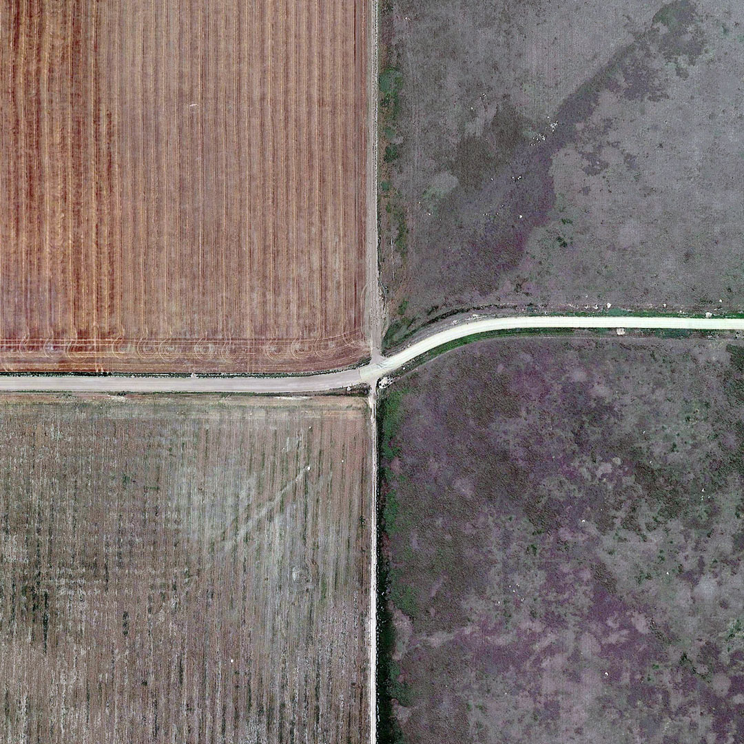
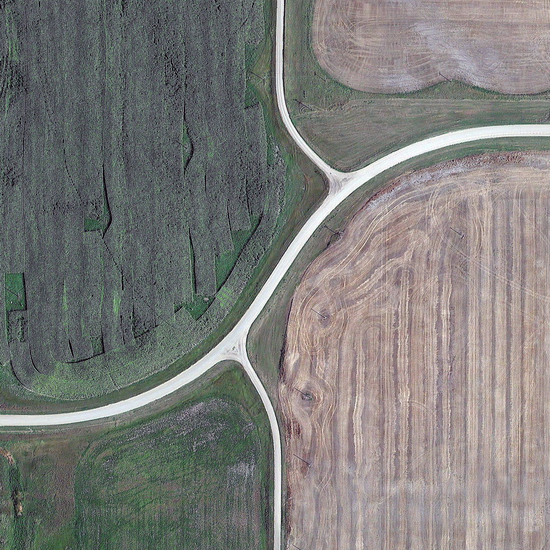
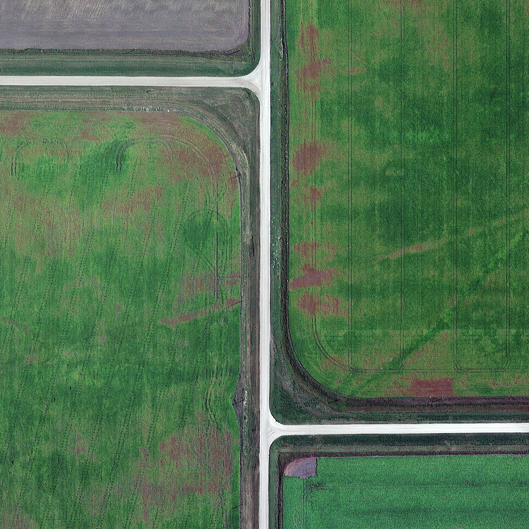
 [Image: From “Grid Corrections” by Gerco de Ruijter, courtesy of the Ulrich Museum of Art].
In case this is of interest, I’ve got a new article up over at Travel + Leisure about photographer Gerco de Ruijter. De Ruijter recently undertook an exploration of sites in the North American landscape where the Jeffersonian road grid is forced to go askew in order to account for the curvature of the Earth.
 [Image: From “Grid Corrections” by Gerco de Ruijter, courtesy of the Ulrich Museum of Art].
De Ruijter is already widely known for his work documenting grids and other signs of human-induced geometry in the landscape, from Dutch tree farms to pivot irrigation systems, which gives this new focus an interestingly ironic air.
 [Image: From “Grid Corrections” by Gerco de Ruijter, courtesy of the Ulrich Museum of Art].
In other words, these are places where a vision of geometric perfection—a seemingly infinite grid, dividing equal plots of land for everyone, extending sea to shining sea—collides with the reality of a spherical planet and must undergo internal deviations.
Those are the “grid corrections” of de Ruijter’s title, and they take the form of otherwise inexplicable T-intersections and zigzag turns in the middle of nowhere.
 [Image: From “Grid Corrections” by Gerco de Ruijter, courtesy of the Ulrich Museum of Art].
The project includes a series of spherical panoramas de Ruijter made using kite photography at specific corrective intersections outside Wichita, in effect distorting the distortions, a kind of topographical reverb.


 [Images: From “Grid Corrections” by Gerco de Ruijter, courtesy of the Ulrich Museum of Art].
And there is also a further sub-series of satellite images—all taken from Google Earth—stitched together to show intersections where grid corrections occur.
 [Image: “Canada/USA 2015 Grid Correction Leota Minnesota,” from “Grid Corrections” by Gerco de Ruijter, courtesy of the Ulrich Museum of Art].
The actual article explains in more detail what these grid corrections are, why they exist in the first place, and how often they appear, including references to James Corner’s Taking Measures Across the American Landscape and to a 2007 post on Alexander Trevi’s blog, Pruned.
 [Image: From “Grid Corrections” by Gerco de Ruijter, courtesy of the Ulrich Museum of Art].
For more, then, not only check out the Travel + Leisure piece, but click around on de Ruijter’s own website—and, if you’re in The Netherlands, stop by the Van Kranendonk Gallery in The Hague tomorrow, Saturday, December 12th, to see a few examples from “Grid Corrections” on display.
Yodaville
 [Image: Yodaville, via Google Maps].
All the Google Maps sleuthing of the Los Angeles “ghost streets” post reminded me of stumbling on a place called Yodaville—seen above—as previously explored here back in 2012. Yodaville is a simulated city in the Arizona desert, deep inside the Barry M. Goldwater Air Force Range, used for targeting exercises.
It is truly in the middle of the nowhere, roughly midway between the Gila Mountains and the U.S./Mexico border.
Its official name is Urban Target Complex (R-2301-West).
(Related: In the Box: A Tour Through the Simulated Battlefields of the U.S. National Training Center).
Whale Song Bunker
 [Image: The old submarine listening station, Isle of Lewis, via the BBC].
This is the most awesomely surreal architectural proposal of 2015: an extremely remote Cold War-era submarine surveillance station on the Isle of Lewis in the Scottish Outer Hebrides might soon be transformed into a kind of benthic concert hall for listening to whale song.
“A community buy-out could see a former Cold War surveillance station turned into a place where tourists can listen to the sound of whales singing,” the BBC reports.
During the Cold War, we read, “the site was part of NATO’s early warning system against Soviet submarines and aircraft, but the Ministry of Defence has no further use for the derelict buildings on the clifftop site.”
“It is now hoped a hydrophone could be placed in the sea to pick up the sound of whales.”
The idea of “derelict buildings on [a] clifftop site” resonating with the artificially amplified sounds of distant whales is amazing, like some fantasy acoustic variation on the “Dolphin Embassy” by Ant Farm.
 [Image: “Dolphin Embassy” by Ant Farm].
I couldn’t find any further word on whether or not this plan is actually moving forward, but, if not, we should totally Kickstart this thing—and, if not there, then perhaps reusing the old abandoned bunkers of the Marin Headlands.
Your own private whale song bunker, reverberating with the inhuman chorus of the deep sea.
(Story originally spotted via Subterranea, the journal of Subterranea Britannica).
A Cordon of Hives
 [Images: From The Elephants & Bees Project “Beehive Fence Construction Manual” (PDF)].
Designing for humans, insects, and elephants at the same time, University of Oxford zoologist Lucy King has developed “the honey fence system,” Edible Geography explains.
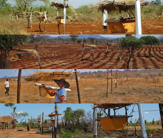 [Images: Via The Elephants & Bees Project].
A honey fence is “a series of hives, suspended at ten-metre intervals from a single wire threaded around wooden fence posts. If an elephant touches either a hive or the wire, all the bees along the fence line feel the disturbance and swarm out of their hives in an angry, buzzing cloud.”
“By encircling a village with a cordon of hives,” we read, “the village’s crops are protected.”
Read more at Edible Geography.
Comparative Astral Isochrones
 [Image: Isochronic map of travel distances from London, from An Atlas of Economic Geography (1914) by John G. Bartholomew (via)].
“This is an isochronic map—isochrones being lines joining points accessible in the same amount of time—and it tells a story about how travel was changing,” Simon Willis explains over at Intelligent Life. The map shows you how long it would take to get somewhere, embarking from London:
You can get anywhere in the dark-pink section in the middle within five days–to the Azores in the west and the Russian city of Perm in the east. No surprises there: you’re just not going very far. Beyond that, things get a little more interesting. Within five to ten days, you can get as far as Winnipeg or the Blue Pearl of Siberia, Lake Baikal. It takes as much as 20 days to get to Tashkent, which is closer than either, or Honolulu, which is much farther away. In some places, a colour sweeps across a landmass, as pink sweeps across the eastern United States or orange across India. In others, you reach a barrier of blue not far inland, as in Africa and South America. What explains the difference? Railways.
Earlier this year, when a private spacecraft made it from the surface of the Earth to the International Space Station in less than six hours, the New York Times pointed out that “it is now quicker to go from Earth to the space station than it is to fly from New York to London.”
 [Image: From Twitter].
In the context of Bartholomew’s map, it would be interesting to re-explore isochronal cartography in our own time, to visualize the strange spacetime we live within today, where the moon is closer than parts of Antarctica and the International Space Station is a shorter trip than flying to Heathrow.
(Map originally spotted via Francesco Sebregondi).