Tax Incentives and the Human Imagination

[Image: Der Wanderer über dem Nebelmeer by Caspar David Friedrich (c. 1818).]

It would be interesting to look at locations of the American popular imagination, as seen in movies and TV, mapped against regional tax breaks for the film industry.

There was a brief span of time, for example, when rural Pennsylvania stood in for authentic Americana, a kind of Rust Belt imaginary, all pick-up trucks and hard-drinking younger brothers, stories framed against the hulking ruins of industrial landscapes—I’m thinking of Out Of The Furnace or Prisoners, both released in 2013, or even 2010’s Unstoppable. Whereas, today, Georgia seems to have stepped into that niche, between The Outsider and, say, Mindhunter (season two), let alone Atlanta, no doubt precisely because Georgia has well-known tax incentives in place for filming.

My point is that an entire generation of people—not just Americans, but film viewers and coronavirus quarantine streamers and TV binge-watchers around the world—might have their imaginative landscapes shaped not by immaterial forces, by symbolic archetypes or universal rules bubbling up from the high-pressure depths of human psychology, but instead by tax breaks offered in particular U.S. states at particular moments in American history.

You grow up thinking about Gothic pine forests, or you fall asleep at night with visions of rain-soaked Georgia parking lots crowding your head, but it’s not just because of the aesthetic or atmospheric appeal of those landscapes; it’s because those landscapes are, in effect, receiving imaginative subsidies from local business bureaus. You’re dreaming of them for a reason.

Your mind is not immaterial, in other words, some angelic force waltzing across the surface of the world, stopping now and again to dwell on universal imagery, but something deeply mundane, something sculpted by ridiculous things, like whether or not camera crews in a given state get hotel room discounts for productions lasting more than two weeks.

Of course, you could extend a similar kind of analysis way back into art history and look at, say, the opening of particular landscapes in western Europe, after decades of war, suddenly made safe for cultured travelers such as Caspar David Friedrich, whose paintings later came to define an entire era of European and European-descended male imaginations. That wanderer over a sea of fog, in other words, was wandering through a very specific landscape during a very particular window of European political accessibility. Had things been different, had history taken a slightly different path, Friedrich might have been stuck in his parents’ house, painting still-lives and weed-choked alleyways, and who knows what images today’s solo hikers might be daydreaming about instead.

[Image: From The Outsider, courtesy HBO; I should mention that The Outsider was set and filmed primarily in Georgia, a departure from Stephen King’s novel, which was primarily set in Oklahoma.]

In any case, the humid forests of rural America, the looming water towers and abandoned industrial facilities, the kudzu-covered strip malls and furloughed police stations—picture the Louisianan expanses of True Detective (season one)—have come to represent the dark narrative potential of the contemporary world. But what if, say, North Dakota or Manitoba (where, for example, The Grudge was recently filmed) had offered better tax breaks?

My own childhood imagination was a world of sunlit suburbs, detached single-family homes, and long-shadowed neighborhood secrets, but, as to my larger point here, I also grew up watching movies like E.T., Poltergeist, Fright Night, and Blue Velvet—so, in a sense, of course I would think that’s what the world looked like.

[Image: From David Lynch’s Blue Velvet (1986), specifically via the site Velvet Eyes.]

So, again, it would be interesting to explore how one’s vision of the world—your most fundamental imagination of the cosmos—is being shaped for you by tax breaks, film incentives, and other, utterly trivial local concerns, like whether or not out-of-state catering companies can get refunds on expenditures over a certain amount or where actors can write off per diems as gifts, not income, affecting whether crime films or horror stories will be shot there, and thus where an entire generation’s future nightmares might be set.

Or, for that matter, you could look at when particular colors, paints, and pigments became affordable for artists of a certain era, resulting in all those dark and moody images you love to stare at in the local museum—e.g. the old joke that, at some point, Rembrandt simply bought too much purple. It wasn’t promethean inspiration; it was material surplus.

We see things for a reason, yet, over and over again, mistake our dreams for signs of the cosmic. Or, to put this another way, we are not surrounded by mythology; we are surrounded by economics. The latter is a superb and confusing mimic.

Buy a Border Patrol Station

[Image: Courtesy U.S. Government Services Administration].

Somewhat amazingly, a former U.S. Border Patrol station is for sale outside the town of Gila Bend, Arizona.

The minimum bid is only $8,000—but the property doesn’t look too good and is “not warranted,” so buyer beware.

[Image: Courtesy U.S. Government Services Administration].

Structural conditions notwithstanding, this could be an amazing opportunity to create a Border Museum, a desert arts center, a writers’ retreat, an urban explorers’ redoubt, a remote branch of the Center for Land Use Interpretation, a field school for an avant-garde university geography program, a pop-up site for an architecture school to host student installations, a future restaurant, a weird Father’s Day gift, a place to store your favorite Paul Manafort trial memorabilia, an asbestos-exposure demonstration facility, or just a roadside site to park your pick-up truck.

Here is the facility on Google Maps.

[Image: Courtesy U.S. Government Services Administration].

Bidding begins on August 28th.

[Image: Courtesy U.S. Government Services Administration].

Note that there is an open house on Friday morning, August 17th, 2018, at 9am, for those of you near Gila Bend.

(Previously on BLDGBLOG: Buy a Los Angeles Sidewalk Corner, Buy a Complex of Submarine Pits, Buy a Skyway, Buy a Fort, Buy a Lighthouse, Buy an Underground Kingdom, Buy a Prison, Buy a Tube Station, Buy an Archipelago, Buy a Map, Buy a Torpedo-Testing Facility, Buy a Silk Mill, Buy a Fort, Buy a Church).

The Soft Spot

geoborder[Image: Close-up of the 2010 State Geologic Map of California].

An interesting story published last month in the L.A. Times explored the so-called “sweet spot” for digging tunnels along the California/Mexico border.

“Go too far west,” reporter Jason Song explained, “and the ground will be sandy and potentially soggy from the water of the Pacific Ocean. That could lead to flooding, which wouldn’t be good for the drug business. Too far east and you’ll hit a dead end of hard mountain rock.”

However, Song continues, “in a strip of land that runs between roughly the Tijuana airport and the Otay Mesa neighborhood in San Diego, there’s a sweet spot of sandstone and volcanic ash that isn’t as damp as the oceanic earth and not as unyielding as stone.”

More accurately speaking, then, it is less a sweet spot than it is a soft one, a location of potential porosity where two nations await subterranean connection. It is all a question of geology, in other words—or the drug tunnel as landscape design operation.

border[Image: Nogales/Nogales, via Google Maps].

With the very obvious caveat that this next article is set along the Arizona/Mexico border, and not in the San Diego neighborhood of Otay Mesa, it is nonetheless worth drawing attention back to an interesting article by Adam Higginbotham, written in 2012 for Bloomberg, called “The Narco Tunnels of Nogales.”

There, Higginbotham describes a world of abandoned hotel rooms in Mexico linked, by tunnel, to parking spots in the United States; of streets subsiding into otherwise unknown narco-excavations running beneath; and of an entire apartment building on the U.S. side of the border whose strategic value is only revealed later once drug tunnels begin to converge in the ground beneath it.

Here, too, though, Higginbotham also refers to “a peculiar alignment of geography and geology,” noting that the ground conditions themselves are particularly amenable to the production of cross-border subterranea.

However, the article also suggests that “the shared infrastructure of a city”—that is, Nogales, Arizona, and its international counterpart, Nogales, Mexico—already, in a sense, implies this sort of otherwise illicit connectivity. It is literally built into the fabric of each metropolis:

When the monsoons begin each summer, the rain that falls on Mexico is funneled downhill, gathering speed and force as it reaches the U.S. In the 1930s, in an attempt to control the torrent of water, U.S. engineers converted the natural arroyos in Nogales into a pair of culverts that now lie beneath two of the city’s main downtown streets, Morley Avenue and Grand Avenue. Beginning in Mexico, and running beneath the border before emerging a mile into the U.S., the huge tunnels—large enough to drive a car through—created an underground link between the two cities, and access to a network of subterranean passages beneath both that has never been fully mapped.

This rhizomatic tangle of pipes, tubes, and tunnels—only some of which are official parts of the region’s hydrological infrastructure—results in surreal events of opportunistic spelunking whereby “kids would materialize suddenly from the drainage grates,” or “you would see a sewer plate come up in the middle of the street, and five people would come up and run.”

Briefly, I’m reminded of a great anecdote from Jon Calame’s and Esther Charlesworth’s book Divided Cities, where the split metropolis of Nicosia, Cyprus, is revealed to be connected from below, served by a shared sewage plant “where all the sewage from both sides of the city is treated.” The authors interview the a local waste manager, who jokes that “the city is divided above ground but unified below.”

In any case, the full article is worth a read, but a tactical geological map revealing sites of likely future tunneling would be a genuinely fascinating artifact to see. I have to assume that ICE or Homeland Securitylet alone the cartels—already have such a thing.

(L.A. Times article originally spotted via Nate Berg).

Yodaville

[Image: Yodaville, via Google Maps].

All the Google Maps sleuthing of the Los Angeles “ghost streets” post reminded me of stumbling on a place called Yodaville—seen above—as previously explored here back in 2012. Yodaville is a simulated city in the Arizona desert, deep inside the Barry M. Goldwater Air Force Range, used for targeting exercises.

It is truly in the middle of the nowhere, roughly midway between the Gila Mountains and the U.S./Mexico border.

Its official name is Urban Target Complex (R-2301-West).

(Related: In the Box: A Tour Through the Simulated Battlefields of the U.S. National Training Center).

Landscape Futures Super-Trip

I’m heading off soon on a road trip with Nicola Twilley, from Edible Geography, to visit some incredible sites (and sights) around the desert southwest, visiting places where architecture, astronomy, and the planetary sciences, to varying degrees, overlap.

[Image: The Very Large Array].

This will be an amazing trip! Our stops include the “world’s largest collection of optical telescopes,” including the great hypotenuse of the McMath-Pierce Solar Telescope, outside Tucson; the Very Large Array in west-central New Mexico; the Controlled Environment Agriculture Center at the University of Arizona, aka the “lunar greenhouse,” where “researchers are demonstrating that plants from Earth could be grown without soil on the moon or Mars, setting the table for astronauts who would find potatoes, peanuts, tomatoes, peppers and other vegetables awaiting their arrival”; the surreal encrustations of the Salton Sea, a site that, in the words of Kim Stringfellow, “provides an excellent example of the the growing overlap of humanmade and natural environments, and as such highlights the complex issues facing the management of ecosystems today”; the Fred Lawrence Whipple Observatory, with its automated scanning systems used for “robotic searches for variable stars and exoplanets” in the night sky, and its gamma-ray reflectors and “blazar lightcurves” flashing nearby; the Grand Canyon; Red Rocks, outside Sedona; the hermetic interiorities of Biosphere 2; White Sands National Monument and the Trinity Site marker, with its so-called bomb glass; the giant aircraft “boneyard” at the Pima Air & Space Museum; and, last but not least, the unbelievably fascinating Lunar Laser-ranging Experiment at Apache Point, New Mexico, where they shoot lasers at prismatic retroreflectors on the moon, testing theories of gravitation, arriving there by way of the nearby Dunn Solar Telescope.

[Image: The “Electric Aurora,” from Specimens of Unnatural History, by Liam Young].

The ulterior motive behind the trip—a kind of text-based, desert variation on Christian Houge’s study of instrumentation complexes in the Arctic—is to finish up my curator’s essay for the forthcoming Landscape Futures book.

That book documents a forthcoming exhibition at the Nevada Museum of Art called Landscape Futures: Instruments, Devices and Architectural Inventions, featuring work by David Benjamin & Soo-in Yang (The Living), Mark Smout & Laura Allen (Smout Allen), David Gissen, Mason White & Lola Sheppard (Lateral Office), Chris Woebken, and Liam Young.

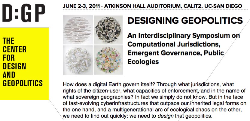
Finally, Nicola and I will fall out of the car in a state of semi-delirium in La Jolla, California, where I’ll be presenting at a 2-day symposium on Designing Geopolitics, “an interdisciplinary symposium on computational jurisdictions, emergent governance, public ecologies,” organized by Benjamin Bratton, Daniel Rehn, and Tara Zepel.

That will be free and open to the public, for anyone in the San Diego area who might want to stop by, and it will also be streamed online in its entirety; the full schedule is available at the Designing Geopolitics site.

(Earlier on BLDGBLOG: Landscape Futures Super-Workshop, Landscape Futures Super-Dialogue, and Landscape Futures Super-Media).