Terrestrial Chiaroscuro

[Image: Reuben Wu, from Lux Noctis].

I’ve been a fan of photographer Reuben Wu’s work for years—it’s hard to visit even his Instagram feed and not come away in a state of awe—so I was thrilled to contribute a short essay for his new book, Lux Noctis.

[Image: Reuben Wu, from Lux Noctis].

Lux Noctis is also the name of an ongoing project of his that uses drone-mounted LED lights to illuminate remote geological formations, towering figures highlighted against the landscape with what appear to be haloes or celestial spotlights.

It’s an ingenious approach to landscape lighting that Wu continues to push in new directions, and one that I compare in my essay to chiaroscuro, the use of dramatic, often single-point lighting to create deep contrasts and a sense of roiling, three-dimensional activity, a technique dating back to the Renaissance.

In Wu’s case, this is terrestrial chiaroscuro: unexpected, robotic sources of aerial light that transform how landscapes can be depicted.

[Image: Reuben Wu, from Lux Noctis].

The book is now available for preorder from Kris Graves Projects, publisher of many other artists books also worth a browse while you’re there.

Fab

[Image: “The Sphere” by Oliver Tessman, Mark Fahlbusch, Klaus Bollinger, and Manfred Grohmann].

The Bartlett School of Architecture has made all three volumes of Fabricate, their excellent series of books and conference proceedings dating back to 2011, free to download.

[Image: Matter Design’s La Voûte de LeFevre, Banvard Gallery (2012)].

More than 700 pages’ worth of technical experiments, speculative construction processes, new industrial tools, and one-off prototypes, the books are a gold mine for research and development.

[Image: Greg Lynn’s “Embryological House,” Venice Biennale (2002)].

3D printers, buoyant robots, multi-axis milling machines, directed insect-secretion, cellular automata, semi-autonomous bricklaying, self-assembling endoskeletons, drone weaving—it’s hard to go wrong with even the most cursory skimming of each volume, and that doesn’t even mention the essays and interviews.

[Image: “Custom forming tool mounted on the six-axis robotic arm,” via Fabricate 2014]

Download each book—from 2017, 2014, and 2011—and be prepared to lose a few days reading through them.

Sovereign Flocking Algorithms

[Image: Flocking diagram by “Canadian Arctic sovereignty: Local intervention by flocking UAVs” by Gilles Labonté].

One of many ways to bolster a nation-state’s claim to sovereignty over a remote or otherwise disputed piece of land is to perform what’s known as a “sovereignty cruise.” This means sending a ship—or fleet of ships—out to visit the site in question, thus helping to normalize the idea that it is, in fact, a governable part of that nation’s territory.

It is, in essence, a fancy—often explicitly militarized—version of use it or lose it.

Last summer, for example, Vietnam organized a private tour of the Spratly Islands, an archipelago simultaneously claimed by more than one nation and, as such, part of the much larger ongoing dispute today over who really owns and controls the South China Sea [sic].

Vietnam’s effort, Reuters reported at the time, was a strategic visit “to some of Asia’s most hotly contested islands, in a move likely to stoke its simmering dispute with Beijing over South China Sea sovereignty.”

It made “little attempt to disguise its political flavor, and comes as Vietnam pursues a bolder agenda in pushing its claims in the face of China’s own growing assertiveness.” Indeed, the cruise was apparently just the beginning, a mere “trial run ahead of Vietnam’s tentative plans to put the Spratlys on its tourism map, including scheduled passenger flights, possibly this year.”

Bring the people, in other words, and you bring evidence of governmental control.

Against this, of course, we must place the construction of entire islands by China, including the recent installation of a new primary school there, on an artificial island, a school whose opening lecture “was a geopolitical class that focused on China’s ownership of the sea.”

These sovereign games of Go taking place in disputed waters could sustain an entire blog on their own, of course, and are a topic we’ll undoubtedly return to. (Briefly, it’s worth noting that the sovereign implications of artificial islands were also part of a course I taught at Columbia a few years ago.)

Surprisingly, however, another region seen as potentially subject to future disputes over sovereignty is the Canadian Arctic. As such, arguments over such things as whether or not the Northwest Passage is an “international strait” (open to use by all, including Russian and Chinese military ships) or if it is actually a case of “internal waters” controlled exclusively by Canada (thus subject to restricted access), are still quite active.

Add to this a series of arguments over indigenous political rights as well as the specter of large-scale terrestrial transformation due to climate change, and a series of intriguing and quite complicated political scenarios are beginning to emerge there. (Who Owns The Arctic? by Michael Byers is an excellent introduction to this subject, as is Mia Bennett’s blog Cryopolitics.)

[Image: Flocking diagram by “Canadian Arctic sovereignty: Local intervention by flocking UAVs” by Gilles Labonté].

With all this in mind, consider a fascinating report issued by Defence R&D Canada back in 2010. Called “Canadian Arctic sovereignty: Local intervention by flocking UAVs” (PDF), and written by Gilles Labonté, it opens stating that “the importance of local intervention capability for the assertion of Canadian Sovereignty in the Northwest passage is recognized.”

However, Canada presently lacks the ability to deploy at any northern position, on demand, assets that could search a wide area for rescue or surveillance purposes. This fact motivated the exploration we report here on the feasibility of a rapid intervention system based on a carrier-scouts design according to which a number of unmanned aerial vehicles (UAVs) would be transported, air launched and recovered by a larger carrier aircraft.

In other words, if Canada can’t send actual Canadians—that is, living human beings—on aerial “sovereignty cruises” by which they could effectively demonstrate real-time political control over the territories of the north, then they could at least do the next best thing: send in a flock of drones.

Doing so, Labonté suggests, would require a particular kind of flocking algorithm, one with an explicitly political goal. “In the present report,” he adds, “we propose a solution to the remaining problem of managing simultaneously the many UAVs that are required by the vastness of the areas to be surveyed, with a minimum number of human controllers and communications.”

Namely, we present algorithms for the self-organization of the deployed UAVs in the formation patterns that they would use for the tasks at hand. These would include surveillance operations during which detailed photographic or video images would be acquired of activities in a region of interest, and searching an area for persons, vehicles or ships in distress and providing a visual presence for such. Our conclusion is that the local intervention system with flocking UAVs that we propose is feasible and would provide a very valuable asset for asserting and maintaining Canadian Sovereignty in the North.

There are “formation patterns” and flocking algorithms, this suggests, that would specifically be of use in “asserting and maintaining Canadian Sovereignty in the North.”

Hidden within all this is the idea that particular flocking algorithms would be more appropriate for the task than others, lending an explicit air of political significance to specific acts of programming and computation. It also implies an interesting connection between the nation-state and behavioral algorithms, in which a series of behavioral tics might be ritually performed for their political side-effects.

For some context, the report adds, “the Canadian Government has had serious considerations of establishing a presence in the north through purchasing nuclear submarines and ice-breakers.” But why not side-step much of this expense by sending UAVs into the Arctic void instead, reinforcing nation-state sovereignty through the coordinated presence of semi-autonomous machines?

Simply re-launch your drones every two or three months, just often enough to nudge the world into recognizing your claim, not only of this remote airspace but of the vast territory it covers.

A halo of well-choreographed aerial robots flocks in the Arctic skies before disappearing again into a bunker somewhere, waiting to reemerge when the validity of the government appears under threat—a kind of machine-ritual in the open three-dimensional space of the polar north, a robotic sovereignty flight recognized around the world for its performative symbolism.

Read the rest of Labonté’s paper—which is admittedly about much more than I have discussed here—in this PDF.

The World as a Hieroglyph of Spatial Relationships Yet to be Interpreted

drones
[Image: Courtesy Iris Automation].

In an interview published on the blog here a few years ago, novelist Zachary Mason, author of The Lost Books Of The Odyssey, pointed out something very interesting about the nearly limitless, three-dimensional space of the Earth’s atmosphere and how it relates to artificial intelligence.

“One of the problems with A.I.,” Mason explained back in 2010, “is that interacting with the world is really tough. Both sensing the world and manipulating it via robotics are very hard problems, and [these are] solved only for highly stripped-down special cases. Unmanned aerial vehicles, for instance, work well because maneuvering in a big, empty, three-dimensional void is easy—your GPS tells you exactly where you are, and there’s nothing to bump into except the odd migratory bird. Walking across a desert, though—or, heaven help us, negotiating one’s way through a room full of furniture in changing lighting conditions—is vastly more difficult.”

Another way of thinking about Mason’s comment—although Mason himself might disagree with the following statement—is that it is precisely the sky’s ease of navigation that makes it ideal for the emergence and testing of artificial intelligence. The Earth’s atmosphere, in other words—specifically because it is an unchallenging three-dimensional environment—is the perfect space for machine-vision algorithms and other forms of computational proto-intelligence to work out their most basic bugs.

Once they master the sky, then, autonomous machines can move on to more complicated environments, such as roads, mountains, forests. Cities.

In any case, I was thinking about Mason’s interview again earlier today when I read that drones are close to achieving “situational awareness”—albeit through visual, not artificially intelligent, means. In other words, it’s not AI—at least not yet—that will give unmanned aerial vehicles their much-needed ability to avoid colliding with other flying objects. Rather, it is a sufficiently advanced visual processing system that can identify and, more importantly, avoid potential obstacles.

Exactly such a system, TechCrunch claims, has been built by a Canadian firm called Iris Automation. Their system is able “to process visual data in real time, so it can see structures that suddenly appear, like a plane, flock of birds or another drone—not just static objects and waypoints that might be mapped using older technologies like GPS.” The company refers to this as “industrial drone collision avoidance,” which suggests a kind of on-board traffic management system for the sky. Air traffic control will be internal.

Now connect a drone’s “situational awareness” to sufficient processing power, and you could help steward into existence a computationally interesting form of autonomous intelligence.

To return to Zachary Mason’s computationally-inflected rewriting of The Odyssey, it would be AI as Athena, springing fully formed into the world from an empty sky.

Machine Quarantines and “Persistent Drones”

scout[Image: An otherwise unrelated photo of a “Scout” UAV, via Wikipedia].

There’s an interesting short piece by Jacob Hambling in a recent issue of New Scientist about the use of “persistent drones” to “hold territory in war zones,” effectively sealing those regions off from incursion. It is an ominous vision of what we might call automated quarantine, or a cordon it’s nearly impossible to trespass, maintained by self-charging machines.

Pointing out the limitations of traditional air power and the tactical, as well as political, difficulties in getting “boots on the ground” in conflict zones, Hambling suggests that military powers might turn to the use of “persistent drones” that “could sit on buildings or trees and keep watch indefinitely.” Doing so “expands the potential for intervention without foot soldiers,” he adds, “but it may lessen the inhibitions that can stop military action.”

Indeed, it’s relatively easy to imagine a near-future scenario in which a sovereign or sub-sovereign power—a networked insurgent force—could attempt to claim territory using Hambling’s “persistent drones,” as if playing Go with fully armed, semi-autonomous machines. They rid the land of its human inhabitants—then watch and wait.

Whole neighborhoods of cities, disputed terrains on the borders of existing nations, National Wildlife Refuges—almost as an afterthought, in a kind of political terraforming, you could simply send in a cloud of machine-sentinels to clear and hold ground until the day, assuming it ever comes, that your actual human forces can arrive.

Fly, Eagles, Fly

Speaking of animals being actively incorporated into urban infrastructure, Dutch police are training eagles to hunt drones. “What I find fascinating is that birds can hit the drone in such a way that they don’t get injured by the rotors,” explains a spokesperson for the National Audubon Society. “They seem to be whacking the drone right in the center so they don’t get hit; they have incredible visual acuity and they can probably actually see the rotors.”

Agrirobotics

The USDA has announced a grant-giving program “for robots to roam farmlands,” Modern Farmer reports. It’s called the “National Robotics Initiative,” and it’s “getting $3 million to give in grants to robotics programs around the country to create robot-led agricultural advances.”

Landscapes of Drone Control

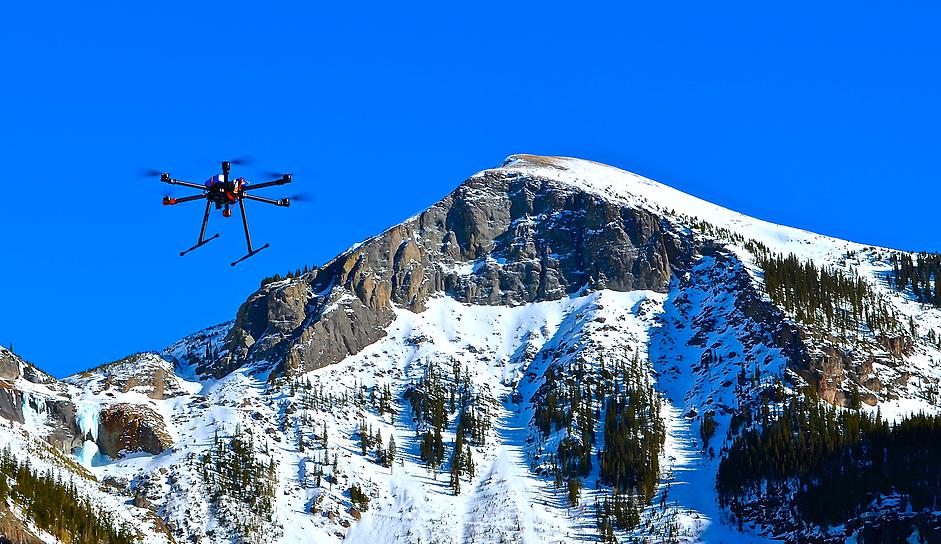
[Image: Photo courtesy Mountain Drones].

A Colorado-based company called Mountain Drones is developing a line of octocopters armed with small explosive charges as a possible tool for setting off artificial avalanches. It’s landscape design by drone.

“Here’s how it would work,” Outside explains:

Instead of spending hours bootpacking to a ridgeline to drop a hand charge, ski patrollers would select a preprogrammed route for the drone to fly and manually drop the charges to clear the slope from a safe distance. Onboard sensors will calculate the snow-water equivalent—a measure of the snowpack’s water content—and depth, allowing patrollers to identify persistent weak layers and breaking points and helping them determine where to make drops.

For now, of course, this is all still stuck at the proposal stage, although the company estimates—somewhat over-optimistically, it seems—that it will be “at least one or two years” before the proper regulations are passed.

Until then, the drones will instead be flying test routes with mock explosives, running various patterns across the mountains in anticipation of the future landscape events they will trigger.

Hacked Homes, Gas Attacks, and Panic Room Design

[Image: “How The Burglar Gets Into Your House” (1903), via The Saint Paul Globe].

One unfortunate side-effect of the Greek financial crisis has been a rise in domestic burglaries. This has been inspired not only by a desperate response to bad economic times, but by the fact that many people have withdrawn their cash from banks and are now storing their cash at home.

As The New York Times reported at the end of July, “in the weeks before capital controls were imposed at the end of June, billions of euros fled the Greek banking system. Greeks feared that their euro deposits might be automatically converted to a new currency if Greece left the eurozone and would quickly lose value, or that they would face a ‘haircut’ to their accounts if their bank failed amid the stresses of the crisis.”

This had the effect that, while the rich simply shifted their assets overseas or into Swiss bank accounts, “the middle class has stashed not just cash but gold and jewelry, among other valuables, under the proverbial mattress.” Now, however, those “hidden valuables had become enticing targets for thieves.”

Or, more accurately, for burglars.

Burglary is a spatial crime: its very definition requires architecture. By entering an architectural space, whether it’s a screened-in porch or a megamansion, theft or petty larceny becomes burglary, a spatially defined offense that cannot take place without walls and a roof.

[Image: A street in Athens, via Wikipedia].

In any case, while Greece sees its burglary rate go up and reports of local break-ins rise, home fortification has also picked up pace. “Many apartment doors have sprouted new security locks with heavy metal plates, similar to the locks used in safes,” we read, and razor wire now “bristles from garden gates where there were none last summer.”

This vision of DIY security measures applied to high-rise residential towers and other housing blocks in Athens is a surprising one, considering that, globally, burglary is in such decline that The Economist ran an article a few years ago asking, “Where have all the burglars gone?

As it happens, I’ve been studying burglary for the past few years for many reasons; among those is the fact that burglary offers insights into otherwise overlooked possibilities for reading and navigating urban and architectural space.

Indeed, burglary’s architectural interest comes not from its ubiquity, but from its unexpected, often surprisingly subtle misuse of the built environment. Burglars approach buildings differently, often seeking modes of entry other than doors and approaching buildings—whole cites—as if they’re puzzles waiting to be solved or beaten.

Consider the recent case of Formula 1 driver Jenson Button, whose villa in the south of France was broken into; the burglars allegedly made their entrance after sending anesthetic gas through the home’s air-conditioning system, incapacitating Button and his wife.

Although the BBC reports some convincing skepticism about Button’s claim, Button’s own spokesperson insists that this method of entry is on the rise: “The police have indicated that this has become a growing problem in the region,” the spokesperson said, “with perpetrators going so far as to gas their proposed victims through the air conditioning units before breaking in.”

There are other supposed examples of this sort of attack. Also from the BBC:

Former Arsenal footballer Patrick Vieira said he and his family were knocked out by gas during a 2006 raid on their home in Cannes. And in 2002, British television stars Trinny Woodall and Susannah Constantine said they were gassed while attending the Cannes Film Festival.

Other accounts, particularly from France, have appeared in the media over the past 15 years or so, describing people waking up groggy to discover they slept through a raid.

It’s worth noting, on the other hand, that actual proof of these home gas attacks is lacking; what’s more, the amount of anesthetic needed to knock out multiple adults in a large architectural space is prohibitively expensive to obtain and also presents a high risk of explosion.

Nonetheless, a security firm called SRX has commented on the matter, saying to the BBC that this is a real risk and even pointing out the specific vulnerability: ventilation intake fans usually found on the perimeter of a property, where they can be visually and acoustically shielded in the landscaping.

Their very inconspicuousness also “makes them ideal for burglars,” however, as homeowners can neither see nor hear if someone is tampering with them; as SRX points out, “we have to try and prevent access to those fans.”

Fortified air-conditioning intake fans. Razor wire defensive cordons on urban balconies. Reinforced front doors like something you’d find on a safe or vault.

[Image: A totally random shot of A/C units, via Wikipedia].

The subject of burglary, break-ins, and home fortification interests me enough that I’ve written an entire book about it—called A Burglar’s Guide to the City, due out next spring from FSG—but it is also something I’ve addressed in an ongoing three-part series about domestic home security for Dwell magazine.

The second of those three articles is on newsstands now in the September 2015 issue, and it looks at the design and installation of safe rooms, more popularly known as panic rooms.

That article is not yet online—I’ll add a link when it’s up—but it includes interviews with safe room design experts on both U.S. coasts, as well as some interesting anecdotes about trends in home fortification, such as installing “lead-lined sheetrock to protect against radioactive attack.” Bullet-proof doors, rocket-propelled grenades, and home biometric security systems all make an unsettling appearance, as well.

Prior to that, in the July/August 2015 issue, I looked at technical vulnerabilities in smart home design. There, among other things, you can read that the “$20,000 smart-home upgrade you just paid for? It can now be nullified for about $400,” using a wallet-size device engineered by Drew Porter of Red Mesa.

Further, you’ll learn how “specific combinations of remote-control children’s toys could be hacked by ambitious burglars to do everything from watching you leave on your next vacation to searching your home for hidden valuables.” That’s all available online.

The final article in that three-part series comes out in the October 2015 issue. Check them all out, if you get a chance, and then don’t forget to pick up a copy of A Burglar’s Guide to the City next spring.

The Electromagnetic Fortification of the Suburbs

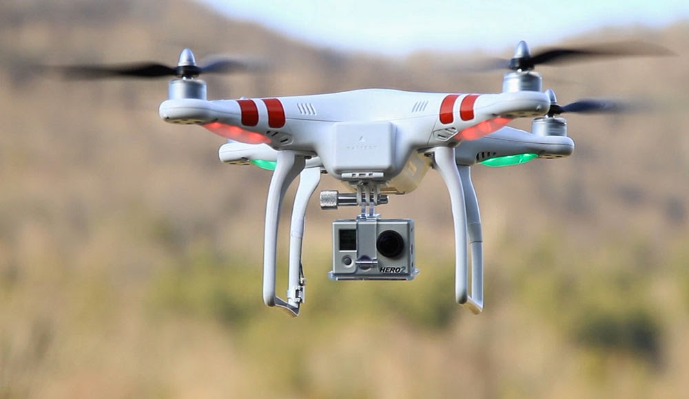
[Image: A drone from DJI].

It’s hardly surprising to read that drones can be repurposed as burglars’ tools; at this point, take any activity, add a drone, and you, too, can have a news story (or Kickstarter) dedicated to the result.

“Why not send an inexpensive drone, snoop in your windows, see if you have any pets, see if you have any expensive electronics, maybe find out if you have any jewelry hanging around,” a security expert wonders aloud to Hawaii’s KITV, describing what he sees as the future of burglary. Burglars “can do all that with a drone without ever stepping a foot on your property line.”

“So what’s a homeowner to do?” the TV station asks.

They suggest following the drone back to its owner, who, due both to battery life and signal range, will be nearby; or even installing “new expensive high-tech drone detection systems that claim to detect the sounds of a drone’s propellers.” This is absurd—suggesting that some sort of drone alarm will go off at 3am, driving you out of bed—but it’s such a perfectly surreal vision of the suburbs of tomorrow.

Fortifying our homes against drone incursion will be the next bull market in security: whole subdivisions designed to thwart drone flights, marketed to potential homeowners specifically for that very reason.

You go home for the weekend to visit your parents where, rather than being enlisted to mow the lawn or clean the gutters, you’re sent you out on drone duty, installing perimeter defenses or some sort of jamming blanket, an electromagnetically-active geotextile disguised beneath the mulch. Complex nets and spiderweb-like antennas go on sale at Home Depot, perfect for snaring drone rotors and leading to an explosion in suburban bird deaths.

[Image: A drone from DJI].

This news comes simultaneously with a story in Forbes, where we read that drone manufacturer DJI is implementing a GPS block on its products: they will no longer be able to fly within 15.5 miles of the White House.

The company is issuing “a mandatory firmware update to all Phantom drones that will restrict flight within a 15.5 mile radius centered around downtown Washington D.C. Pilots looking to operate their Phantom drone will not be able to take off or fly within the no-fly-zone.”

Based off a drone’s GPS coordinates, the technology to geo-fence drones from entering a particular airspace, especially around major airports, has been around in Phantoms since early last year. The new update will add more airports to its no-fly-zone database as the 709 no-fly-zones already in the Phantom’s flight controller software will expand to more than 10,000, with additional restrictions added to prevent flight across national borders.

This is remarkable for a number of reasons, not the least of which is the fact that firmware updates and geography now work together to disable entire classes of products within a given zone or GPS range. Put another way, drones today—but what tomorrow?

Geofencing or “locationized” firearms have already been discussed as a possible future form of gun control, for example, and it would not be at all surprising to see “locationized” smartphones or geofenced cameras becoming a thing in the next few years.

All a government (or criminal syndicate) would have to do is release a (malicious) firmware update, temporarily shutting down certain types of electronics within range of, say, a presidential inauguration (or a bank heist).

[Image: A drone from DJI].

More to the point of this post, however, GPS-based geofencing will also become part of the electromagnetic armature of future residential developments, a new, invisible layer of security for those who are willing to pay for it.

Think, for example, of the extraordinary geographic dazzle effects used by government buildings to camouflage their real-world locations: as Dana Priest and William Arkin wrote for The Washington Post back in 2012, “most people don’t realize when they’re nearing the epicenter of Fort Meade’s, even when the GPS on their car dashboard suddenly begins giving incorrect directions, trapping the driver in a series of U-turns, because the government is jamming all nearby signals.”

If half the point of living in the suburbs is to obtain a certain level of privacy, personal safety, and peace of mind, then it is hardly science fiction to suggest that the electromagnetic fortification of suburbia is on the immediate horizon.

You won’t just turn on a burglar alarm with your handy smartphone app; you’ll also switch on signal-jamming networks hidden in the trees or a location-scrambling geofence camouflaged as a garden gnome at the edge of your well-mown lawn. Drones, dazzled by invisible waves of unpredictable geographic information, will perform U-turns or sudden dives, even racing off to a pre-ordained security cage where they can be pulled from the air and disabled.

The truly high-end residential developments of tomorrow will be electromagnetically fortified, impervious to drones, and, unless you’ve been invited there, impossible for your cars and cellphones even to find.

Flying Robotic Construction Cloud

Quentin Lindsey, Daniel Mellinger, and Vijay Kumar from the University of Pennsylvania’s GRASP Lab—General Robotics, Automation, Sensing and Perception—have devised a system whereby autonomous flying helicopters can assemble a rudimentary architectural grid using small magnetic beams.

This technology begs a series of questions, of course, including who might first pick up on and directly invest in this construction process (the field exploration wings of transnational oil-services firms? forward-operating base commanders of the 22nd-century U.S. military? rogue GSD students self-supported by a family trust fund?), what sorts of architectural styles might result given the technical and material limitations associated with magnetic cloud-construction (a return to the minimalist grid? Sol Lewitt as architectural progenitor?), and how successfully this could be scaled up to the dimensions of whole towns and cities.

It might not be altogether unfeasible, in other words, given enough time and investment, that we’ll someday see flocks of autonomous helicopters roaring off into western Australia, or into the Canadian Arctic, autonomously assembling supply-chain-governed grid-cities where every magnet, bolt, beam, and screw is dutifully accounted for and guided into place by intelligent airborne mechanisms. Then the humans move in.

Or, extending this into the clichéd territory where BLDGBLOG and the Terminator begin to overlap, perhaps the machines will construct factories for the production of more machines, which will then fly onward and further to build yet more factories, constructing a sovereign halo of autonomous machine-urbanism in the earth’s north polar latitudes.

(Via @WillWiles).