
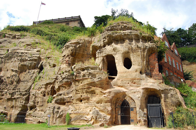
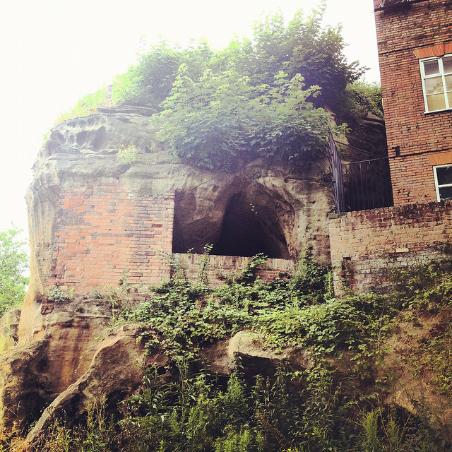
 [Image: Cliffs and caves of Nottingham; photo by Nicola Twilley].
For several years now, I’ve admired from afar the ambitious laser-scanning subterranean archaeological project of the Nottingham Caves Survey.
Incredibly, there are more than 450 artificial caves excavated from the sandstone beneath the streets and buildings of Nottingham, England—including, legendarily, the old dungeon that once held Robin Hood—and not all of them are known even today, let alone mapped or studied. The city sits atop a labyrinth of human-carved spaces—some of them huge—and it will quite simply never be certain if archaeologists and historians have found them all.
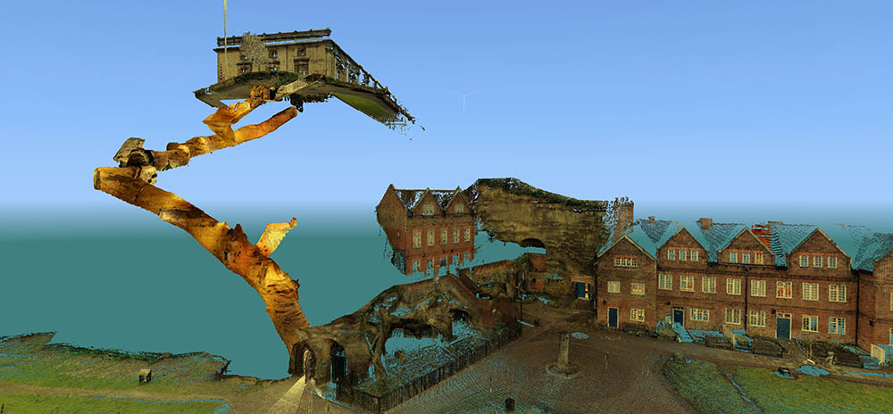
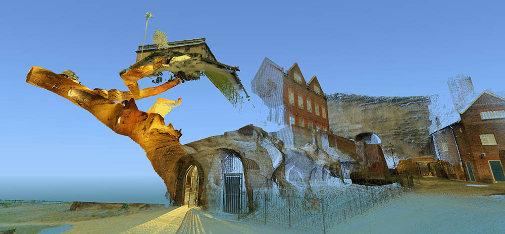
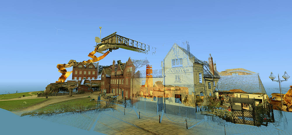 [Images: Laser scans from the Nottingham Caves Survey show Castle Rock and the Mortimer’s Hole tunnel, including, in the bottom image, the Trip to Jerusalem Pub where we met archaeologist David Strange-Walker; images like this imply an exhilarating and almost psychedelic portrait of the city as invisibly connected behind the scenes by an umbilical network of caves and tunnels. Scans courtesy of the Nottingham Caves Survey].
“Even back in Saxon times, Nottingham was known for its caves,” local historian Tony Waltham writes in his helpful guide Sandstone Caves of Nottingham, “though the great majority of those which survive today were cut much more recently.” From malt kilns to pub cellars, “gentlemen’s lounges” to jails, and wells to cisterns, these caves form an almost entirely privately-owned lacework of voids beneath the city.
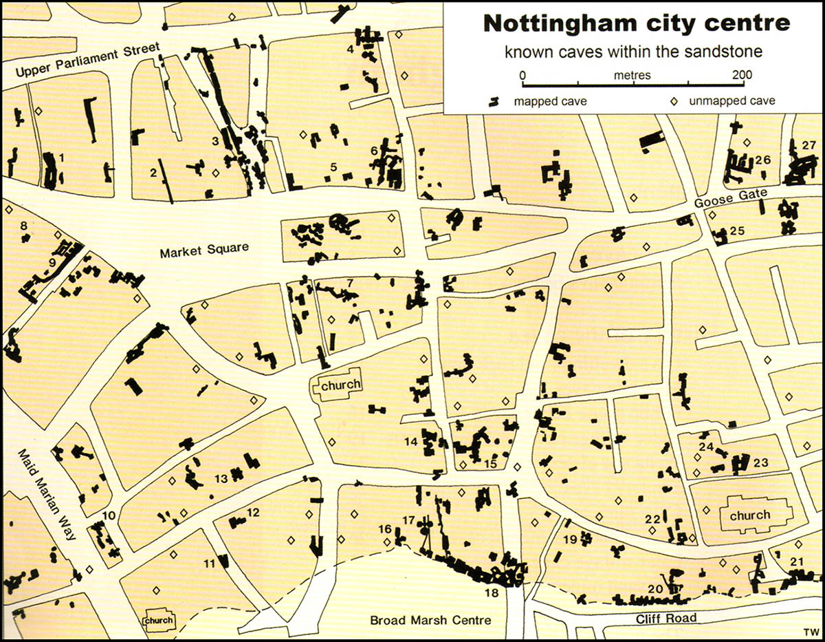 [Image: Map of only the known caves in Nottingham, and only in Nottingham’s city center; map by Tony Waltham, from Sandstone Caves of Nottingham].
As Waltham explains, “Nottingham has so many caves quite simply because the physical properties of the bedrock sandstone are ideal for its excavation.” The sandstone “is easily excavated with only hand tools, yet will safely stand as an unsupported arch of low profile.”
In a sense, Nottingham is the Cappadocia of the British Isles.
 [Image: The extraordinary caves at 8 Castle Gate; scan courtesy of the Nottingham Caves Survey].
The purpose of the Nottingham Caves Survey, as their website explains, is “to assess the archaeological importance of Nottingham’s caves. Some are currently scheduled monuments and are of great local and national importance. Some are pub cellars and may seem less vital to the history of the City.”
Others, I was soon to learn, have been bricked off, taken apart, filled in, or forgotten.
“All caves that can be physically accessed will be surveyed with a 3D laser scanner,” the Survey adds, “producing a full measured record of the caves in three dimensions. This ‘point cloud’ of millions of individual survey points can be cut and sliced into plans and sections, ‘flown through’ in short videos, and examined in great detail on the web.”
[Video: One of very many laser-scan animations from the Nottingham Caves Survey].
While over in England a few weeks ago, I got in touch with archaeologist David Strange-Walker, the project’s manager, and arranged for a visit up to Nottingham to learn more about the project. Best of all, David very generously organized an entire day’s worth of explorations, going down into many of the city’s underground spaces in person with David himself as our guide. Joining me on the trip north from London was Nicola Twilley of Edible Geography; architect Mark Smout of Smout Allen and co-author of the fantastic Pamphlet Architecture installment, Augmented Landscapes; and Mark’s young son, Ellis.
 [Image: Artificially enlarged pores in the sandstone; photo by BLDGBLOG].
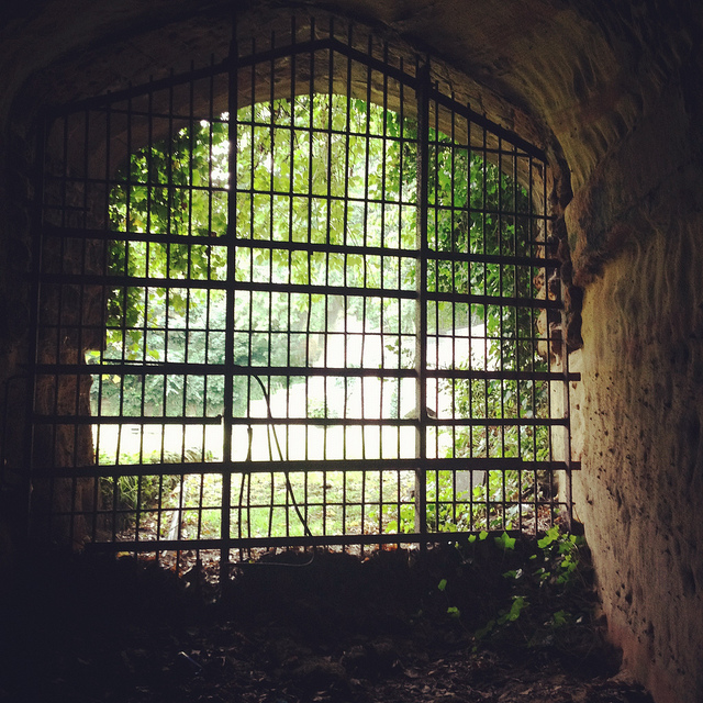
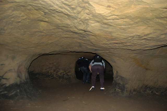
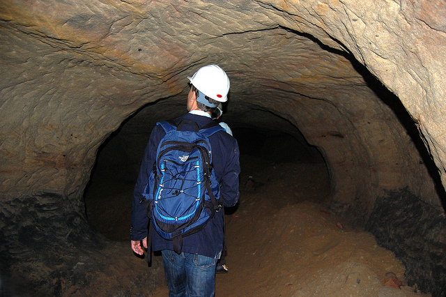
We met the very likable and energetic David—who was dressed for a full day of activity, complete with a well-weathered backpack that we’d later learn contained hard hats and floodlights for each of us—outside Nottingham’s Trip to Jerusalem pub.
Rather than kicking off our visit with a pint, however, we simply walked inside to see how the pub had been partially built—that is, expanded through deliberate excavation—into the sandstone cliffside.
The building is thus more like a facade wrapped around and disguising the artificial caves behind it; walking in past the bar, for instance, you soon notice ventilation shafts and strange half-stairways, curved walls and unpredictable acoustics, as the “network of caves” that actually constitutes the pub interior begins to reveal itself.
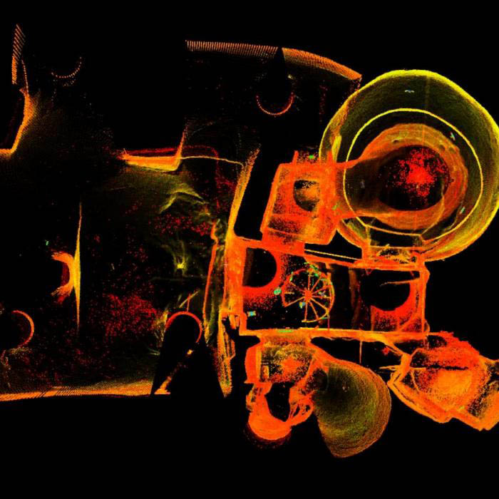
 [Image: A laser scan showing the umbilical connection of Mortimer’s Hole, courtesy of the Nottingham Caves Survey].
My mind was already somewhat blown by this, though it was just the barest indication of extraordinary spatial experiences yet to come.
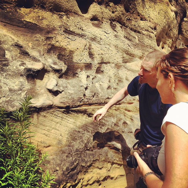 [Image: Examining sandstone with Dr. David Strange-Walker; photo by BLDGBLOG].
Wasting no time, we headed back outside, where afternoon rain showers had begun to blow in, and David introduced us to the sandstone cliff itself, pointing out both natural and artificially enlarged pores pockmarking the outside.
The sandstone formations or “rock units” beneath the city, as Tony Waltham explains, “were formed as flash flood sediments in desert basins during Triassic times, about 240 million years ago, when Britain was part of a hot and dry continental interior close to the equator. Subsequent eons of plate tectonic movements have brought Britain to its present position; and during the same time, the desert sediments have been buried, compressed and cemented to form moderately strong sedimentary rocks.”
The city is thus built atop a kind of frozen Sahara, deep into which we were about to go walking.
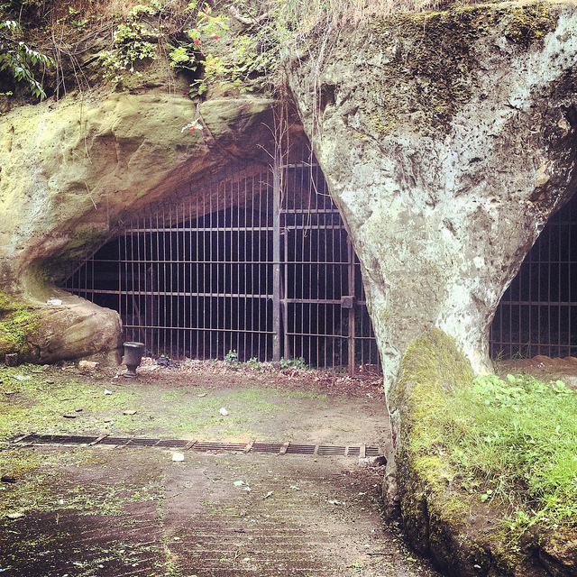
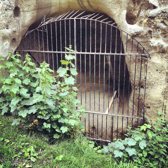 [Image: A gate in the cliff; photo by BLDGBLOG].
Outside here in the cliff face, small openings led within to medieval tunnels and stairs—including the infamous Mortimer’s Hole—that themselves curled up to the top of the plateau; doors in the rock further up from the Trip to Jerusalem opened onto what were now private shooting ranges, of all things; and, with a laugh, David pointed out shotcrete cosmetic work that had been applied to the outer stone surface.
 [Image: Artificial shotcrete geology; photo by BLDGBLOG].
We headed from there—walking a brisk pace uphill into the town center—with David casually narrating the various basements, cellars, tunnels, and other urban perforations that lay under the buildings around us, as if we were traveling through town with a human x-ray machine for whom the city was an archaeologically rich cobweb of underground loops and dead-ends.
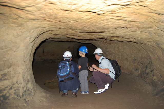
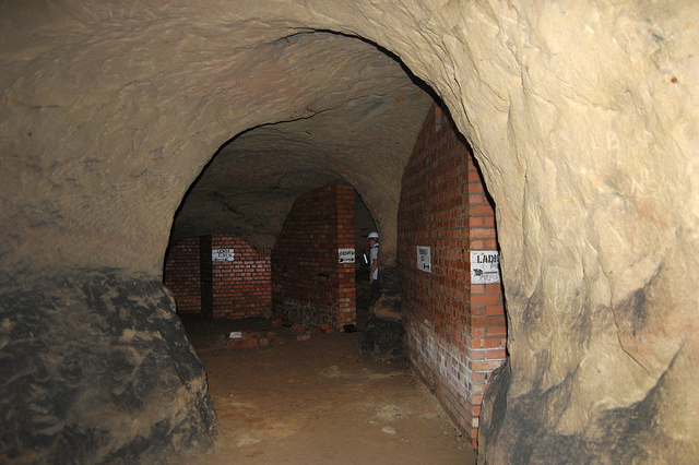
We soon ended up at the old jails of the Galleries of Justice. A well-known tourist destination, complete with costumed re-enactors, the building sits atop several levels of artificial caves that are well worth exploring.
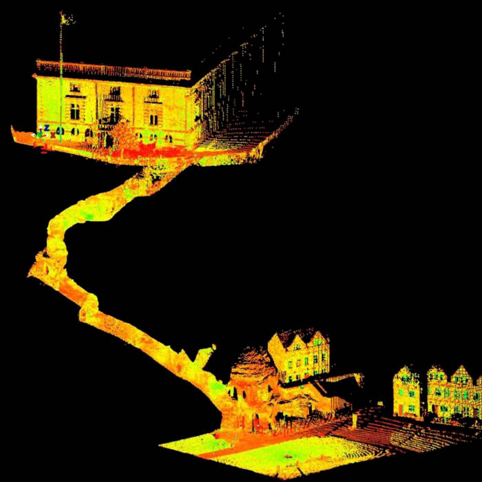
 [Image: Scan of the Guildhall caves, courtesy of the Nottingham Caves Survey].
We were joined at this point by the site’s director, who generously took time out of his schedule to lead us down into parts of the underground complex that are not normally open to the general public.
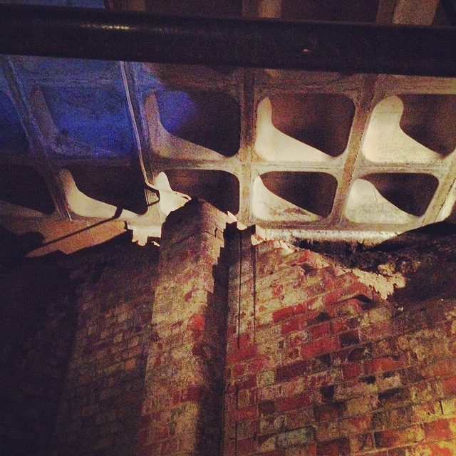
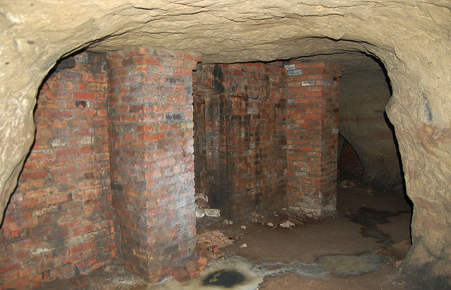
Heading downward—at first by elevator—we eventually unlocked a door, stepped into a tiny room beneath even the jail cells, crouching over so as not to bang our heads on the low ceiling, and we leaned against banded brick pillars that had been added to help support all the architecture groaning above us.
Avoiding each other’s flashlight beams, we listened as our two guides talked about the discovery—and, sadly, the willful reburial—of caves throughout central Nottingham.
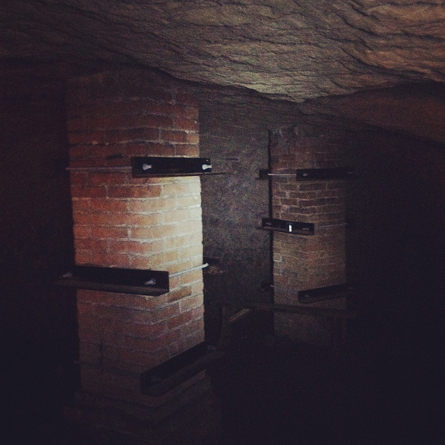 [Image: Brick pillars below Nottingham; photo by BLDGBLOG].
We learned, for instance, that, elsewhere in the city, there had once been a vacuum shop with a cave beneath it; if I remember this story correctly, the shop’s owners had the habit of simply discarding broken and unsold vacuum cleaners into the cave, inadvertently creating a kind of museum of obsolete vacuum parts. Discontinued models sat in the darkness—a void full of vacuums—as the shop went out of business.
We heard, as well, about a nearby site where caves had been discovered beneath a bank during a recent process of renovation and expansion—but, fearing discovery of anything that might slow down the bank’s architectural plans, the caves were simply walled up and left unexplored. They’re thus still down there, underneath and behind the bank, their contents unknown, their extent unmapped—a fate, it seems, shared by many of the caves of Nottingham.
Rather than being greeted by the subterranean and historical wonder that such structures deserve—and I would argue that essentially all of subterranean Nottingham should be declared a UNESCO World Heritage Site—the caves are too often treated as little more than annoying construction setbacks or anomalous ground conditions, suitable only for bricking up, filling with concrete, or forgetting. If the public thinks about them at all, in seems, it is only long enough to consider them threats to building safety or negative influences on property value.
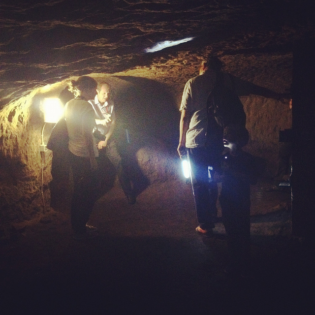
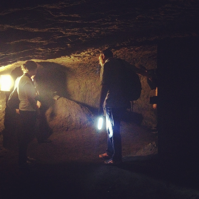 [Images: Learning about caves; photos by BLDGBLOG].
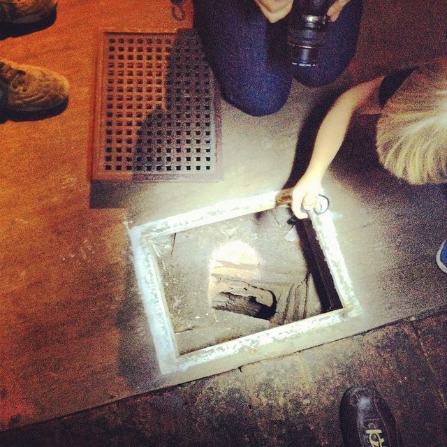
In any case, on our way out of the Galleries of Justice, we lifted up a ventilation grill in the floor and looked down into a small vertical shaft, too narrow and contorted even for Ellis to navigate, and we learned that there are urban legends that this particular shaft leads down to a larger room in which Robin Hood himself was once held… But we had only enough time to shine our flashlights down and wonder.
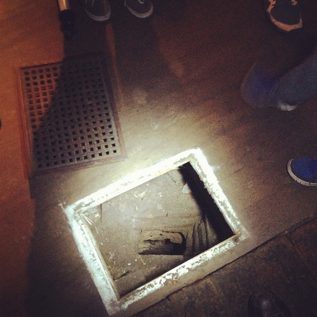 [Images: Ellis Smout looks for Robin Hood below; photos by BLDGBLOG].
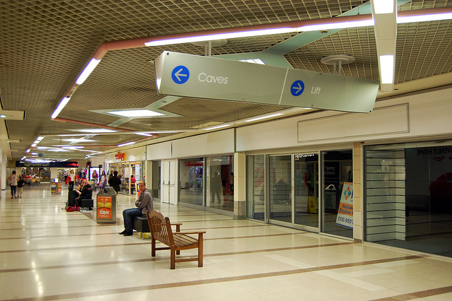
From here, we headed over to our final tourist-y site of the day, which is the awesomely surreal City of Caves exhibition, located in Nottingham’s Broad Marsh shopping mall.
You literally take an escalator down into an indoor mall, where, amidst clothing outlets and food courts, there is an otherwise totally mundane sign pointing simply to “Caves.”
If you didn’t know about Nottingham’s extensive sub-city, this would surely be one of the most inexplicable way-finding messages in mall history.
 [Image: Caves; photo by Nicola Twilley].
Here, where we picked our copy of Tony Waltham’s Sandstone Caves of Nottingham pamphlet, from which I’ve been quoting, we learned quite a bit more about how the city has grown, how the caves themselves have often been uncovered (for example, during building expansions and renovations), and what role Nottingham’s underground spaces served during the Nazi bombings of WWII.
 [Image: Beneath Broad Marsh shopping mall; photo by BLDGBLOG].
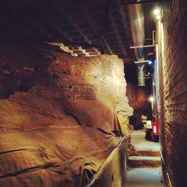
The specific underground complex beneath the shopping mall offers an interesting mix of old tanning operations and other semi-industrial, pre-modern work rooms, now overlapping with 20th-century living and basement spaces that were sliced open during the construction of the Broad Marsh mall.
 [Images: Cave spaces beneath the Superstudio-like concrete grid of Nottingham’s Broad Marsh shopping Mall].
That these caves were preserved at all is testament to the power of local conservationists, as the historically rich and spatially intricate rooms and corridors would have been gutted and erased entirely during post-War reconstruction without their intervention.
As it now stands, the mall is perched above the caves on concrete pillars, with the effect that curious shoppers can wander down into the caves through an entrance that could just as easily lead to a local branch of Accessorize.
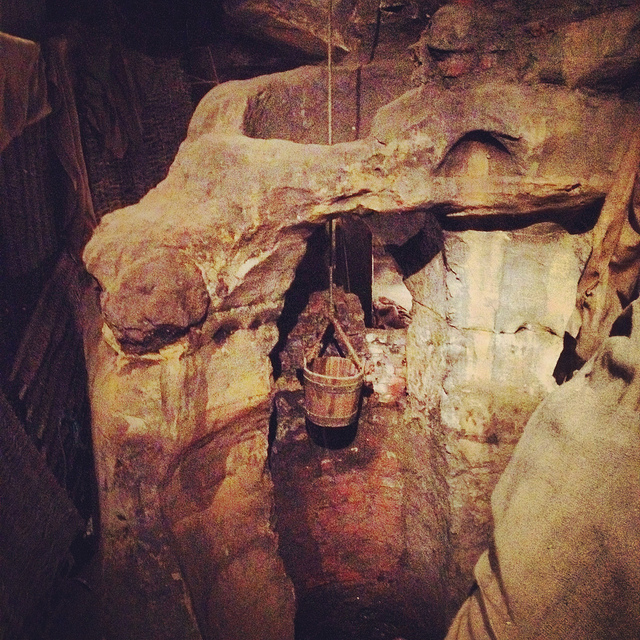 [Image: A well bucket in the caves beneath Broad Marsh; photo by BLDGBLOG].
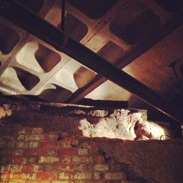
Again, we were fortunate to be taken down into some off-limits areas, stepping over lights and electric wires and peering ahead into larger rooms not on the tourist route.
 [Images: Lines of lights we switched on in one of the off-limits rooms below Broad Marsh; photo by BLDGBLOG].
This included stepping outside at one point to wander through an overgrown alleyway behind the mall. Small openings even back here stretched beneath and seemingly into the backs of shops; one doorway, a short scramble up a hill of weed-covered rubble, appeared to contain a half-collapsed spiral staircase installed inside a brick-lined sandstone opening.
 [Image: A doorway to voids behind Broad Marsh Centre; photo by BLDGBLOG].
At this point, we began to joke about the ease with which it seemed you could plan a sort of speleological super-heist, breaking into shops from below, as an entire dimension of the city seemed to lie unwatched and unprotected.
Nottingham, it appeared, is a city of nothing but doors and openings, holes, pores, and connections, complexly layered knots of space coiling beneath one building after another, sometimes cutting all the way down to the water table.
Incredibly, the day only continued to build in interest, reaching near-impossible urban sights, from catacombs in the local graveyard to a mind-bending sand mine that whirled and looped around like smoke rings beneath an otherwise quiet residential neighborhood.
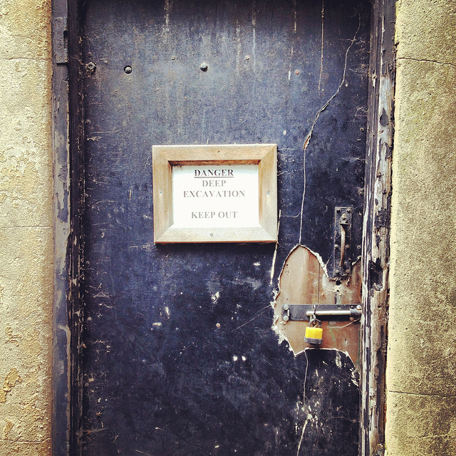
Leaving the mall behind, and maintaining a brisk pace, David took us further into the city, where our next stop was the Old Angel Inn, another pub with an extensive cellar of caves, in this case accessed through a deceptively workaday door next to an arcade game.
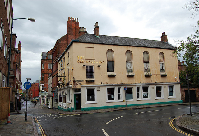
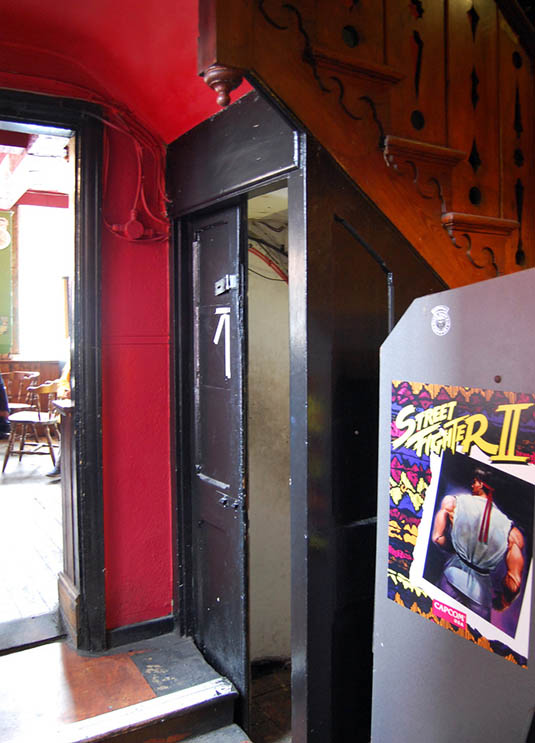 [Images: The Old Angel Inn (top), including the door inside the pub that leads down to the caves below; photos by Nicola Twilley].
Once again, it can hardly be exaggerated how easy it would be to visit or even live in Nottingham and have absolutely no idea that underground spaces such as this can be found almost anywhere. As Tony Waltham points out, “It would be a fair assumption that every building or site within the old city limits either has or had some form of cave beneath it. About 500 caves are now known, and this may be only half the total number that have been excavated under Nottingham.”
 [Images: The caves of the Old Angel Inn, courtesy of the Nottingham Caves Survey].
In any case, “Although the Old Angel is a ‘modern’ brick building,” as the Nottingham Caves Survey describes the pub on its website, “an investigation of the caves below reveals stone walls belonging to an earlier incarnation. It is likely that there were buildings on this site as far back as the Anglo-Saxon period. Whether the caves beneath are also this old cannot be demonstrated definitively.”
Typical, as well, for these types of pub caves, we found ventilation and delivery tunnels leading back up to the surface, and the walls themselves are lined with long benches, perfect for sitting below ground and, provided you have candles or a flashlight along with you, enjoying a smoke and a pint of beer. As Tony Waltham explains, pub cellars often include “perimeter thralls,” or “low ledges cut in the rock,” normally used for storing kegs and barrels of beer but quite easily repurposed for a quick sit-down.
But I sense I’m going on way too long about all this, especially because the two most memorable details of the entire day were yet to come.
Jumping forward a bit, we left the Old Angel and followed some twists and turns in the street to find ourselves standing outside a nightclub called Propaganda.
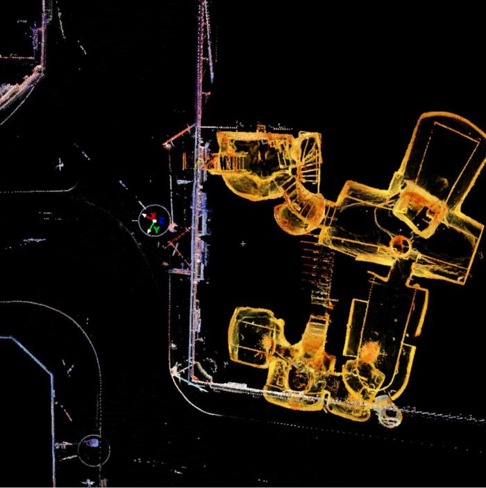
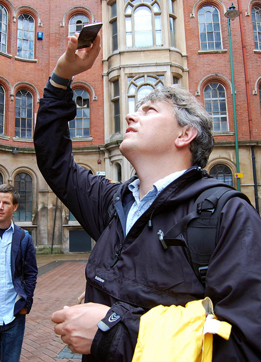
Here, David revealed that he has been working on what, in my opinion, will easily be one of the must-have apps of the year. In a nutshell, David has managed to make the subterranean 3D laser-scans of the Nottingham Caves Survey accessible by location, such that, holding up his iPod Touch, he demonstrated that you could, in effect, scan the courtyard we were standing in to see the caves, tunnels, stairways, cellars, vents, storage rooms, and more that lay hidden in the ground around us.
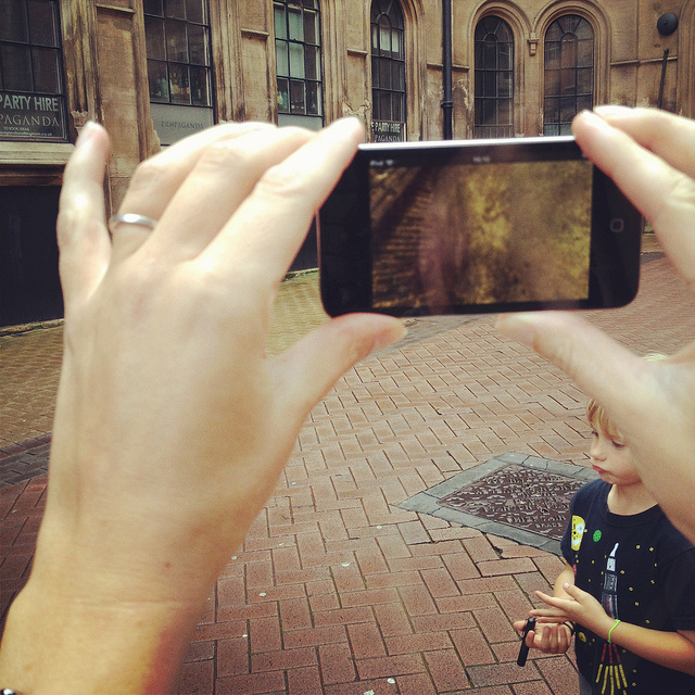
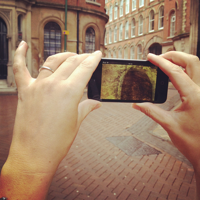
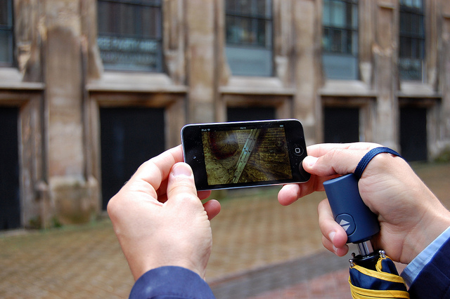 [Images: We test-drive the cave-spotting app; bottom photo by Nicola Twilley].
Ideally, once the Survey’s extensive catalog of 3D visualizations and laser point-clouds has been made available and the app is ready for public download, you will be able to walk through the city of Nottingham, smartphone in hand, revealing in all of their serpentine complexity the underground spaces of the city core.
For anyone who has ever dreamt of putting on x-ray glasses and using them to explore architectural space, this app promises to be a thrilling and vertiginous way to experience exactly that—peering right through the city to see its most ancient foundations.
[Video: A fly-through of the Propaganda Nightclub malting caves].
I, for one, can’t wait to see what David and the Nottingham Caves Survey do with the finished application and I eagerly await its public availability.
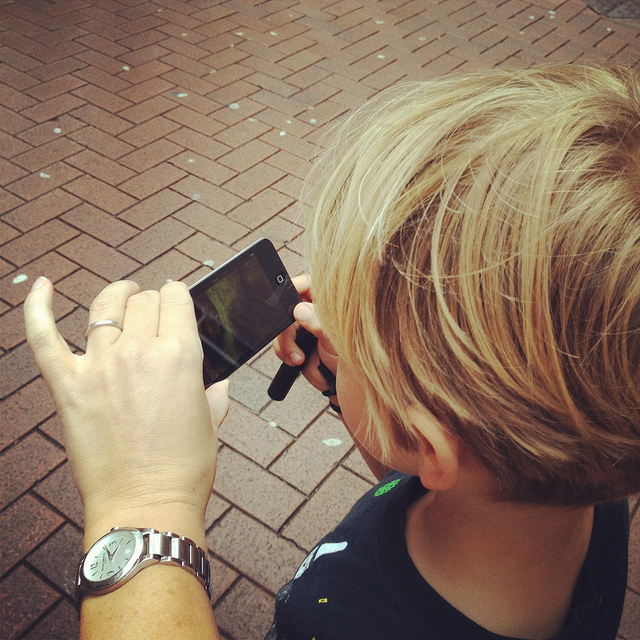
 [Image: Mark Smout looks for caves in the sky; photo by Nicola Twilley].
I’ll wind up this already quite long post with just a few more highlights.
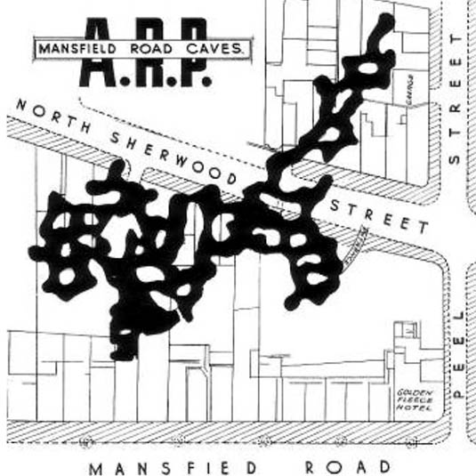
Nottingham’s Rock Cemetery, north from the center of town along the Mansfield Road, contains, among other things, the collapsed remains of a sand mine. Three of the mine’s old entrances are now gated alcoves surrounded by graves, like something out of Dante. They “are the only surviving remnants of the mine,” Waltham writes in his pamphlet.
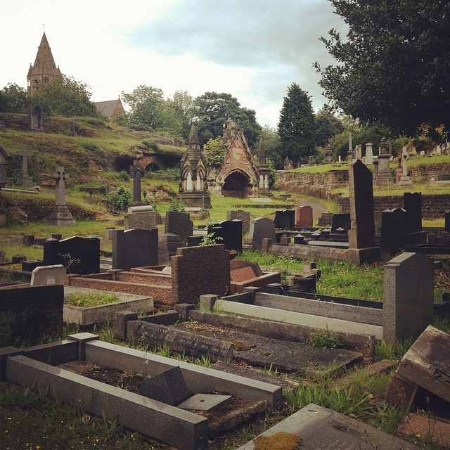
 [Images: Nottingham’s Rock Cemetery, where archaeologist David Strange-Walker explained the history of the local landscape].
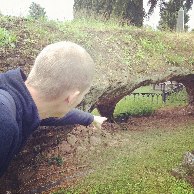
However, an ambitious plan to carve sizable catacombs, inspired by Paris and Rome, through the sandstone beds of the ancient desert here resulted in the never-completed Catacomb Caves, “probably done in 1859-63,” Waltham suggests. These long arched tunnels, accessible through one of the gates described above, eventually lead to a radial terminus from which branch the unused proto-catacombs.
The air there is cloudy with sand—leading me, several days later, to experience a brief attack of hypochondria, worried about developing silicosis—the walls are graffiti’d, and years of trash are piled on the sides of the sandy floor (which has since taken on the characteristics of a dune sea in places, as 150 years of footfall and a collapsing ceiling have led to the appearance of drifts).

 [Images: The Rock Cemetery catacomb gates].
What was so extraordinary here, among many other things, was that, for most of this walk through the catacombs, we were actually walking below the graves, meaning that people were buried above us in the earth. At the risk of overdoing it, this felt not unlike becoming aware of an altogether different type of constellation, with bodies and all the stories their lives could tell held above us in a terrestrial sky like legends and heroes, like Orion and Cassiopeia, as we looked up at the vaulted ceiling, flashlights in hand.
 [Image: Inside the catacombs; photo by Nicola Twilley].
But the best site of all was next.
 [Image: A door on the street—the black door with bars—leading down into a sand mine; photo by BLDGBLOG].
Serving as something of the ultimate proof that Nottingham is a city of overlooked doors that lead into the underworld, there were two locked doors—one of which (the black door, near the sidewalk) appears in the photo, above, another of which, on a street nearby, leads down into the Peel Street Caves—simply sitting there on the sidewalk that, if opened, will take you down into extensive and now defunct sand mines. David’s laser-scans of these for the Nottingham Caves Survey are absolutely gorgeous, as you can see, below.
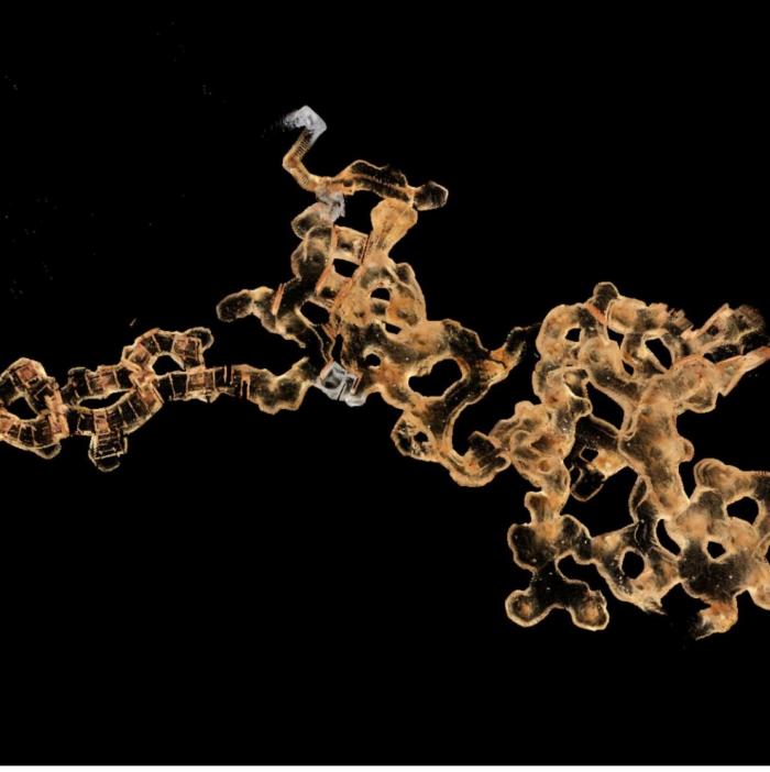
 [Image: The Peel Street Caves sand mine, courtesy of the Nottingham Caves Survey].
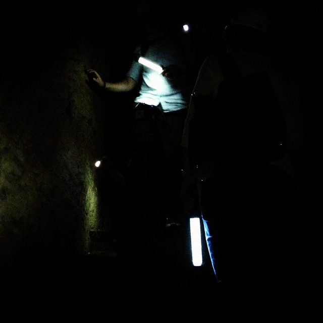
For a variety of reasons, I am going to avoid being too specific about some of the details here, but, aside from that, I can only enthuse about the experience of donning our hard hats and heading down several flights of comparatively new concrete steps into a coiling and vast artificial cavern from the 19th century, one we spent nearly an hour exploring.
 [Image: Nicola Twilley and Mark Smout head down into the sand mine; photo by BLDGBLOG].
Getting lost down there would be so absurdly easy that it is frightening even to contemplate, and, in case the group of us somehow got split up or our batteries ran out of juice, we joked about—if only we could remember them—the easy techniques for navigating a labyrinth offered in Umberto Eco’s novel The Name of the Rose.

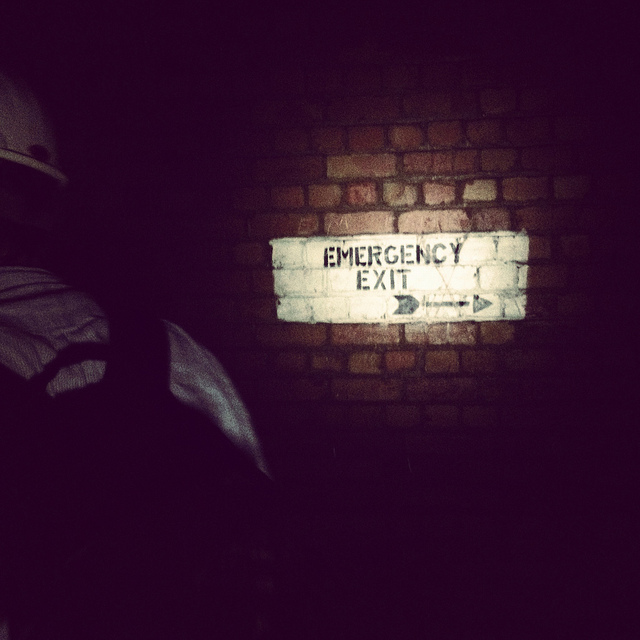 [Image: Many of these way-finding signs are actually incorrect, David explained, and seem to have been painted as a kind of sick joke by someone several years ago; photos by BLDGBLOG].
Avoiding such a fate, however, we found graffiti and men’s and women’s latrines; we popped our heads through holes allowing glimpse of other levels; and we cracked our helmets loudly against the low and rough roof more times than I could count.
 [Images: Inside the sand mine; all photos by Nicola Twilley].
And even that doesn’t complete the day. From here, heading back out onto the street through a nondescript steel door, as if we had been doing nothing more than watching football in someone’s basement, we went on to eat pie and chips in a restaurant built partially into a cave; we walked back across town, returning to where we started, talking about the future and seemingly obvious possibility of Nottingham’s caves being declared a UNESCO World Heritage Site and thus saved from their all but inevitable destruction (it’s easy to imagine a future in which a tour like the one David gave us will be impossible for lack of caves to see); and we all said goodbye beneath an evening sky cleared of clouds as a late-day breeze began to cut through town.
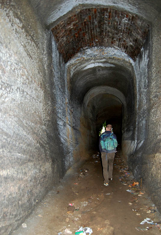
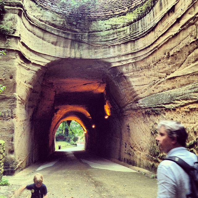 [Image: Mark & Ellis Smout explore our final “underground” space of the day, the magnificent Park Tunnel; the banded strata clearly visible in the walls show how the tunnel was carved through the dunes of an ancient desert. Photo by BLDGBLOG].
David proved to be a heroic guide that day. His energy never flagged throughout the tour, and he never once appeared impatient with or exhausted by any of our often ridiculous questions—not to mention our tourists’ insistence on pausing every three or four steps to take photographs—and he remained always willing to stay underground far longer than he had originally planned, all this despite having never met any of us before in person and only communicating with me briefly via a flurry of emails the week before.
Meeting David left me far more convinced than I already was that the Nottingham Caves Survey fully deserves the financial support of individuals and institutions, so that it can complete its ambitious and historically valuable work of cataloging Nottingham’s underground spaces and making that knowledge freely accessible to the general public.
Weirdly, England has within its very heart a region deserving comparison to Turkish Cappadocia—yet very few people even seem to know that this subterranean world exists. There very well could be more than 1,000 artificial caves beneath the city, many of them fantastically elaborate, complete with fine carvings of lions and ornate stairwells, and it is actually somewhat disconcerting to think that people remain so globally unaware of Nottingham’s underground heritage.
With any luck, the work of David Strange-Walker, Trent & Peak Archaeology, and the Nottingham Caves Survey will help bring this extraordinary region of the earth the attention—and, importantly, the focused conservation—it is due.
(For further reading, don’t miss Nicola Twilley’s write-up of the tour on her own blog, Edible Geography; and Tony Waltham’s Sandstone Caves of Nottingham, cited extensively in this post, is worth a read if you can find a copy).

 [Image: One of
  [Image: Another type of “building cut” from
 [Image: The howling of Hell,
 [Image:
  [Image: Curiosity reveals its Morse code, courtesy of
  [Image: Curiosity’s tire treads, courtesy of
 [Image: Bradbury Landing, via the
 [Image: The British Exploratory Land Archive’s “capture blanket” in use on Hampstead Heath, London; photo by Mark Smout].
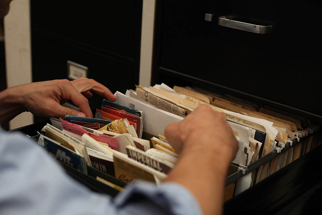
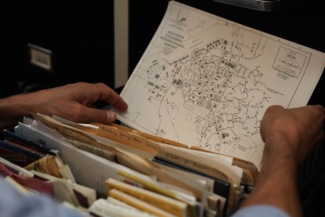
 [Images: Going through the archives, maps, and files of the Center for Land Use Interpretation, including one of my favorite headlines of all time: “Emptiness welcomes entrepreneurs”; photos by Mark Smout].
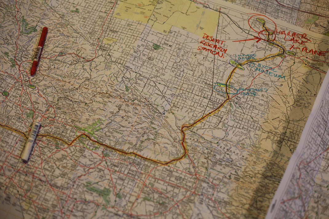
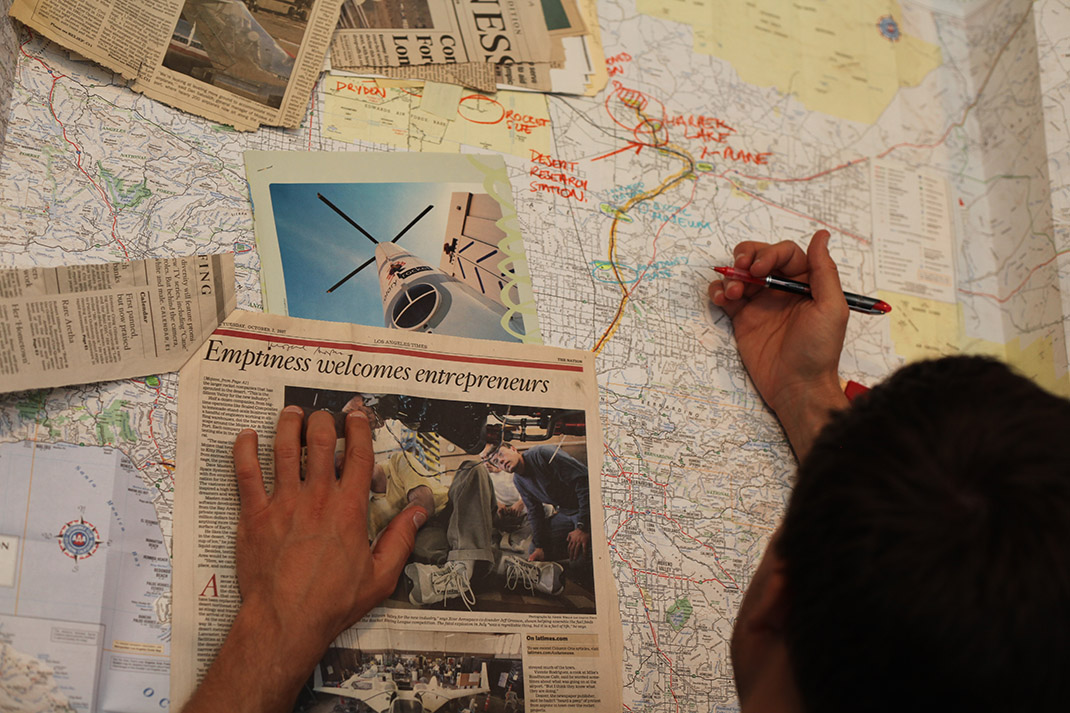
 [Images: Exploring Greater Los Angeles with Matthew Coolidge, Ben Loescher, and Aurora Tang; photos by Mark Smout].
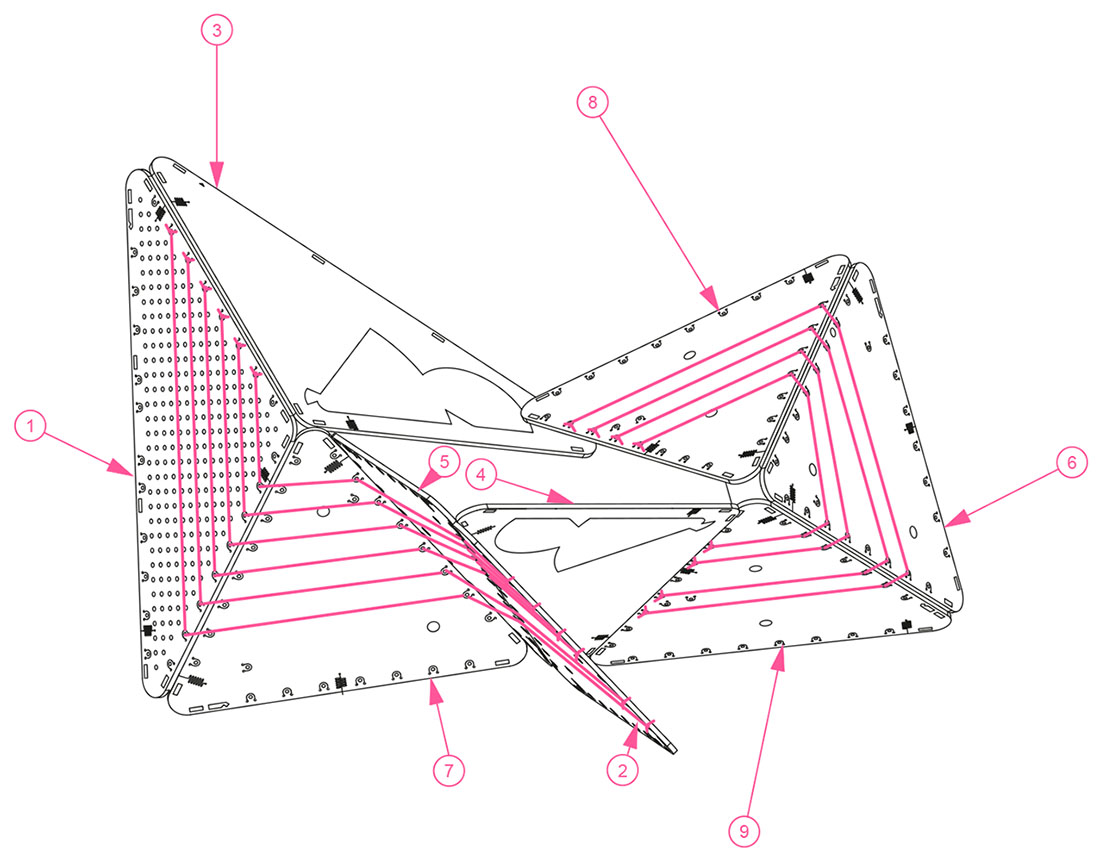
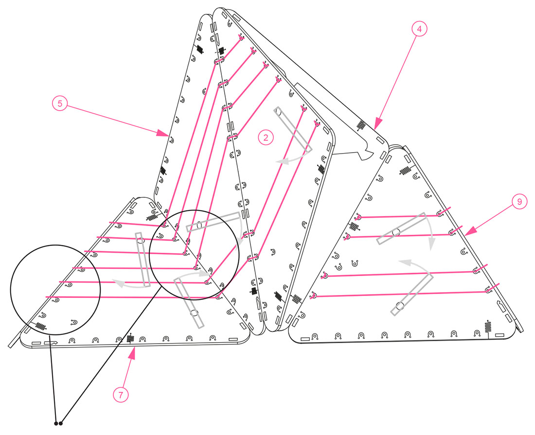
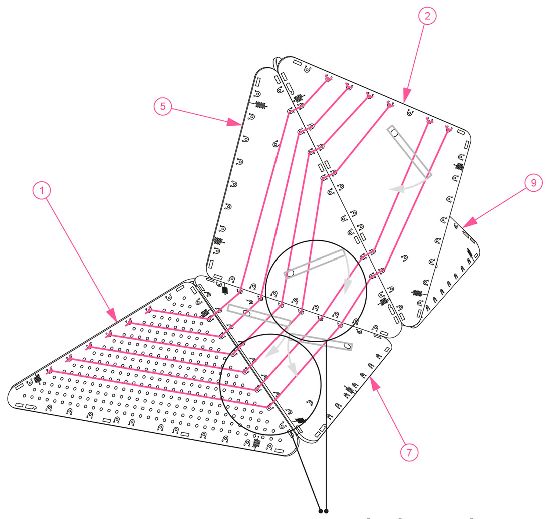 [Images: Assembly diagrams for the BELA “clinometer,” a speculative device “for the measurement of variable slopes on sites such as scrap yards, landfills, slag heaps and other industrial dumping grounds… functioning as an easily readable survey tool and as a unique design object that calls public attention to the process of measuring artificial landscapes”].
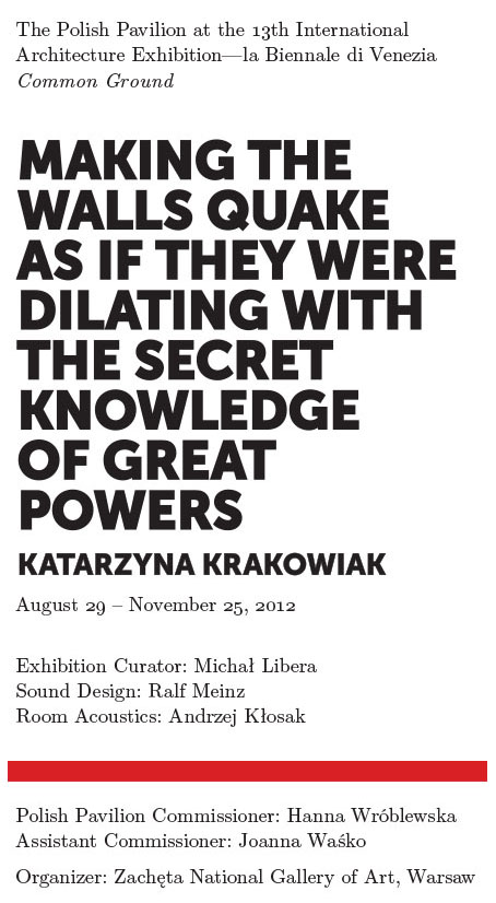 Her piece, called Making the walls quake as if they were dilating with the secret knowledge of great powers is, in the words of Michal Libera, the pavilion’s curator, a controlled “amplification of the Polish Pavilion as a listening-system.”
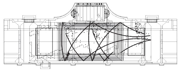 [Image: A sound-study of the 2012 Polish Pavilion by Andrzej Kłosak for Katarzyna Krakowiak].
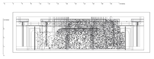 [Image: Another sound-study of the 2012 Polish Pavilion by Andrzej Kłosak for Katarzyna Krakowiak].
 [Images: Photos by Simon Rouby for “
 [Image: From “
 [Image: From Nick Foster’s “
 [Images: From Nick Foster’s “
 [Image: From “
 [Image: From “
 [Images: From “
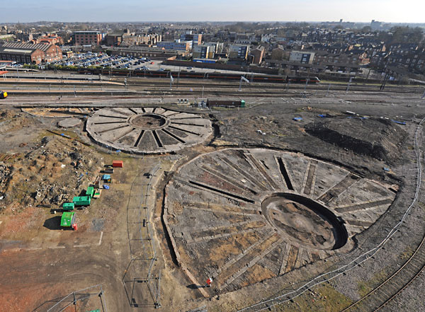 [Image: Aerial photo of the roundhouses site, courtesy of