 [Image: Via Google Maps; view larger].
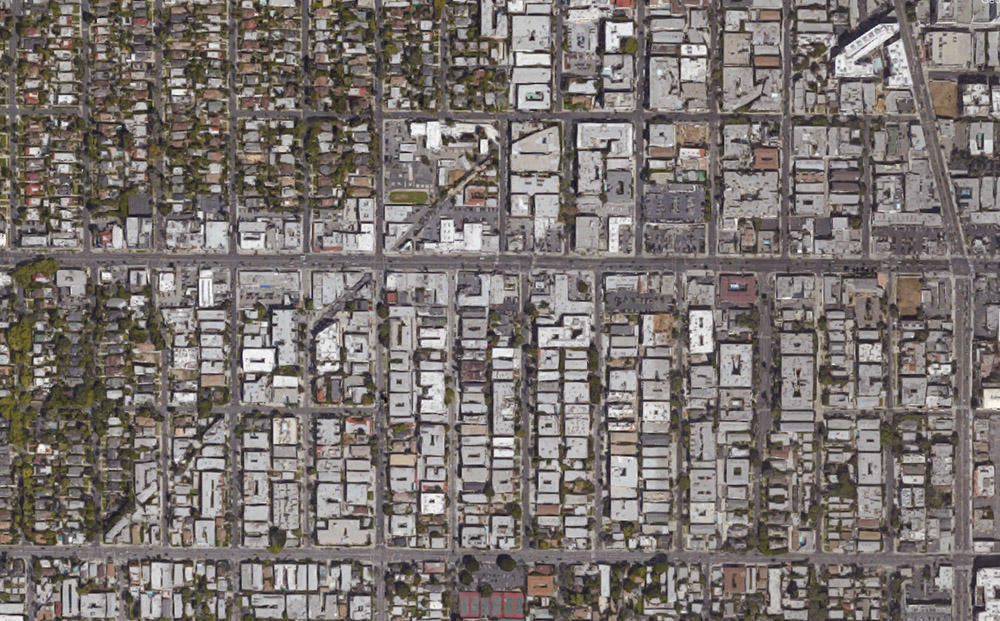
In a short story called “Reports of Certain Events in London” by China Miéville—a text often cited here on BLDGBLOG—we read about a spectral network of streets that appear and disappear around London like the static of a radio tuned between stations, old roadways that are neither here nor there, flickering on and off in the dead hours of the night.
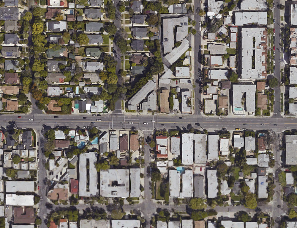
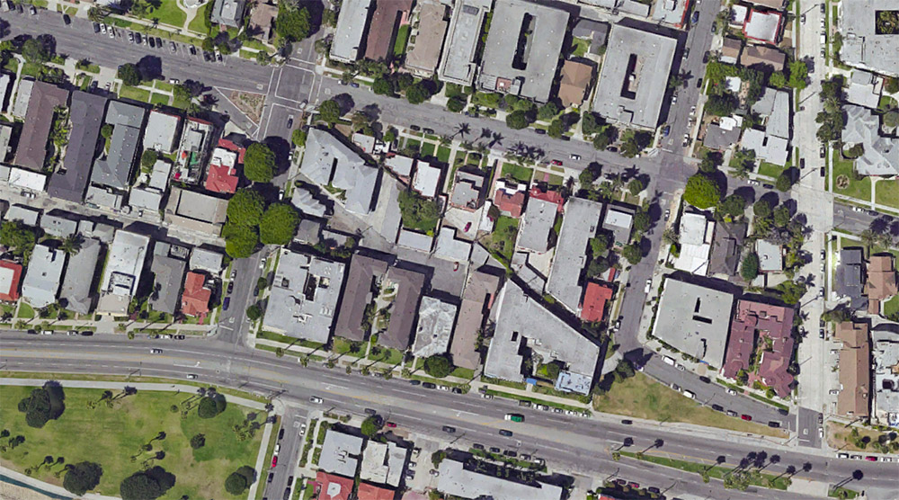
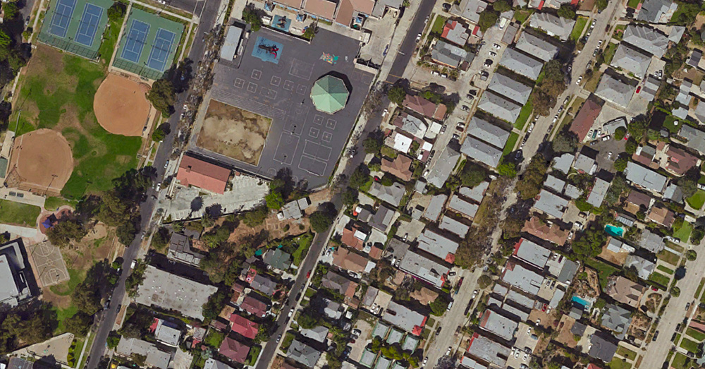
For reasons mostly related to a bank heist described in my book, A Burglar’s Guide to the City, I found myself looking at a lot of aerial shots of Los Angeles—specifically the area between West Hollywood and Sunset Boulevard—when I noticed this weird diagonal line cutting through the neighborhood.
 [Image: Via Google Maps; view larger].
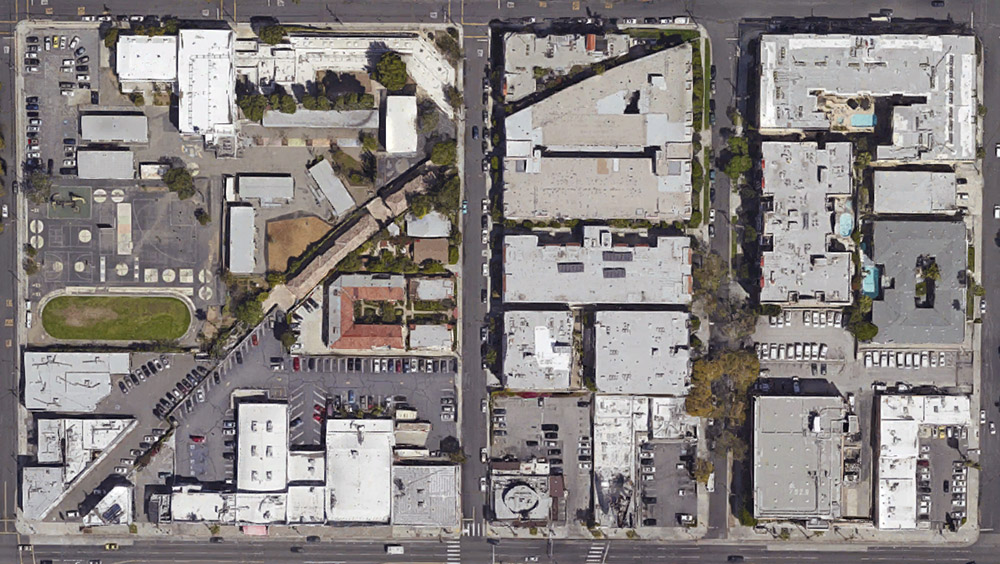
It is not a street—although it obviously started off as a street. In fact, parts of it today are still called Marshfield Way.
At times, however, it’s just an alleyway behind other buildings, or even just a narrow parking lot tucked in at the edge of someone else’s property line.
 [Image: Via Google Maps; view larger].
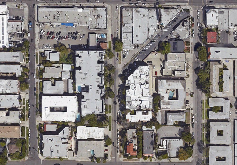
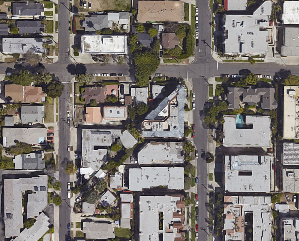
Other times, it actually takes on solidity and mass in the form of oddly skewed, diagonal slashes of houses.
The buildings that fill it look more like scar tissue, bubbling up to cover a void left behind by something else’s absence.
 [Image: Via Google Maps; view larger].
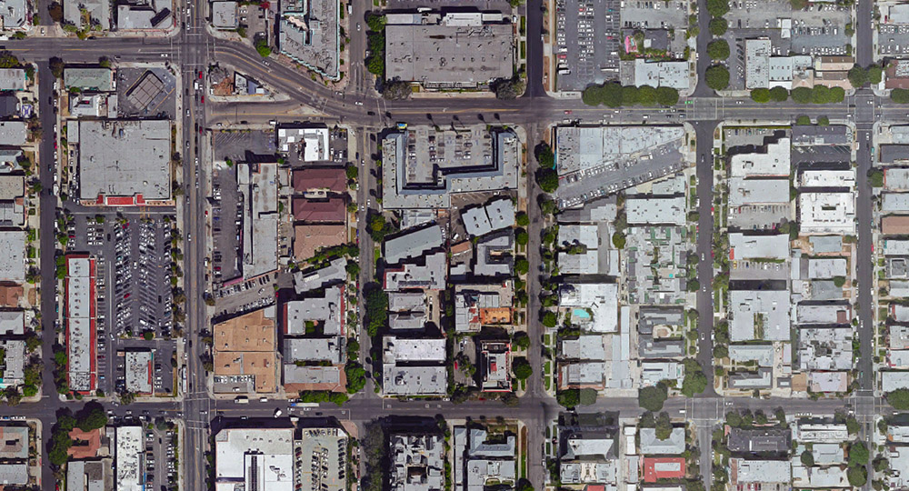
First of all, I love the idea that the buildings seen here take their form from a lost street—that an old throughway since scrubbed from the surface of Los Angeles has reappeared in the form of contemporary architectural space.
That is, someone’s living room is actually shaped the way it is not because of something peculiar to architectural history, but because of a ghost street, or the wall of perhaps your very own bedroom takes its angle from a right of way that, for whatever reason, long ago disappeared.
 [Image: Via Google Maps; view larger].
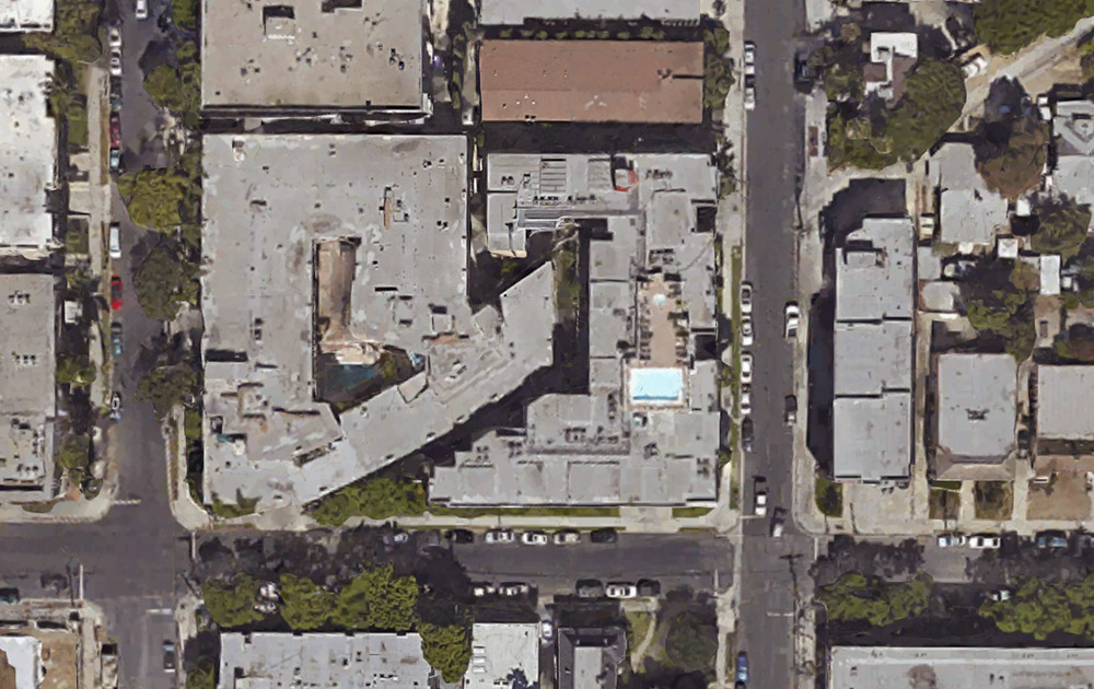
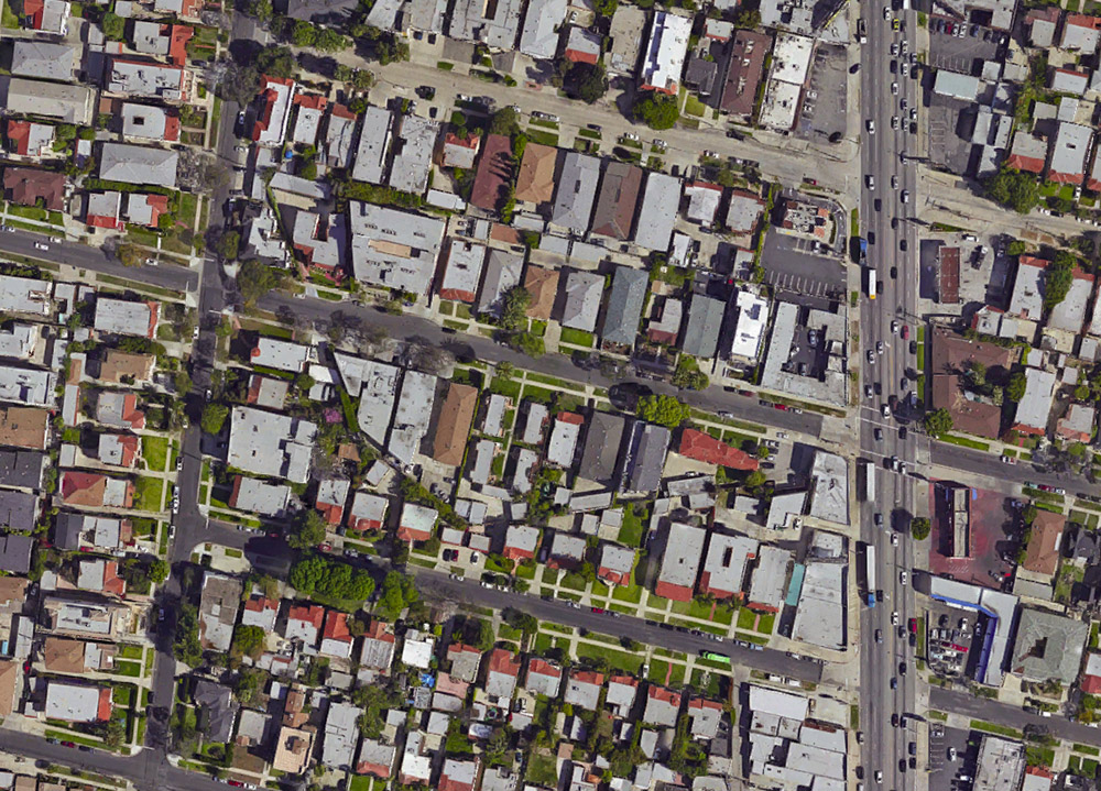
If you follow this thing from roughly the intersection of Hollywood & La Brea to the strangely cleaved back of an apartment building on Ogden Drive—the void left by this lost street, incredibly, now takes the form of a private swimming pool—these buildings seem to plow through the neighborhood like train cars.
Which could also be quite appropriate, as this superficial wound on the skin of the city is most likely a former streetcar route.
But who knows: my own research went no deeper than an abandoned Google search, and I was actually more curious what other people thought this might be or what they’ve experienced here, assuming at least someone in the world reading this post someday might live or work in one of these buildings.
 [Image: Via Google Maps; view larger].
And perhaps this is just the exact same point, repeated, but the notion that every city has these deeper wounds and removals that nonetheless never disappear is just incredible to me. You cut something out—and it becomes a building a generation later. You remove an entire street—and it becomes someone’s living room.
I remember first learning that one of the auditoriums at the Barbican Art Centre in London is shaped the way it is because it was built inside a former WWII bomb crater, and simply reeling at the notion that all of these negative spaces left scattered and invisible around the city could take on architectural form.
Like ghosts appearing out of nowhere—or like China Miéville’s fluttering half-streets, conjured out of the urban injuries we all live within and too easily mistake for property lines and real estate, amidst architectural incisions that someday become swimming pools and parking lots.
*Update* Some further “ghost streets” have popped up in the comments here, and the images are worth posting.
 [Image: Via Google Maps; view larger].
The one seen above, for example, is “another ghost diagonal that begins on 8th St. at Hobart, and ends at Pico and Rimpau,” an anonymous commenter explains.
Another example, seen below—
 [Image: Via Google Maps; view larger].
—is “a block in the Pico-Robertson area,” a commenter writes:
I lived there as a teenager, but never noticed the two diagonals until I looked at it with google maps. There are some lots on the west side of the next two blocks north which also have diagonals. And if you continue north across Pico Blvd, you can see diagonal property lines around St. Mary Magdalene Catholic School and the church.
Thanks for all the tips, and by all means keep them coming, if you are aware of other sites like this, whether in Los Angeles or further afield; and be sure to read through the comments for more.
*Second Update* The examples keep coming. A commenter named Lance Morris explains that he did an MFA project “about this very thing, but in Long Beach. There’s a long diagonal scar running from Long Beach Blvd and Willow all the way down to Belmont Shore. I tried walking as closely to the line as I could and GPS tracked the results. There are even 2 areas where you can still see tracks!”
This inspired me to look around the area a little bit on Google Maps, which led to another place nearby, as seen below.
 [Image: Via Google Maps; view larger].
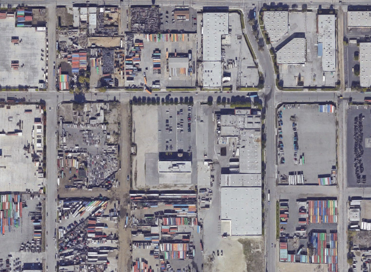
Again, seeing how these local building forms have been generated by the outlines of a missing street or streetcar line is pretty astonishing.
Further, the tiniest indicators of these lost throughways remain visible from above, usually in the form of triangular building cuts or geometrically odd storage yards and parking lots. Because they all align—like some strange industrial ley line—you can deduce that an older piece of transportation infrastructure is now missing.
 [Image: Via Google Maps; view a bit larger].
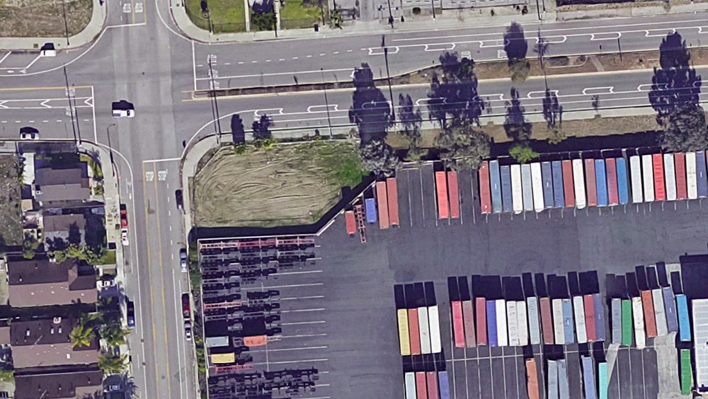
Indeed, if you zoom out from there in the map, you’ll see that the subtle diagonal line cutting across the above image (from the lower left to the upper right) is, in fact, an old rail right of way that leads from the shore further inland.
To give a sense of how incredibly subtle some of these signs can be, the diagonal fence seen in the below screen grab—
 [Image: Via Google Maps; view larger].
—is actually shaped that way not because of some quirk of the local storage lot manager, but because it follows this lost right of way.
*Third Update* There are yet more interesting examples popping up now over in a thread on Metafilter.
There, among other notable comments, someone called univac points out that the streetcar scar that “begins on 8th St. at Hobart, and ends at Pico and Rimpau”—quoting an earlier commenter here on BLDGBLOG—”actually has one echo in the diagonally-stepped building here, and picks up again in the block bounded by Wilton, Westchester, 9th and San Marino, and ends at a crooked building just north of 4th and Olympic.”
 [Image: Via Google Maps; view larger].
You can see the middle stretch of that route in the image, above. For more, check out the thread on Metafilter.
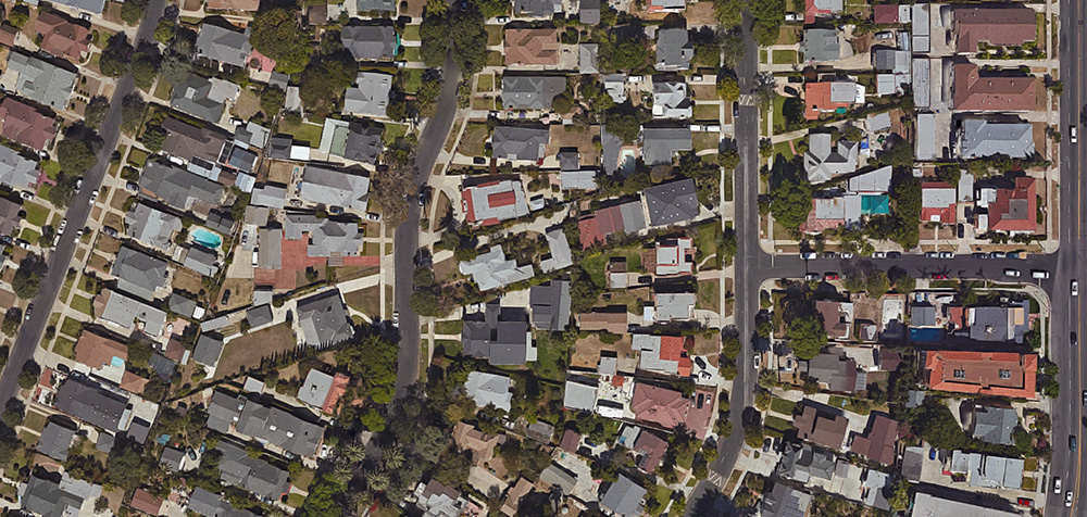
Not only this, however, but the old right of way followed by that commenter actually extends much further than that, all the way southwest to a small park at approximately Pico and Queen Anne Place.
 [Image: Via Google Maps; view larger].
In the above image, you can see a small structure—a garage or a house—turned slightly off-axis in the northeast corner, indicating the line of the old streetcar line, with some open lawns and small paved areas revealing its obscured geometry as you look down to the southwest.
http://onlyinhollywood.org/ever-wondered-theres-triangle-la-brea-end-hollywood-boulevard/
Great post. Here are three from New York, a former street, former rail line and former aqueduct.
That right of way is not actually a ghost street: it used to be the train to Santa Monica. The old Red Car line ran on Hollywood Blvd and then cut diagonally across the street grid to reach Santa Monica Blvd.
This is one in Vancouver, BC. Used to be rail line. There's a former roundhouse, now a community centre, about a kilometer west but I'm not sure if they share a history.
49°16'54.22" N 123°06'14.47" W
You can clearly see this kind of cut in Fremont, CA where a part of the Hetch Hetchy aqueduct passes underground.
My understanding is that they were forced to purchase all of the land above the excavation work, and because of the odd shape it's rather difficult to sell now.
The coolest diagonal street was creating by stagecoaches racing each other from San Pedro to the hotel on 1850's – and on – hotels on Main Street. Former Weller Street – which is now named after a Japanese-American astronaut.
What Anonymous said…
Definitely railroad tracks. The curve gives it away. We have it here in SF as well, through the Mission and Noe Valley, particularly in the park known as Juri Commons. It's actually more evident on the ground because there is a diagonal stripe of midcentury houses among Victorians that were built after the tracks were dismantled. I wonder sometimes what's in some of those back yards . . .
Interesting article about it: http://burritojustice.com/2014/01/22/dolores-st-bridge/
In the late 1970s, I lived in a Hollywood house (later razed for a big apartment building) on North Martel at the corner of Hawthorne. The diagonal ran right next the house, and yes, it was a remnant of the old Pacific Electric railway. There was still a piece of track there. I loved seeing it — having that connection to LA history, and since the house was an older one, imagining earlier residents sitting on the front porch and watching the cars go by.
My immediate reaction is these streets follow old mission boundaries. If that is the case these occurrences happen all over Southern California.
I fellow grad student from my time in the Geography Department at CSU Long Beach did his master's thesis on this topic. His work won the university's thesis of the year. I'm sure the thesis can be looked up online.
Former railway tracks? Would explain the typical curve as well
http://www.uncanny.net/~wetzel/hollytopo.JPG
Here's a map of the PE rail line that traveled southwest on Marshfield Way starting at Hollywood & La Brea.
The art historian Joseph Connors has done an analysis of several streets in Rome that describes similarly ghostly (and legally-derived) reasons for why buildings are shaped the way they are, why some jut out over the sidewalk and others are set back, etc.
Yes! I used to live in Hayes Valley, San Francisco near the end of the old Central Freeway. They are just now building apartments in the diagonal gap left by the freeway: https://goo.gl/maps/DrbjSCNT5X42
Also, I learned today about Amon Carter/Greater Southwest Airport in Dallas/Fort Worth, TX where the runway was turned in to a road. You can still see the imprints from the taxiways and terminal roads 40 years after it closed: https://goo.gl/maps/wEU9XxBfui82
totally.
When I lived nearby, I was in love with this old car route.
anonymous is right…the Sanborn Fire Insurance atlas volume 10 for LA done in 1919 shows it as Pacific Electric right of way on sheets 1042, 1043, 1044
Here's a block in the Pico-Robertson area. I lived there as a teenager, but never noticed the two diagonals until I looked at it with google maps. There are some lots on the west side of the next two blocks north which also have diagonals. And if you continue north across Pico Blvd, you can see diagonal property lines around St. Mary Magdalene Catholic School and the church.
That's not a street, it's a train.
I used to swim in that triangular pool on Ogden. Since then, discover the origins of this line has been a treat.
I live there now, this is an old ticket window looking out on the pool as I write this.
Those vanishing streets in London reminded me of the premise of this season's Doctor Who episode "Face the Raven," in which an invisible "trap" street harbored a bunch of E.T. refugees…
No great mystery. 🙂 Former railway tracks. we used to rent one of the offices along it.
It was a rail line:
http://onlyinhollywood.org/wp-content/uploads/2014/06/Marshfield-Map.jpg
Thanks for all the comments (and for the links to other examples, in particular).
Stanley, those New York examples are fantastic; I'll have to visit those in person someday.
Leo, I'll have to look out for the Joseph Connors study you mention—sounds fascinating.
Meanwhile, any other dead streets, abandoned rail lines, former Mission boundaries, etc., becoming houses or city buildings later—whether they're in LA, SF, London, Vancouver, or NYC—keep them coming! These are amazing to see.
me too.
Exactly correct! I used to live off Genesee Ave between Santa Monica and Fountain. The line ran right by the house. The following link is a blog about the old subway system, but has a map of the street car routes. http://www.awalkerinla.com/2012/05/11/las-original-subway/
And, Brian Sims, I'm pretty certain your friend's study was on rancho boundaries and not mission boundaries. Mission boundaries were broken up much earlier and there were only two in LA County while there were many, many more ranchos.
My mother, who I just lost a few months ago, used to talk with great affection about the Red Car. When she first came to the United States as a young bride in the late 40's, she could take it from her home in Inglewood to downtown LA. I wish it had still been around when I was a child.
I live in and work for the city of Lancaster Pennsylvania has a land surveyor. Lancaster is the oldest inland city in America. The old right of way of the Pennsylvania Railroad main line cuts through town in a dipping sweeping curve and is definitely visible in aerials. But this occurs even in the country. You can often pick up old railroad lines that are abandoned by looking at the contour lines on USGS topographic quadrangle maps. The contours are impacted by the old road beds. Part of my job is to track down old sewer lines which were actually streams that were piped and now run diagonally across blocks and under buildings without any record of their location. I need to formalize the city's rights to enter and maintain them. We also have old tunnels that were built secretly during Prohibition for the transport of beer. Learn to read the land it's fascinating. Bruce Hall, PLS
Here's the general vicinity in 1948 — you can pretty clearly see that it's the Red Car right of way.
And there's another ghost diagonal that begins on 8th st. at Hobart, and ends at Pico and Rimpau. Most likely an early street car or Train right of way.
theres a bunch of additional info in the comments of facebook posts linking this article (pictures, links, discussion) — link, link
It's the old Hollywood Pacific Electric line.
I was going to suggest that this looks like a rail route. We had one in Santee, California in eastern San Diego and there's one here in Riverton, Wyoming. Diagonals are quite commonly old railway lines and when the trains stopped running cities just did whatever because there often wasn't a whole lot of room with just the rails and the right of way. Riverton turned the land into a citywide bike and walking path and park.
Possibly a former (or buried) drainage ditch? There's one near my house in Pasadena, and I've seen a few others when I use Google Maps satellite view.
There is another one of these in Old Town Pasadena. And, Burbank has the remains of an airport, at Grand Central Ave.
I did my MFA project at CSULB 2 years ago about this very thing, but in Long Beach. There's a long diagonal scar running from Long Beach Blvd and Willow all the way down to Belmont Shore. I tried walking as closely to the line as I could and GPS tracked the results. There are even 2 areas where you can still see tracks!
Many of the "ghost streets" throughout Los Angeles were created by the Pacific Electric trolley lines, some of which were considered for the new Metro light rail system. Most of the boulevards Los Angeles has, in fact, are not from the hand of some Baron Haussmann, but are left over from rail lines no longer in use.
One great source might be what are called "Sanborn maps" done by insurance companies from the 1800s through about the 1940s.
Not usually available online but perhaps available in libraries, they give snapshots of many older areas showing what buildings were used for.
Here in Modesto, CA the Hetch Hetchy has a bike trail on top of it nowadays
Further south you'll clearly see an old train right-of-way that extends thru OC, from NW to SE.
It was the right-of-way for a subway line that never got built. The Pacific Electric Railway owned the property but never dug the sunken trench for the tracks. After the streetcar system was dismantled, the property was subdivided and sold.
As others have pointed out these are all ex-railroad tracks.
I wish this documentary was available for streaming somewhere but if you're into this stuff it an amazing documentary and I can highly recommend it.
It has some bonus materials as well including going around with a P.E. history buff as he points out some of these places.
I have been born bred and raised here I know just about all of the streets/train tracks,trolley lines- & I am 43 and before the city tore them up they were every where ~ now as ghost streets so fellow native LA Gen X'ers you in 1980's how many high steel heeled zip up boots did you get stuck in a track ?
As mention above, for Vancouver, Canada: the first Google map link shows a ghost running diagonally southwest to northeast near downtown, being part of the original rail corridor, now alley- and walk-ways, sometimes gated off for condo communities but, as I understand it, required to remain as an un-building thoroughfare. The second, running diagonally southeast to northwest, is probably an offshoot of the still-existing but unused Arbutus Rail Cooridor, (terminating at the still-existing military base in one of the city's most desirable neighbourhoods, Kitsilano — link, link
Actually if you look at th Sr 30 now the 210 from highland to Redlands that was an old people line and heading up from there electric Blvd was also a old PE row
The Fosse Way in England is an old Roman road, which is (in parts) still followed by modern roads, but in others is only revealed by land and building boundaries.
https://en.wikipedia.org/wiki/Fosse_Way
OK, we've just found Diagon Alley! Now all we need to find is Platform 9 3/4ths, and we can get to Hogwarts!
The Long Beach diagonal is the old Red Car tracks. It then went through Seal Beach [where it's now the park through Old Town along Electric Ave.], then along PCH in Huntington Beach, and eventually along the Newport Penninsula to the Balboa Pavilion.
This is how I find old rail, trolley and traction lines in southern Ohio. Land boundaries tend to stay the same over the years because it is costly to change. You'll need a surveyor and lawyer to make the changes. I thought I was the only one who noticed this.
There are a few in SF to more related to former train right-of-ways. See the Juri Commons in the Mission for example. The scar tissue continues beyond the remnants where the park stands: link
Most of those "ghost streets" as you put it are where the old Red Line trolleys ran back in the day. They use to run all over Southern California in LA and Orange Counties, so you will see them all over So Cal in older neighborhoods. Some time in the 1950's they started to get rid of them, by the early 1960's they were all gone.
Here is rural western/central ny. Yes I said rural — the Finger Lakes region; farm roads and heavily traveled stage coach lines sometimes are altered. Here is a location here just west of the City of Geneva at the North end of Seneca Lake. One challenge to spotting these here in rural areas; Sanborn maps do not often provide any coverage. I happen to have a map from the City historian from 1909. It shows a road that runs diagonal from NE to SW. The only remnant of it is the hedgerow at the corner of the parking lot south of the building. I bet no one know why the hedgerow runs that direction at all. https://goo.gl/maps/gqes9cW1Ms72
Another one: This is on the Hoabrt and William Smith campus. It is a bit harder to spot, but it is now a small driveway at on the east side of the map. It was a short road that ran next to the church and due west to the street. https://goo.gl/maps/wXpWaLGGD6t
I found it on an old USGS quad – here: http://arcg.is/1TZEAxO
Great post!!! So cool.
Part of the charm of old European cities was determined by the earlier paths that turned into permanent streets. But instead of hiding these wonderful form givers they often used them to great special places that form open areas for so called village pumps. We could learn much from these opportunities and create special places that are unique to a community through parks, plazas and other open spaces at the intersection of the old and new grids. A minor example is the eastern entry to Beverly Hills where Burton way becomes little Santa Monica Blvd. this subtle bend straightening out into the grid of the city creates a subtle portal to the city just as the intersection of Wilshire and Santa Monica does at the western end.
A similar built up scar also exists in the city centre of Hobart, Tasmania (Australia). It was the original rivulet that flowed from the Mount Wellington range behind the city down to the Derwent River, with the city settled at the point where the rivulet met the river. Over time the rivulet was converted from a natural to a man made structure, first with bricks and then concrete, whilst the city continued to develop around it. Eventually the bridges across the rivulet were extended and the rivulet was covered over almost completely. Most of these covered spaces have been converted into arcades that create a unique, covered pedestrian network that winds through the city, which is ideal for the southern city that receives chilly southerly breezes from the Antarctic region. You can still see into the rivulet at key points within the city, which is full of amazing graffiti from artists all around the world that seek it out; plus weird shrines and vaulted brick tunnel offshoots constructed by convicts who made the bricks by hand. You can also get down into the rivulet and wander the length of the city completely underground- but it is still a rivulet often flash floods in the hours after rain on the mountain. A quick google search of 'Hobart rivulet' will show some of the interior shots and looking at the Hobart CBD on Google Earth will show the scar that cuts across the city: link
The long right of way that is seen at 8th St. at Hobart and also at Wilton, Westchester, 9th and San Marino was part of a planned subway route:
http://users.snowcrest.net/marnells/vineyardsub.htm
Interesting information is found if you search "vineyard subway" in the l.a. times archive. From what I can gather, the right of way was purchased as far back as 1907, talks of completing the subway made the news in 1913, 1917 and the early 20's, and then die down. There is mention of the sale of some of the right of way by the 1930s so by then the idea had been abandoned.
You'll find a lot of these "ghost streets" all over Los Angeles, Orange, and San Bernardino Counties. Many were old Pacific Electric Routes. Most were passenger, but some were also used for freight traffic, so they survived into the 1970's and 1980's under Southern Pacific. Many buildings were rail served. The ones with the odd shapes were built while the right-of-way was still in use or hadn't been officially abandoned (a sometimes-complicated process). After abandonment, many became streets or service alleys. Some became lot expansions or parcels themselves.
Some evidence still survives in Downtown Los Angeles along the east and west sides of Alameda Blvd. between the 10 an 101 freeways as there were a lot of rail-served industries there. Also, the 101 Freeway near LA Union Passenger Terminal (aka Union Station) was originally the Aliso Street Viaduct carrying the PE tracks that headed out the Ramona Expressway (San Bernardino Freeway).
"Rut nuts" are people who search for ancient roads passageways. Good article about the Oregon Trail here by Ian Frazier.
There is a section of the Red Line that went to the orange groves in Monrovia, Duarte and Bradbury in the San Gabriel Valley. Here are the google map coordinates in satellite view. You can see the swooping road to the left (just south of the park) and then it continues east (see houses all in a row) and into the Duarte recreational trail. Some of the bridges that were over the Red Line still span the depression that's where the recreational trail now is.
Another great source to find abandoned Right Of Ways are old topographic maps, available at the USGS website for Free.
In my neighborhood in Brooklyn, there is only a vestigial remnant of a colonial-era road called Red Hook Lane, which used to run diagonally from downtown to the waterfront in Red Hook. If you look at the upper right of this view, then down a couple of blocks there are some property lines that still conform: https://www.google.com/maps/@40.6900443,-73.9901672,307m/data=!3m1!1e3
I also sketched it up to make it clearer: http://imgur.com/7DgjE72
Chicago has its traces of Ogden Avenue in Old Town – see link
There’s not too many in Winnipeg, a lot of our rail and large roads came in at the same time as the buildings were going up, so there’s not much change. I did , however, find this neat one – http://madfishmonger.tumblr.com/post/137110257528/after-reading-this-fascinating-article-about
Thanks for sharing this, it’s fascinating.
Love these images of a city’s historical thoroughfares. It seems architects have remained sensitive to these over time. I’ve always enjoyed walking home past the Atlas Stair Building at 22nd and Harrison in San Francisco, where the old railroad right of way can be clearly interpreted by the funky curvature of the building. This old railroad corridor cuts diagonally through the square blocks of the Mission district, and feels long lost but can be seen from Google Earth.
http://foundsf.org/index.php?title=Harrison_Street_Industrial_Corridor
Here’s a little bit different phenomenon in Jacksonville Beach, not due to old train routes, but I would guess due to development that predates the current street grid system. These six blocks are rotated about 10 degrees relative to the rest of the streets, which run parallel and perpendicular to the beach. I’d love to know the background.
https://www.google.com/maps/@30.2803527,-81.3944249,837m/data=!3m1!1e3
When I was a kid growing up in Long Beach, CA the Pacific Electric from LA would use much of what the Metro Red Line uses and coming out onto Long Beach Blvd. at Willow St. to the line(s) going up and down Ocean Ave. As I recall one line went along Ocean Ave thru Belmont Shore and down thru Seal Beal and Huntington Beach many years ago.
I read through all the comments and, yes, it is noted this article references the Pacific Electric Red Car line that ran from Hollywood and La Brea diagonally through West Hollywood until it reached Santa Monica Blvd. at Fairfax, and several have linked the map of this route.
I am linking a post from the website Noirish Los Angeles, that gives you a photographic tour of this route from that Hollywood/La Brea starting point through to Beverly Hills. It uses actual photographs taken when the line was active as they traverse this P.E. route.
http://forum.skyscraperpage.com/showpost.php?p=5743682&postcount=8350
Great post! Something I’ve also been interested in since studying urbanism at USC. I currently live in Koreatown and there are plenty of skinny diagonal properties like that. I always suspected most were old rail car rights-of-way.
You’re probably already familiar with it, but if not ZIMAS is a great resource for finding ‘ghost streets’ and other vestigial planning anomalies (http://zimas.lacity.org/). You can turn the layers on and off to get just the property boundaries, and they will pop out clear as day. Santa Monica, Beverly Hills and other cities have their own GIS websites that you can use in a similar way.
I live in the cut down building with the triangle shaped pool in the 5th photo. This answers so many questions I’ve had walking around this block.
One in the Valley!
https://www.kcet.org/history-society/phantom-fast-lanes-whitnall-highway-and-the-footprint-of-best-laid-plans