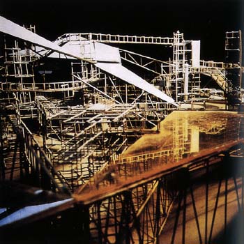
 [Image: The Maunsell Sea Forts, photographed by Pete Speller, courtesy of Nick Sowers].
I missed an amazing opportunity the other week to visit the Maunsell Towers – aka the Maunsell Sea Forts – with Nick Sowers, author of an excellent Archinect school blog and one of my students from this summer’s studio down on Cockatoo Island in Sydney.
For the last year or so, Nick has been traveling around the world on a much-deserved John K. Branner Fellowship, documenting army bases, abandoned bunkers, and other sites of historical military interest. From South Korea to the Maginot Line, from classical war zones and medieval walled cities to “bunker recycling services” and D-Day, Nick’s itinerary is breath-taking. It is also, I hope, intriguing enough to catch the eye of future publishers or gallerists who might want to give Nick the space in which to break down all that he’s seen; there are very many of us who would love to learn more.
Of course, we could also hear more about his trip: Nick is acoustically-inclined, and he has been documenting the sounds of these militarized landscapes over on another blog he runs, called Soundscrapers.
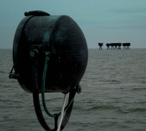
 [Images: Photos by Nick Sowers].
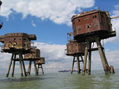
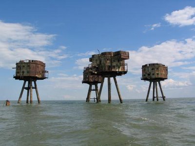
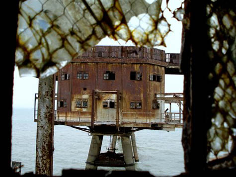
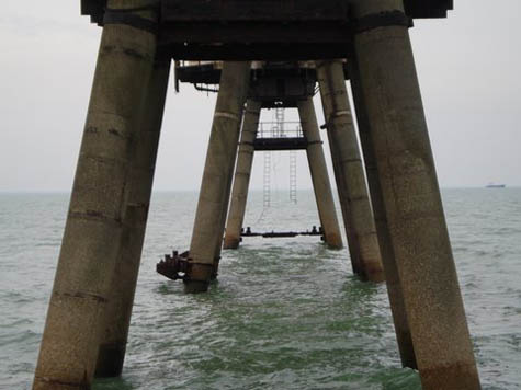
So Nick and his wife were in England the other week, and we unfortunately missed meeting up – but they managed to take a boat tour out to the Maunsell Sea Forts, iconic architectural structures in the Thames Estuary, inspirations for Archigram, and one of the few real-life buildings (if you can call them that) that gave me the idea to start BLDGBLOG. In fact, I’ve mentioned these places in lectures and I’ve posted about them on the blog before – but I’ve never had a chance to visit.
Nick’s photos, presented here, alongside photos by Pete Speller, will tell the story instead.
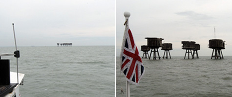
 [Images: Photos by Nick Sowers].
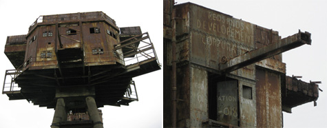
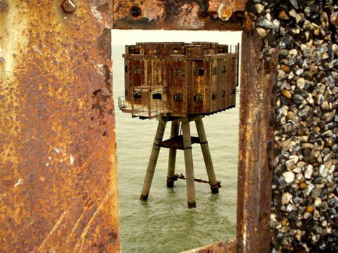
As Underground Kent explains, “The Thames Estuary Army Forts were constructed in 1942 to a design by Guy Maunsell.”
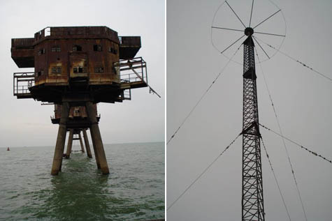
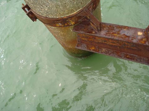
Their purpose was to provide anti-aircraft fire within the Thames Estuary area. Each fort consisted of a group of seven towers with a walkway connecting them all to the central control tower. The fort, when viewed as a whole, comprised one Bofors tower, a control tower, four gun towers and a searchlight tower. They were arranged in a very specific way, with the control tower at the centre, the Bofors and gun towers arranged in a semi-circular fashion around it and the searchlight tower positioned further away, but still linked directly to the control tower via a walkway. All the forts followed this plan and, in order of grounding, were called the Nore Army Fort, the Red Sands Army Fort and finally the Shivering Sands Army Fort. All three forts were in place by late 1943, but Nore is no longer standing. Construction of the towers was relatively quick, and they were easily floated out to sea and grounded in water no more than 30m (100ft) deep.
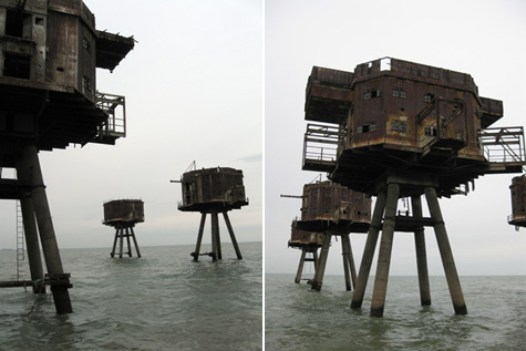
They thus entered into the imaginations of speculative architects everywhere; they helped give visual shape to Archigram’s Walking City; and they continue to offer a kind of real-life spatial analogue for Constant’s New Babylon for anyone with access to a boat.
 [Image: The Maunsell Sea Forts, photographed by Pete Speller, courtesy of Nick Sowers].
Nick explained in an email that he visited the structures with Tony Pine, a “sound engineer” – i.e. pirate radio operator – who spent the afternoon “telling stories of the days in the 60s when Archigram came out to visit the structures, and also about incredibly cold winters when they burned the wood-fibre linings of the tower interiors to stay warm.”
Also along for the ride was Robin Adcroft, director of Project Redsand, who “describes himself as the caretaker of the structures.” Adcroft points out the genealogical importance of these structures:
The Thames Sea Forts are the last in a long history of British Marine Defences. The Army Anti Aircraft forts have played a significant role in post World War 2 developments. Notably in offshore fuel exploration and drilling platforms. The successful rapid deployment of the Maunsell Forts soon after led to the construction of the first offshore oil platform in the Gulf of Mexico in the late 1940s.
Both conceptually and materially, the Maunsell Towers have an architectural legacy that seems oddly under-explored.
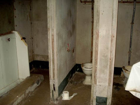

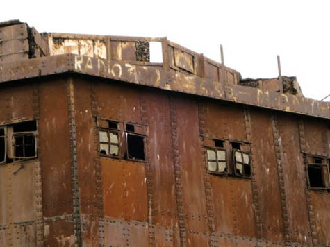
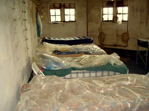 [Images: Inside the forts; photos by Pete Speller, courtesy of Nick Sowers].
But “it’s interesting,” Nick adds: “no one actually owns these things.”
Apparently the transport authority wanted to give Project Redsand a deed but they declined it, not wanting the liability. A ship crashed into Shivering Sand (an outpost which is visible from Redsand) in the 60s, taking out one of the towers and killing two maintenance personnel. Red Sand is not actually in the shipping lane, but it is very much a hazard. The original 1/4 inch plate steel is rusting through to a paper thickness. We had to wear hardhats when the boat pulled in next to the structures.
Project Redsand has more information about efforts to preserve the forts – and they link to this short YouTube video in which you can see how these clustered towers might be stabilized and maintained for generations to come.

 [Images: Photos by Pete Speller, courtesy of Nick Sowers].
Meanwhile, be sure to follow Nick Sowers’s slowly-ending travels around the militarized world on his Archinect blog – and he can also be found on Twitter.
 [Image: Saltair, photographed ca. 1901, courtesy of the Library of Congress].
 [Image: Via Google Maps].
 [Image: Global map of “optimal intermediate locations between trading centers,” based on the earth’s geometry and the speed of light, by
 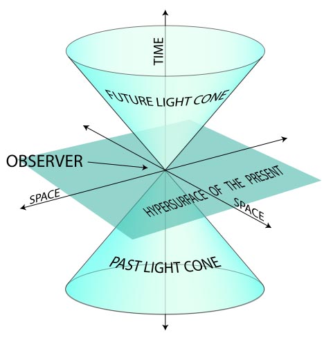 [Image: Diagrammatic explanation of a “light cone,” courtesy of
  [Image: An otherwise unrelated image from NOAA featuring a geodetic