Archive Fever

[Image: Photo by James DiLoreto/Smithsonian Institution, via the New York Times].

There was an interesting article in The Atlantic several months ago, written by Ed Yong, about the remains of as-yet undiscovered new species hiding away in the collections of natural history museums.

Fish2[Image: Behind the scenes of the American Museum of Natural History, New York; Instagram by BLDGBLOG].

Those species are, Yong suggests, just some of “the many secrets that are still locked within their drawers and dioramas,” secrets that will only be revealed and studied if we increase our attention on museum archives and stockrooms not as known quantities, but as potential resources of the altogether new and undocumented.

[Image: Amongst the fish of the American Museum of Natural History, New York; Instagram by BLDGBLOG].

I was reminded of this by a short piece in the New York Times last week, about the skull of “a previously unknown species of extinct dolphin” found “sitting in a drawer at the Smithsonian Museum of Natural History.” It is from a descendent of a South Asian river dolphin, and was found in Alaska in 1951.

“One of the great things about the Smithsonian,” researcher Alexandra T. Boersma explained to the New York Times, as if taking a cue from Yong’s article, “is that the collections are so vast. We were just walking around to see if anything was interesting. And then, wow!”

[Image: Piscine preservation at the American Museum of Natural History, New York; Instagram by BLDGBLOG].

Briefly, recall the instigating event in A.S. Byatt’s novel Possession. There, a researcher uncovers previously unknown letters written by a Victorian poet, folded up and stashed inside a book that “had been undisturbed for a very long time,” we read, “perhaps even since it had been laid to rest.”

Never before published—perhaps never before read by anyone other than their original author—these handwritten notes set off a long sequence of investigations and discoveries and, in the novel’s fictional world, help to partially rewrite British literary history.

Byatt’s archival fantasy—of unknown but magnificent things lying hidden in museums and libraries, in the very places that promised tidiness and knowledge, coherence and totality—is at least equally stimulating when applied to collections of all sorts, from Yong’s and Boersma’s natural history cabinets stuffed full of potential new species, even evidence of forgotten ecosystems, to collections of minerals, antiquities, architectural fragments, or street photographs.

Just one insufficiently described historic artifact, one misattributed drawing, one unpolished gemstone accidentally dropped into the wrong drawer, and off you go, struck by the fever of weaving the threads of the world back together again, one loose detail forcing the entire structure of everything you know to rearrange.

Urban Under

[Image: Photo by Bradley Garrett].

I’m honored to have written a preface for the new book Global Undergrounds: Exploring Cities Within, edited by Paul Dobraszczyk, Carlos López Galviz, and Bradley Garrett.

The authors document more than eighty subterranean sites, on every continent, from a nuclear bunker outside London to a secret military city buried in the ice. It is organized into thirteen chapters, by themes including “Security,” “Dwelling,” “Refuse,” and “Futures.”

[Image: Photo by Bradley Garrett].

The book is motivated by an intense desire to see: to reveal the underground circuits of utility tunnels, sanitation services, transportation networks, and everyday labor that writhe beneath the surface of the urban world. By doing so, it hopes “to foreground the connections between space and politics that converge underground.”

The editors’ collective goal was obviously more than just adventure tourism, or to produce a new gonzo collection of picturesque photographs. Rather, it was to experience these spaces firsthand whenever possible through direct exploration, whether that meant hiking down into the galleries of abandoned mines or sneaking through the tunnels of an underground prison.

[Image: Photo by Bradley Garrett].

Readers already familiar with Garrett’s work, both academic and journalistic, will know, of course, that for him infiltrating sites of public infrastructure is something of an oxymoron, given their nominal status as public space.

Nonetheless, it is often only through surreptitious means that we can truly analyze these labyrinthine systems that we have been funding all along and, today, remain so vulnerably reliant upon.

The book suggests that the peripheries of the built environment—these underspaces tucked away from view—are much more central than their physical position might suggest, and that putting them into an enlarged historical and political context is vital for understanding them.

If that sounds of interest, consider picking up a copy.

Plasma Bombs and Sky Bridges

[Image: Via NOAA].

The U.S. Department of Defense has awarded a handful of small business grants for exploring the “controlled enhancement of the ionosphere.” The aim of the grants is to find new ways “to improve radio communication over long distances”—and one of these ways might be “detonating plasma bombs in the upper atmosphere using a fleet of micro satellites,” or cubesats, New Scientist reports.

As the initiating government contract describes it, in order to perform this new atmospheric role, the cubesats—or an equally viable competitor technology—will need to produce “highly exothermic condensed phase reactions yielding temperatures considerably higher than the boiling points of candidate metal elements with residual energy to maximize their vapor yield… Such hardware will provide for controlled release options such as conventional point release, as well as extended in time and space.”

They would be, in effect, small plasma ovens—the metaphoric “bombs” of the New Scientist article.

The resulting “vapor yield” from metallic elements boiling in space would then chemically interact with the Earth’s atmosphere to create the aforementioned plasma. While spreading locally through the ionosphere, the plasma would, in turn, generate small patches of electromagnetic reflectivity across which radio signals could be bounced or relayed.

By ricocheting along this sky bridge of temporary plasma patches—like tiny chemical mirrors in space—radio signals would be able to travel far beyond the curvature of the Earth, greatly increasing the distance and accuracy of specific transmissions.

This long-range transformation of the sky itself into a transmitting medium recalls the work of radio historian Douglas Kahn. Kahn’s book Earth Sound Earth Signal specifically looks at the role of terrestrial and atmospheric dynamics on radio transmission, including the deliberate incorporation of those seemingly unwanted side-effects—such as interference from sunspot activity—into electronic art projects.

Kahn’s work came up on BLDGBLOG several years ago, for example, in discussing a proposal from the 1960s for transforming an entire Antarctic island into a radio-transmitting apparatus. The topographic profile and geologic make-up of the island made it a great potential resonator, according to researcher Millett G. Morgan.

[Image: [Image: Deception Island, from Millett G. Morgan’s September 1960 paper An Island as a Natural Very-Low-Frequency Transmitting Antenna].

By taking advantage of these physical factors—and even subtly tweaking them in what we could also call “controlled enhancement”—the island would become part of a dispersed global infrastructure of electromagnetic relay points.

It’s worth mentioning that this would also make a fascinating landscape design project: sculpting a patch of terrain, from its exposed landforms and its subsurface mineralogy to the flora planted there, such as tree-antennas, so that the whole thing becomes a kind of radio-transmitting garden.

In any case, these tactical archipelagoes of plasma dispersed across the ionosphere by military cubesats would enable emergency wartime radio contact around the planet. By introducing patches of reflectivity, they would create a temporary extension of ground-based antenna infrastructure, stretching from one side of the Earth to another, an invisible bridge in the sky put to use for planet-wide communication.

Read the original contracting information over at the Small Business Innovation Research hub.

Briefly, it’s interesting to note another piece of recent tech news. Back in April, Swati Khandelwal reported that “a team of researchers from the University of Washington’s Sensor Lab and the Delft University of Technology has developed a new gadget that doesn’t need a battery or any external power source to keep it powered; rather it works on radio waves.”

She was referring to a device called WISP, “a small, battery-less computer that works on harvested radio waves,” in the words of project researcher Przemyslaw Pawelczak.*

[Image: Przemyslaw Pawelczak’s “small, battery-less computer that works on harvested radio waves”].

This is relevant for the possibility that this sort of thing could be scaled up to much larger pieces of equipment, such as uncrewed ground vehicles or other autonomous machines (including rovers on other planets); those devices could then be deployed in the field and simply wait there, essentially hidden in a powerless state.

You could then turn on these otherwise dormant computers, even from a great distance, using only pinpointed radio transmissions assisted on their way around the planet by localized plasma clouds; like electromagnetic Frankensteins, these sleeper-systems could thus be brought back to life by this strange, military wizardry of otherwise impossible radio transmissions.

Patches of plasma appear in the sky—and machines around the world begin to awaken.

[Note: When using the appropriate Polish lettering, Przemysław Pawełczak’s name renders oddly with this blog’s typeface; it is thus deliberately misspelled in the text, above; apologies to Pawełczak. Thanks to Wayne Chambliss for his thoughts on sleeper systems while I was writing this post. Very vaguely related: Operation Deep Sleep: or, dormant robots at the bottom of the sea].

“Today’s world has no equivalent”

[Image: Tromsø, Norway; photo by BLDGBLOG].

Ted Nield’s book Supercontinent: Ten Billion Years in the Life of Our Planet—previously discussed back in 2012—is an exercise in what has long been referred to here as landscape futures.

In Nield’s case, this means literally imagining what the surface of the Earth might look like after hundreds of millions of years’ worth of tectonic transformations have deformed it beyond all recognition. Supercontinent could thus be read alongside Jan Zalasiewiez’s The Earth After Us as a useful guide for thinking about radical landscape change on a truly inhuman timescale.

Nield writes, for example, that, “even if some civilization of 200 million years ago had completely covered [the Earth] in cities and then wiped itself out in some gigantic global nuclear holocaust, nothing—not even the faintest trace of some unnatural radioisotope—would now remain on the surface.” Some of us might think that writing books, for example, is a way to achieve immortality—or winning an Oscar or becoming a national leader—yet covering the entire planet with roads and buildings is still not enough to guarantee a place in any sort of collective future memory. Everything will be erased.

The book goes from a speculative, but apparently realistic, scenario in which subduction zones might open in the Caribbean—thus dragging North America back toward a seemingly inexorable collision with Eurasia—to the future implications of past tectonic activity. Supercontinents have come and gone, Nield reminds us, and the cycle of these mega-islands is “the grandest of all the patterns in nature.” “750 million years before Pangaea formed,” he writes, “yet another [supercontinent] broke up; and before that another, and so on and on, back into the almost indecipherable past.”

At one point, Nield asks, “what of older supercontinents? What of the supercontinent that broke up to give us Pangaea? And the one before that? Compared with Pangaea, those lost worlds seem truly lost. As with all geological evidence, the older it is, the less of it survives, the more mangled it has become and the harder it is to interpret.”

It is all but impossible to picture them—to see oneself standing on them—as you can with Pangaea. They have their magical names, which lend them reality of a sort despite the fact that, for some, even their very existence remains controversial. About Rodinia, Pannotia, Columbia, Atlantica, Nena, Arctica or distant Ur, the mists of time gather ever more thickly.

The amazing thing is that this cycle will continue: long after North America is expected to reunite with Eurasia, which itself will have collided with North Africa, there will be yet another splintering, following more rifts, more bays and inland seas, in ever-more complicated rearrangements of the Earth’s surface, breeding mountain ranges and exotic island chains. And so on and so on, for billions of years. Bizarre new animals will evolve and bacteria will continue to inter-speciate—and humans will long since have disappeared from the world, unable to experience or see any of these future transformations.

While describing some of the potential ecosystems and landscapes that might result from these tectonic shifts, Nield writes that “our knowledge of what is normal behavior for the Earth is extremely limited.”

Indeed, he suggests, the present is not a key to the past: geologists have found “that there were things in the deepest places of Earth history for the unlocking of whose secrets the present no longer provided the key.” These are known as “no-analog” landscapes.

That is, what we’re experiencing right now on Earth potentially bears little or no resemblance to the planet’s deep past or far future. The Earth itself has been, and will be again, unearthly.

[Image: Oulanka National Park, Finland; photo by Peter Essick, courtesy of the University of Missouri].

In any case, I mention all this because of a quick description found roughly two-fifths of the way through Nield’s book where he discusses lost ecosystems—landscapes that once existed here but that no longer have the conditions to survive.

Those included strange forests that, because of the inclination of the Earth’s axis, grew in almost permanent darkness at the south pole. “These forests of the polar night,” Nield explains, describing an ancient landscape in the present tense, “withstand two seasons: one of feeble light and one of unremitting dark. Today’s world has no equivalent of this eerie ecosystem. Their growth rings show that each summer these trees grow frenetically. Those nearer the coast are lashed by megamonsoon rains roaring in from [the lost continent] of Tethys, the thick cloud further weakening the feeble sunshine raking the latitudes at the bottom of the world.”

There is something so incredibly haunting in this image, of thick forests growing at the bottom of the world in a state of “unremitting” darkness, often lit only by the frozen light of stars, swaying now and again with hurricane-force winds that have blown in from an island-continent that, today, no longer exists.

Whatever “novel climates” and unimaginable geographies lie ahead for the Earth, it will be a shame not to see them.

(Related: Ghosts of Planets Past: An Interview with Ron Blakey).

Shrink-Wrapped Superloads and Monumental Processions

rock[Image: Michael Heizer’s rock; Instagram by BLDGBLOG].

A long time ago, in a city far, far away, I audited a class about Archigram taught by Annette Fierro at the University of Pennsylvania.

One of many things I remember from the class was a description of how the Centre Pompidou, a building designed by Richard Rogers and Renzo Piano, was constructed.

Apparently, in order for the building to be assembled, huge pieces of structure had to be rolled through the streets in the middle of the night, long after traffic had died down and after almost everyone had gone to sleep.

Whole boulevards and intersections were closed to make way for the passage of these massive objects, as if the ribs and thigh bones of some colossal creature were being painstakingly assembled in a distant neighborhood, in the dark. The building began as a distributed network of large, chaperoned objects.

You can imagine Parisian insomniacs of the late 1970s, wandering the streets before—lo!—these oversized, monumental spans moving at a crawl through the city would come into view. It would have been as if Paris itself had somehow been caught dreaming new buildings into existence at 2am.

The Space Shuttle in front of a doughnut shop; photo by Pulitzer Prize-winning photographer Don Bartletti, courtesy Los Angeles Times].

This same sort of awe at the mis-fit between an object’s size and its urban context arose a few years ago when a somewhat underwhelming art project by Michael Heizer was hauled, street by street, to LACMA; and it then happened again when the Space Shuttle made its slow way through Los Angeles back in October 2012.

I remember talking to architecture critic Christopher Hawthorne around that time, and he compared the Shuttle’s 2mph roll through the city to a Roman Triumph, as if Angelenos were celebrating an imperial event of extra-planetary importance, this grand object—this throne room—being paraded out in public for all to see.

It’s worth recalling how Cambridge classicist Mary Beard described the Triumph in an old interview with BLDGBLOG. “Here you’ve got the most fantastic parade ever of Roman wealth and imperialism,” she explained:

The Romans score disgustingly big victories, massacring thousands, and they come and celebrate it in the center of the city, bringing the prisoners and the spoils and the riches and all the rest. At one level, this is a jingoistic, militaristic display that would warm the heart of every European dictator ever after—but, at the same time, scratch the surface of that. Look at how the Romans talked about it. That very ceremony is also the ceremony in which you see the Romans debating and worrying about what glory is, what victory is. Who, really, has won? It’s a ceremony that provides Rome with a way of thinking about itself. It exposes all kinds of Roman intellectual anxieties.

Moving the Space Shuttle—or, for that matter, Heizer’s rock—gave not just Los Angeles but the entire United States an unexpected “way of thinking about itself,” in Beard’s terms, not just of the city’s historical relationship with the U.S. space program but of the country’s larger, and not necessarily perpetual, impulse to explore beyond the planet.

shuttle[Image: The Space Shuttle Endeavour in Los Angeles; photo by Andrew Khouri, courtesy Los Angeles Times].

These sorts of mega-objects, transported at great expense across urban infrastructure, are what the Center for Land Use Interpretation (CLUI) has described as “big things on the move.”

CLUI suggests that Heizer’s rock was “a bit like a religious procession, with acolytes in hard hats and safety-vest vestments walking alongside the sacred monolith, all lit up and flashing.” When the Space Shuttle hit the street, however, “Much was said about the irony of a craft that had circled the earth 4,700 times at speeds up to 17,000mph taking three days to get through L.A. traffic.”

As CLUI points out, Heizer’s rock and NASA’s Shuttle were both dwarfed by the actual largest “superload” to move through L.A.’s nighttime streets.

This third object “had little in the way of promotion,” they write; “in fact, the owners of it were hoping it would pass through the city as unnoticed as possible,” despite being “the largest and heaviest vehicle to ever pass through the streets of Los Angeles.”

The cargo was a steam generator from the San Onofre Nuclear Generating Station on the coast just south of Orange County, which was being hauled to a disposal site in Utah, 830 miles away.
Though it was junk, it was radioactive, so cutting it into smaller pieces would just generate more contaminated material. A custom superload truck was made, with a total weight for the truck and load totaling 1.6 million pounds. The generator was covered in thick paint so pieces would not flake off.

To be absolutely sure of its safety, “armed guards stayed with the truck all the time, especially when it was parked for the day by the side of the road and the rest of the crew were sleeping in motels.”

I mention all this after some photos were published this week in the Northwest Evening Mail, featuring huge, shrink-wrapped parts of a British Astute-class nuclear submarine being transported through the city of Barrow.

[Image: A shrink-wrapped section of a nuclear submarine; photo by Lindsey Dickings via the Northwest Evening Mail].

The newspaper warned that, while the “superstructure” made its sectioned way through the city, “car parking will be restricted.”

[Image: Photo by Lindsey Dickings via the Northwest Evening Mail].

In a sense, though, the sight of this dissected weapon of war is more artistic than an art project. A dream-like sequence of shrink-wrapped superstructures, abstract and white, channeling Christo or perhaps even the sculptures of Rachel Whiteread, inches forward street by street, shutting down secondary roads and sidewalks while waiting to be assembled in an eventual future shape, somewhere further down the road.

(Spotted via @CovertShores).

Please Don’t Take My Photochrome

05639v[Image: The Ghent Gate, Bruges, Belgium; via Library of Congress].

It’s easy to lose time clicking through the Library of Congress photochrome—or photochrom—collection.

05638v[Image: St. Croix Gate, Bruges, Belgium; via Library of Congress].

Each image has a strangely volumetric beauty, enhanced by subtle depths of shade, that results from a development and printing process that also produced these otherworldly intensities of color.

04949v[Image: Sevigne Gate, Bordeaux, France; via Library of Congress].

06570v[Image: Narrow Streets, Naples, Italy; via Library of Congress].

Houses, castles, mountains, rivers, ruins.

04978v[Image: The valley of Chamonix from the Aiguille du Floria, Chamonix Valley, France; via Library of Congress].

Utterly mundane subjects seem hallucinatory, like stills from an old animated film—

04936v[Image: Old house in Rue St. Martin, Bayeux, France; via Library of Congress].

—or even hand-colored illustrations from a fairy tale.

05683v[Image: The Rabot Gate, Ghent, Belgium; via Library of Congress].

Many look like paintings.

06011v[Image: The cathedral, Carthage, Tunisia; via Library of Congress].

Purely in the interests of weekend eye-candy, I just thought I’d post a bunch here.

06030v[Image: Sidi-Ben-Ziad, Tunis, Tunisia; via Library of Congress].

I could look at these all day—these old streets and roofscapes, honey-colored rocks and even brilliant white robes glowing with sunlight.

06029v[Image: Tresure Street, Tunis, Tunisia; via Library of Congress].

06026v[Image: Mosque of St. Catherine, Tunis, Tunisia; via Library of Congress].

05528v[Image: Red Sea street, Algiers, Algeria; via Library of Congress].

It’s also interesting to watch as small moments of modernity pop-up in the landscape, like funiculars or—in other images not included here—cable railways, train stations, and steamships.

05105v[Image: Cable railway, Marseille, France; via Library of Congress].

In other cases, it’s just the pure bulk of masonry and its interaction with sunlight that remains so visually compelling, where looking at the city almost meant looking at a geological formation, an artificial mountain chain that you knew was filled with rooms and hallways waiting to be explored.

05138v[Image: Abbey from the ramparts, Mont St. Michel, France; via Library of Congress].

05049v[Image: New Gate, Grasse, France; via Library of Congress].

05088v[Image: Basilica Fourviere, Lyons, France; via Library of Congress].

Finally, these old, looming roof profiles from buildings in Germany are spectacular.

Architects and engineers today should spend more time thinking about roofs, as spaces that can be inhabited, not merely as minimal surfaces used for no other purpose than to cover another space.

Roofs should be labyrinths you can walk through and get lost within. Roofs should have dimension; they should have windows and rooms. They should be spaces in their own right, not just lines where other spaces end.

00465v[Image: Knockenhauer Amtshaus, Hildesheim, Hanover, Germany; via Library of Congress].

00512v[Image: The Sack House, Brunswick (i.e., Braunschweig), Germany; via Library of Congress].

00451v[Image: Leibnitz House, Hanover, Germany; via Library of Congress].

00481v[Image: Das Rattenfangerhaus, Hameln, Hanover, Germany; via Library of Congress].

00522v[Image: Brusttuch, Goslar, Hartz, Germany; via Library of Congress].

00665v[Image: Holstengate, Lübeck, Germany; via Library of Congress].

In any case, last but not least, here are some still-standing “bridge houses” in Bad Kreuznach, Germany.

00762v[Image: Bridge houses, Kreuznach (i.e., Bad Kreuznach), Nahethal, Rhenish Prussia, Germany; via Library of Congress].

See many, many, many more photochrom prints over at the Library of Congress.

Zone for Game

[Image: Via TechCrunch].

There was finally something interesting to read about Pokémon Go. The game—which involves overlaying the physical world with a grab-bag of exotic creatures that players attempt to capture for points—might help catalyze a new form of virtual urban zoning.

In England, BuzzFeed reported earlier this week, “one person has been so unsettled by strangers turning up at their house that they’ve been forced to ask their member of parliament to intervene.” Apparently, the game’s virtual characters have been showing up within this person’s property lines, which has been “attracting people from far and wide to come and do battle.”

The peeved constituent presumably wants to establish some sort of legal mechanism for preventing uninvited virtual inhabitants from popping up on his or her private property.

[Image: Altered photo of an American front lawn, via Wikipedia].

In the U.S., meanwhile, a New Jersey man has also had enough of these sorts of pixellated guests.

As Kashmir Hill writes for Fusion, “So many people started showing up around [the New Jersey man’s] house, smartphones in hand, hunting Pokémon that he is now suing the makers of the game for creating a nuisance and unjustly enriching themselves by using his backyard as a virtual home for the game’s cartoon creatures.”

In a sense, the game’s designers are operating an illegal—albeit virtual—business on his property.

The New Jersey man’s legal complaint alleges that he “became aware that strangers were gathering outside of his home, holding up their mobile phones as if they were taking pictures. At least five individuals knocked on Plaintiff’s door, informed Plaintiff that there was a Pokémon in his backyard, and asked for access to Plaintiff’s backyard in order to ‘catch’ the Pokémon.”

Trespassing, unlicensed business activity, illegal occupancy, even burglary—as Hill points out, this has led to a rather fascinating challenge to the limits of personal property rights.

It is “quite a novel lawsuit,” she writes, referring specifically to the New Jersey case. “It is laughable, on the one hand, yet it does raise interesting questions around who owns the augmented reality space overlaid on people’s real world properties. When you own land, there are limits to how far above and below your house you own. A new question would be the extent of your rights to the new dimension on top of your property that is augmented reality.”

For Hill, this goes on to raise a series of related questions, including, “if augmented reality really catches on, and an internet environment overlaid on our real world surroundings becomes common, what will be the rules around using that augmented space? Could anyone put a virtual billboard on the front of your house or would they need your permission?”

Could you sell, lease, or subdivide the digital rights to your own home, yard, or lobby?

Could you extract a toll, tax, or commission from virtual usage?

[Image: “With the success of Pokémon Go, we set out to discover if any of the little monsters were hiding within the walls of our own L.A. Times newsroom.” Were those little monsters digitally trespassing? Photo via the L.A. Times].

A while back, we looked at zoning rules in the U.K., hoping to learn what those rules might reveal about the extent to which everyday citizens can use, or even fundamentally transform, personal real estate. What can the state regulate—what can zoning rules control—versus what a private property owner commands? What about digitally?

These Pokémon Go examples suggest something altogether more ominous, I might suggest, wherein a digital entertainment company could prove to have de facto access to your yard, your car, your front stoop, your place of business, using any one of those merely as a stage or platform for passive economic activity.

How much would I love to read a Supreme Court decision—and its dissent!—about these very questions, posing an absolute outside limit to personal digital property rights, where virtual homesteads begin and end, or the extent to which we have the right to populate other people’s space with augmentations and intrusions.

[Image: Skid Row, Los Angeles, via Wikipedia].

Briefly, it’s worth adding that this could also have urban-scale implications.

As Curbed L.A. pointed out this week, Los Angeles “is a veritable menagerie of diverse and unusual Poké-creatures,” which means that “the city may soon be overrun with Poké-tourists,” people from diverse geographic backgrounds hoping to capture high-value targets.

Pokémon Go will disappear from public memory relatively soon, of course, yet it is all but guaranteed to be replaced by other augmented-reality games that also rely on a quote-unquote real, physical location to determine the strategic value of player actions.

To what extent, then, will entire urban entities such as Los Angeles seek to collaborate with, or even directly fund, virtual inhabitants—virtual landmarks, virtual historic sites, virtual destinations—and what are the rules or regulations that might apply to them?

Finally—as anyone who has read Delirious New York or is familiar with the work of Hugh Ferriss knows—cities are fundamentally shaped by zoning laws, literally down to the shadows cast by individual buildings. What, then, might digital or virtual zoning actually look like? How might it shape urban environments to come?

What, as Kashmir Hill asked, is “the extent of your rights to the new dimension on top of your property that is augmented reality”?

*Update* In a slightly expanded version of this post syndicated by Motherboard, I point out that Thailand is already looking “to restrict zoning for the Pokémon Go game after receiving several complaints from people who are disturbed by the trainers, or players, of the game.”

The proposed blocklist would begin with sites of national security, removing them from the field of potential gameplay. However, it is not hard to imagine private citizens using their own political influence to help determine which homes—let alone which streets or entire neighborhoods—would be added to the no-game zone. Think of it as geofencing as a form of urban design.

More over at Motherboard.

(Thanks to @AnthonyAdler for tweeting about “virtual environment policy” a few days ago).

“We’re opening up the solar system”

[Image: Cropped Apollo mission panorama, courtesy Lunar and Planetary Institute, via @Rainmaker1973; view full].

Some lunar news: “The first company to apply for a commercial space mission beyond Earth orbit has just received approval from the federal government,” Ars Technica reports. “As part of the Google Lunar X Prize competition, Moon Express intends to launch a small, single-stage spacecraft to land on the Moon by the end of 2017.”

“We’re opening up the solar system,” company co-founder Bob Richards says, with at least some degree of over-statement.

As the Wall Street Journal suggested back in June, the mission could prove to be merely “the first in an array of for-profit ventures throughout the solar system,” and it is “expected to set important legal and diplomatic precedents for how Washington will ensure such nongovernmental projects comply with longstanding international space treaties.”

There will be a lot to watch for in the next few years, in other words, including the archaeological implications of these missions.

On a vaguely related note, the company’s other cofounder is Naveen Jain, who has what sounds like a pretty amazing private meteorite collection.

Global Positioning Shift

australia[Image: Australia, rendered by Neema Mostafavi for NASA].

Australia, it turns out, is not quite where maps think it is. Thanks to plate tectonics, the island nation is moving north by 1.5 centimeters a year, which means that the entire country is now nearly five feet further north than existing cartography suggests it should be.

As a result, Australia’s lat/long coordinates are going “to shift,” the BBC reports.

Interestingly, “the body responsible for the change said it would help the development of self-driving cars, which need accurate location data to navigate.” In other words, the navigational capabilities of autonomous vehicles and other self-driving robots are, at least indirectly, affected by plate tectonics—by the ground literally moving beneath their wheels.

“If the lines [of latitude and longitude] are fixed, you can put a mark in the ground, measure its co-ordinate, and it will be the same co-ordinate in 20 years,” explained Dan Jaksa of Geoscience Australia. “It’s the classical way of doing it.”
Because of the movement of the Earth’s tectonic plates, these local co-ordinates drift apart from the Earth’s global co-ordinates over time.
“If you want to start using driverless cars, accurate map information is fundamental,” said Mr Jaksa.
“We have tractors in Australia starting to go around farms without a driver, and if the information about the farm doesn’t line up with the co-ordinates coming out of the navigation system there will be problems.”

Put another way, gaps have been opening up between the world of robotic navigation and the actual, physical barriers those machines seek to navigate.

You could perhaps argue that there is our Australia—that is, a human Australia of streets, walls, and buildings—and then there is the machines’ Australia, a parallel yet intersecting world of skewed reference points and offset walls, a kind of ghost nation, inhabited only by robots, departing further and further from the limits of human geographic experience every day.

aussie
[Image: Via the Australian Intergovernmental Committee on Surveying and Mapping].

Of course, this would not be the first time that the accuracy of geographic information has a measurable effect on precision agriculture. However, it is also not the first time that geographers have realized that they don’t know precisely where a country really is.

In his recent book about GPS, Pinpoint, author Greg Milner writes about “the geopolitical importance of geodesy,” or the study of the Earth’s exact geometric shape (it is an “oblate spheroid”).

“The geopolitical significance of geodesy increased with the onset of the Cold War,” Milner writes. “In a very real sense, the West did not know the exact location of the USSR”—and, thus, did not know exactly how or where to target its missiles. “‘Missiles were the big drivers in getting the datums tied down,’ Gaylord Green remembers. ‘If I wanted to hit a target in Russia, I couldn’t hit squat if I didn’t have their datum tied down to mine.’”

Briefly, it’s worth pointing out a fascinating side-note from Milner’s book: “The trajectory a missile follows is influenced by the gravity field where it is launched, and its aim can be disrupted by the gravity at the target, so countries often kept their gravity data classified.” I love the John le Carré-like implications of classified gravity data, including what it might take to smuggle such info out of an enemy nation.

But let’s go back to the missile thing: in addition to the question of how farm equipment and other self-driving vehicles can successfully navigate the landscape when they don’t, in fact, have the correct terrestrial coordinates, Australia’s strange misplacement on global maps implies that every potential military target in the country would also have been roughly five feet away from where existing charts say they are.

An old, uncorrected missile system in a decaying military base somewhere mistakenly fires sixty years from now, rockets off toward Australia… and plummets into the sea, missing its coastal target by several feet. Plate tectonics as a slow national defense mechanism.

Read more at the BBC.

Shocked to discover “they were living in ‘hill country’”

MysteriousUpswelling[Image: “Mysterious upswelling of Opp street above curb, Wilmington (1946),” courtesy
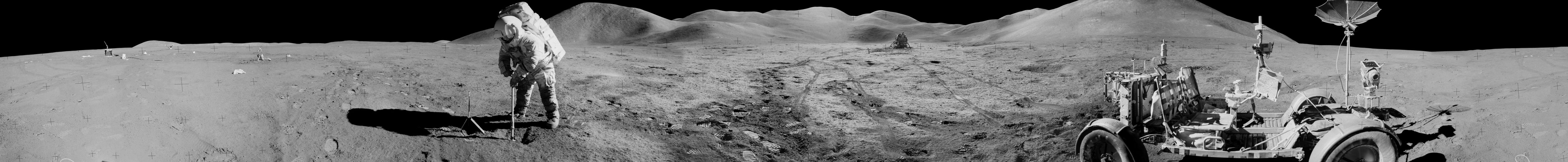
 USC Libraries].

In 1946, a “mysterious upswelling” occurred in a street in the neighborhood of Wilmington, California, near Long Beach. The photograph above, courtesy of the USC Libraries, pictures a young boy who went outside to measure it.

As part of an irregular series of short posts for KCET’s Lost L.A.—about things like Los Angeles partially illuminated by the light of an atomic bomb—I wrote a quick piece, inspired both by the photo itself and by its caption. “Surprising uprising,” it begins. “George Applegate measures mysterious swelling of Opp Street in Wilmington. Residents were shocked yesterday morning to discover they were living in ‘hill country.’ Street is seven inches above the curbing. Officials are investigating.”

Although I don’t mention this in the KCET post, I was instantly reminded of terrain deformation grenades and the instant, pop-up landforms of an old LucasArts game called Fracture. There, specialized weapons are put to use, tactically reshaping the earth’s surface, resulting in “mysterious upswellings” such as these.

There could be hills anywhere in Los Angeles, we might infer from this, lying in wait beneath our streets and sidewalks, prepping themselves for imminent exposure,” I write over at KCET. “A street today is a mountain tomorrow.”

(Also related: The previous post, Inland Sea).